 We hiked a section of the PCT in the Santa Rosa Mountains in Southern California. We hiked up the Cedar Springs Trail for 2 miles up to the PCT and then hiked south to 74. Overall, 14 miles with 2,000 ft of elevation gain.
View along the Cedar Springs Trail.
As we climbed up towards the PCT, we could see a lake far below.
On the trail junction with the PCT
We found a bench here on the PCT, for a nice break in the shade.
 Heading south on the PCT, I love the trail up on the crest.
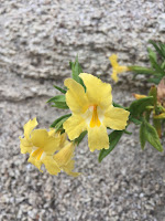
We saw lots of wildflowers in bloom!

We found a nice place among huge granite boulders for a lunch break.
Pano along the PCT looking east towards the Cochella Valley.
We saw lots of lizards today.
We passed some fabulous boulder fields.

There were lots of Nolina in bloom.
Wide angle shot from near the end of our trail, looking back at the Santa Rosa Mountains and the boulder fields:


No comments:
Post a Comment