Tuesday, March 24, 2020

Mount Rose

Spring has come to the lower elevations of the Olympic Mtns. We saw yellow violet in bloom on the lower Mount Rose Trail (6.4 miles when doing the loop at the top, with 3,500 ft of elevation gain.

A deer on the lower part of the trail.
We didn't encounter snow on the trail until we passed the loop junction. We took the shorter trail on the left up Mount Rose
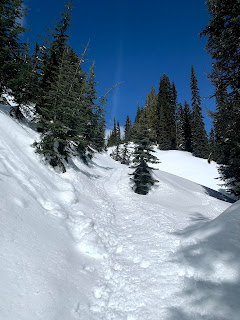
The snow was well packed and we were able to hike with micro spikes.
Large cat prints in the snow.
There were some icicles higher up the trail.
Nice view of Mt Washington and Mt Elinor as we neared the view area over Lake Cushman.


Copper Mtn from the same area.


We took a lunch break off trail from the view area over Lake Cushman below. We could barely see Mt Rainier due to the haze beyond Lake Cushman.


Last bit up towards the top of Mount Rose is quite steep.
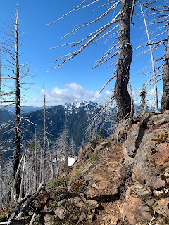
Some of the trail was exposed dirt and rock near the top.


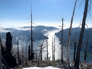
Looking over Lake Cushman from further up the trail.
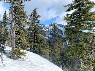


View of Mt Washington and Mt Elinor through the trees near the top.
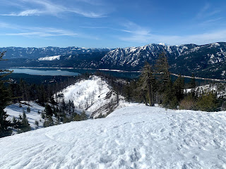
Pano from the rocky outcropping that is the top of Mount Rose, looking mainly west over Lake Cushman and some of the southern Olympic Peaks.

We continued along the ridge of Mount Rose following the loop clockwise.
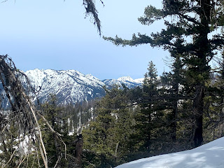
The occasional views of some of the nearby peaks were through the trees, here: Copper Mtn.
The trail stays up along the ridge as it goes eastward (Mt Washington and Mt Elinor between the trees)


Then the trail descends down through the forest.
One of the creek crossings went over the trail as we neared the loop junction.
Even in the forest, we enjoyed todays sunlight!
Thursday, March 19, 2020

Carter and Madcap Falls

 The gate up to Paradise (Mt Rainier NP) stayed closed today, so from Longmire we hiked up to Carter and Madcap Falls along the Wonderland Trail. We went a bit beyond the waterfalls for an overall hike of 6.5 miles rt with 1,200' gain. We ended up carrying our snowshoes and using our micro spikes.
Sun providing a golden light through the trees in the morning.
 This section of the Wonderland Trail is mostly in the forest, here we had a view between the trees of the Nisqually River and Eagle Peak.
Further up the trail, we could look down the Nisqually River and in the far distance see High Rock with the fire lookout on top.
Near Cougar Rock Campground, the trail crosses over the Nisqually River. Nice view of Mt Rainier here.
Log bridge over the Nisqually River
View of Mt Rainier from the log bridge
As the Wonderland Trail starts to follow up along the Paradise River, we had a couple of views looking up at Eagle Peak.

Carter Falls

Madcap Falls

View of Paradise River a bit further upstream.
Clouds were gathering over Mt Rainier as we were returning down the trail


Tuesday, March 17, 2020

Hex Mountain

Beautiful sunny day, we drove to the east side of Lake Cle Elum to hike up to Hex Mountain, 7 miles round trip with 2,600 ft of gain
Great place for social distancing, we saw 5 other hikers as we were coming back and the "trail" is very wide. Snow firm packed in the morning and starting to soften up in the afternoon, We used micro spikes about the last 1/2 up to Hex Mountain. Trail starts on logging roads. Although mostly snow covered, there were large areas with bare dirt and rock along the way.
view near the summer trailhead sign
Hex Mountain, our route goes up the left ridge.
Looking part way down the ridge to Cle Elum Lake
some peaks to the northwest
Mt Stuart seen through the trees
last bit up Hex Mountain is steeper that it looks

northward to Mt Stuart
southwest to Lake Cle Elum and Mt Rainier


Pano from atop Hex Man from Mt Stuart to Mt Rainier


Monday, March 16, 2020

Mount Walker

 Drove to south of Quilcene on Hwy 101 to hike up Mount Walker, 5 miles round trip with 2,000 ft of gain.
This hike is mostly in the forest. About 1/2 mile up the trail, there was a peekaboo view of a couple of Olympic Peaks through the trees. I watched the morning sun light up these peaks.
 The north viewpoint is reached in 2 miles with 2,000 ft of gain, a great workout! There was only a little bit of snow on top and a light dusting of snow on about the last 1/2 mile of trail
 View of snow capped Olympic Peaks to the northeast
 View to the northwest
 zoom of Mt Baker and Mt Shuksan
 There is a 1/2 mile, mostly road walk, between the north and south viewpoints. There was a glimpse of another Olympic Peak between some tree branches as I neared the south viewpoint
 Mt Rainier and Hood Canal from the south viewpoint


Another peek at the two Olympic Peaks through the tree on my way back down. I only saw one other hiker on this trail today.

Thursday, March 12, 2020

Mazama Ridge Loop Snowshoe

Returned to Paradise at Mt Rainier National Park to do a loop hike over Mazmaa Ridge with a side trip along part of the Paradise Glacier Trail. 5.6 miles with 1,500 ft total elevation gain. I only saw 3 other snowshoers along my hike.
On the way to Mt Rainier National ParkI saw a herd of elk, They were on each side of the highway.
From Paradise, I  snowshoed down the closed Paradise Road to 4th Crossing. View of Paradise Valley, and cloud covered Tatoosh.
Sun trying to break through the clouds as I headed up Mazama Ridge from 4th Crossing. From the road at 4th Crossing to my high point of the Paradise Glacier trail was a gain of 900+ feet.
View of Mt Rainier from Mazama Ridge, with some frosty trees.


Up along the Paradise Glacier, I like to go up a small hill at 6232 ft. I was up here by myself. There were a couple of older ski tracks, but I broke trail up to this hill.
Cornices over Stevens Canyon


Some tall frosty trees


Clouds rising above the Tatoosh as I headed back towards Mazama Ridge, following my tracks from this morning.

Views of the Tatoosh got better as I continued down Mazama Ridge. There were lots of tracks going down Mazama Ridge, with the trail well packed.
Some nice views of Rainier as the trail continued down.
I so enjoyed this route staying high on Mazama Ridge with views for some time
When the route descended into the forest, there were some occassional views of Rainier.
Once this route dropped down to Inspiration Saddle, it joined the marked route from Narada Falls to Reflection Lakes and a trail up to Paradise. I turned to the marked route that we take me up to Paradise on the trail.
some more views of Rainier along the way.
a view of Eagle Peak
The Paradise River is mostly covered in snow.
From where the marked trail splits down to Narada Falls or up to Paradise, I headed up to Paradise.
There is a 600 ft gain in 0.8 mile up to Paradise.
As the trail gains elevation, there was a view of the Tatoosh.
And back at Paradise, the trail emerges near the Paradise Inn.
Gray jay sitting on a car roof in the parking lot.


Saw a fox in a road turnout below Paradise.
The route I took today is in purple, the red route is the summer Skyline trail.