Wednesday, May 31, 2017

Mount Rose

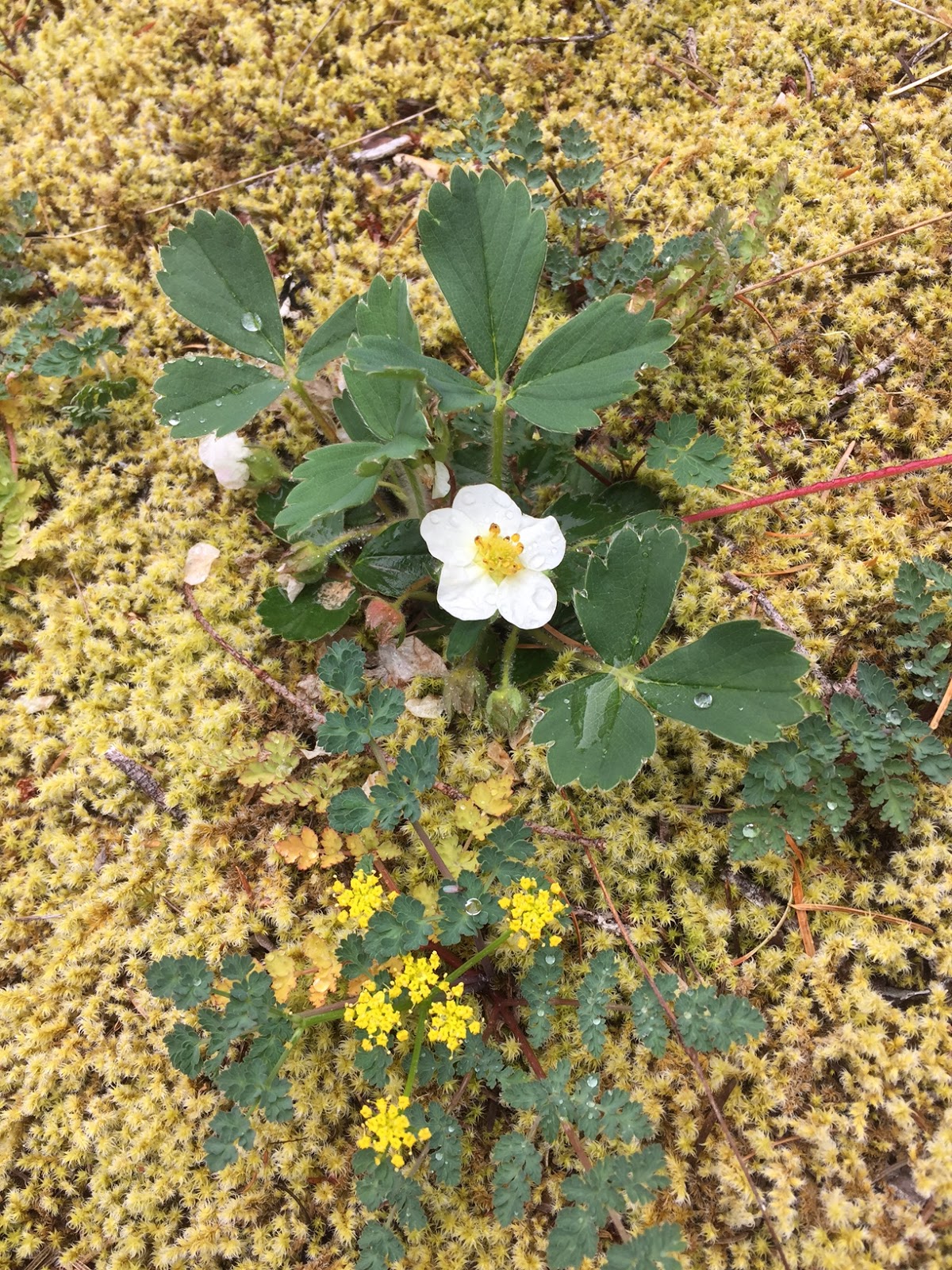
 We headed out to Mount Rose, which is in the south end of the Olympic Mountains. This is a 6.4 mile hike, if you do the loop at the upper section. Because of the snow, we decided to hike up and back taking the left trail of the loop up to the summit, making our hike 5.8 miles rt with 3,500 ft of elevation gain.
There is a short trail from the parking lot to the the trailhead, we passed over two foot bridges and saw the creek full of water from the melting snow.
 This trail is mainly in the forest, with occasional glimpses of Lake Cushman below.  We saw a few dogwood trees in bloom amongst the towering fir trees.


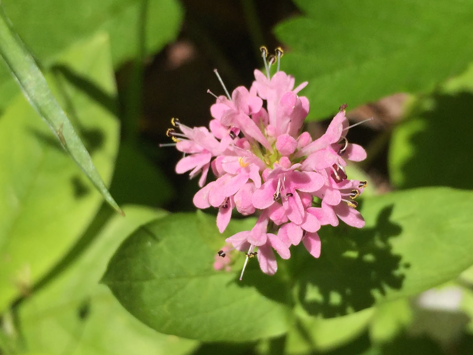
A bit off the trail, were some rhododendrons in bloom. It was very misty this morning.

The trail climbs 1,190 ft in the first 1.1 miles at the Mt Skokomish Wilderness Boundary. Then an additional 1,060 ft in the next 0.7 miles to reach the junction with the summit/loop trail. Then it is 1,250 ft in the final 1.1 miles to the summit.


We encountered consistent snow at 3,400 ft.
We lost the trail here, and went cross country for a while.
We eventually, found a few pink ribbons on tree branches marking the way up towards the summit. But there were places where the ribbons had been torn and were only fragments. And there were stretches where we could not see any ribbons.


 About 200 - 300 ft below the summit, we found a spot to take a break and enjoy the view. We could see, Lake Cushman, Hood Canal, Puget Sound, and above the clouds in the distance: Mt Rainier.


It seems that several trees have come down since by last trip to the top a couple of years ago. We continued to have some views to the southeast until we reached the top rock outcropping.


Pano from the rock outcropping at the summit of Mount Rose, looking west - northwest

 Not only is this trail steep going up, it is steep coming down.
 Some of the flowers and plants we saw in bloom today on the trail:


Friday, May 26, 2017

Triple Falls Loop

 The last hike of our May Road Trip was the Triple Falls Loop Hike on the Oregon side of the Columbia Gorge. This is a 4.7 mile hike with 600 ft of elevation gain.
We started at the parking area nest to Horsetail Falls (176 ft drop)
 We hiked up the trail to the left of the falls. This huge rocky wall was covered with moss and lupine in bloom.

This trail continues up a couple of switchbacks.


A brief clearing gives a view of the Columbia River to the north.


And in 0.4 miles, we reached Ponytail Falls (80 ft drop) with the trail continuing behind the waterfall.
 View of Ponytail falls from the trail behind the falls.
 As the trail continues along the basalt cliffs, there is a short spur trail that leads to views overlooking the Columbia River to the east.
 The trail passes a large weeping wall before descending down some switchbacks to
 Oneonta Creek where you can see the drop off above Lower Oneonta Falls and
  Middle Oneonta Falls
The trail then joins the Oneonta Trail, where a 0.9 mile side trip leads to
 Triple Falls (64 ft drop)


 After enjoying the falls, we returned down the Oneonta Trail down to the Historic Columbia River Highway then returned to Horsetail Falls.


Some of the wildflower we saw in bloom along the trail:


SaveSave

Thursday, May 25, 2017

Dog Mountain

 Hiked up Dog Mountain via the new trail and came down the Augspurger Trail for 7.5 mile loop hike with 2,900 ft of elevation gain.
The first 1.8 miles are in the woods, but there were so many wildflowers in bloom today that we enjoyed all of this trail.


The trail is a steady climb throughout.


The sign marking the split between the old and new trails was gone, but some one had made a pine cone arrow showing the way on the new trail.
 From the first clearing at 1.8 miles, we could balsamroot in bloom, and far above, the fields were awash in yellow.
 Great view of the Columbia River flowing west.
 At 2.9 miles, another open area is reached, nicknamed Puppy Mountain. We could now see Wind Mountain to the west along the Columbia River.
 Pano to the south from "Puppy Mountain"

 The trail stays in the open as it continues to climb up Dog Mountain.


 There were lots of paintbrush and larkspur in bloom as well as balsamroot.
 As the trail continued to climb, we began to see Mt Hood across the Columbia River to the south,

 and Mt St Helens to the northwest.

 Beautiful fields of flowers near the top of Dog Mountain.

 The very top of Dog Mountain is covered in trees with very limited views.

Some of the other flowers we saw in bloom along the trail: