Friday, July 29, 2016

Antler Peak at Mount Rainier National Park

 I drove out to Sunrise at Mt Rainier National Park to hike up to Antler Peak. This can be seen along the Sourdough Ridge Trail from the parking lot. This is a 1.7 mile round trip hike with 700 ft of elevation gain. This is not a maintained trail like Dege Peak (further down the Sourdough Trail), but an easyish scramble.


 View of Mt Rainier from the Sourdough Trail
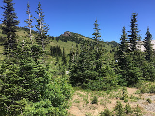
 Side view of Antler Peak, there are lots of short trees along the flank. I found it hard to spot the animal tracks to follow up, trying to avoid stepping on any flora.
From the top of Antler Peak, the trees interfered with getting 360 degree views. Here is a Pano from the southwest to the north: Mt Rainier, Mount Freemont, and in the far north, Mt Baker and Glacier Peak

Zoom of Mt Baker

 zoom of Glacier Peak
 Looking toward Mount Freemont, if you zoom in you can see Freemont Lookout.
Pano from the east shoulder of Antler Peak looking south:  in the far distance the Goat Rocks and Mt Adams and Mt Rainier

zoom, behind the ridge, the Goat Rocks and the very top of Mt Adams

When I was returning to the Sunrise parking area, I decided to not go back down, but take the "higher" Sourdough Ridge Trail a bit further before descending.


There are several places along the Sourdough Ridge Trail, where you can look out to the north. Here looking toward Huckleberry Basin and Green Park, in the far distance Mt Baker and Glacier Peak can be seen.


 another view of Mt Rainier as I returned to the parking area.
 There were many butterflies flying around, I managed to get a picture of one of them.


Some of the wildflowers I saw in bloom along the trail today:


Naches Loop Trail

 Drove out to Chinook Pass and parked at Tipsoo Lake to do the Naches Loop Trail. Beautiful hike with lots of wildflowers and gorgeous views. 3.2 mile loop with 500 ft of elevation gain. Part of the trail is in Mt Rainier National Park and the rest is in the William O Douglas Wilderness (part of which is on the PCT). It was so beautiful, I hiked around Tipsoo Lake both at the beginning and end of the trail.

 Lots of wildflowers in bloom, these were in the meadow around Tipsoo Lake.
Mt Rainier and Yakima Peak at Tipsoo Lake.
 The trail goes over this bridge above Hwy 410 and is part of the PCT here.

 Looking back along the trail towards Yakima Peak, with Mt Rainier peaking out.
 Lots of wildflowers in bloom
 There were several streams flowing on the north side of the loop.
 Looking up at Naches Peak from the east side of the trail
 A mountain tarn near the trail
 Looking down at Dewey Lake.
 Coming around to the south side of the loop, Mt Rainier and Naches Peak.
 So many lovely views of Mt Rainier along this trail


Looking south to Seymour Peak, Mt Adams (in the far distance) and Shriner Peak, I could see the lookout on Shriner Peak with my zoom.
zoom of Mt Adams


 more views of Mt Rainier
 There is a large pond across Hwy 410 from Tipsoo Lake.
 Back at Tipsoo Lake, Mt Rainier peaking over the trees
 Yakima Peak at Tipsoo Lake
Naches Peak across from Tipsoo Lake

Some of the many wildflowers in bloom I saw along the trail today: