We had a short 5.2 mile section of the Wonderland Trail to do to have completely hiked the Wonderland Trail (most was done has shuttle hikes and short overnight trips over the past 2 summers). As the day was so nice, we decided to hike to a few other destinations starting at Sunrise at Mt Rainier National Park.
We first hiked out to Skyscraper Peak and then up to /First and Second Burroughs before returning to Sunrise (this could be done as an 11 mile hike). Overall, we hiked 16 miles with 2,200 ft of gain and 4,800 ft of loss.

From the Sunrise parking area, we went up the service road through Yakima Park to Sunrise Camp and had this nice view of Mt Rainier along the way.

From Sunrise Camp, we joined the Wonderland Trail heading west, going up towards Frozen Lake.
Here there were three trail options, left to the Burroughs Mtns, straight along the Wonderland Trail and Skyscraper Man (above our shadows) or right to Mount Fremont. We continued on the Wonderland Trail.

View of Mount Fremont from above Berkley Park

Found a nest sitting on the side of the trail.
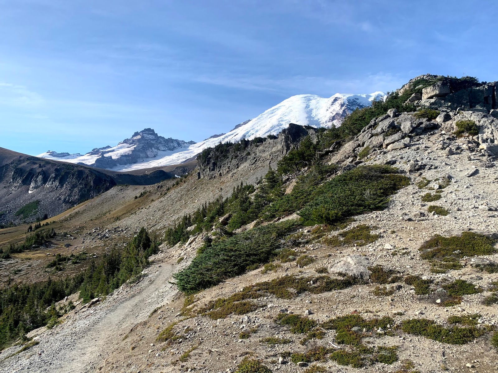
About 3.6 miles from Sunrise, the Wonderland Trail takes a big turn around a ridge. View from the east side of the ridge looking south to Mt Rainier.
Going around the bend on the west side is this fabulous view of Mt Rainier on the Wonderland Trail.
From here, we took the boot track up to the top of Skysraper Mountain.
View of Mt Rainier from the top of Skyscraper Mountain. We took a nice break up here.
We spotted a herd of mountain goats in the distance
View to the north, we saw the Olympic Mtns, Glacier Peak, Mount Stuart among other Cascade Peaks beyond Grand Park and Mount Fremont

zoom of Glacier Peak
zoom of Mount Stuart
We then returned eastward along the Wonderland Trail, looking back at a view of Second Burroughs and Mt Rainier
A glimpse of Mt Rainier as we head up the trail to First Burroughs
View of Mt Rainier and Second Burroughs from First Burroughs
View to the north from First Burroughs, Skyscraper Mountain on the left, Mount Fremont on the right.
On Second Burroughs, we took another break, here we are so close to Mt Rainer, I could not get the mountain into a regular shot.
Wide angle view of Mt Rainier from Second Burroughs
The squirrels and chipmunks are very aggressive on Second Burroughs
We returned to First Burroughs, returning toward Sunrise on the Sunrise Rim Trail, which has gorgeous views all along the trail.
Gorgeous turquoise tarn in Glacier Basin below Mt Rainier on the Sunrise Rim trail.
Shadow Lake back near Sunrise Camp, we are now back on the Wonderland Trail heading west.
About 1/2 mile before reaching the parking area at Sunrise, the Wonderland Trail heads south towards the White River Campground. I was happy to see a few views of Mt Rainier on this mostly forested section of the trail.
We passed several streams as we descended down the switchbacks through the forest.

The Wonderland Trail goes through the White River Campground to the log bridge over the White River. We saw this warning sign and decided to check out the water level on the White River for ourselves.
Very happy to see the White River was well below the level of the log bridge, we could continue on the Wonderland Trail without needing to take the mile plus detour.
view of the mostly cloud covered Mt Rainier from the log bridge over the White River.
view from the south side of the White River
From here we continued along the Wonderland Trail until we reached the junction with the trailhead to Summerland and our completion of our Wonderland journey!!!
Some of the wildflowers and fungi we saw along the trails today:


 First, I took the Alta Vista Trail, this gains 500 ft in about 1/2 mile. Lovely views looking back over the Tatoosh Range.
 I saw a hazy Mt St Helens in the far distance to the south.


 After passing the trail up to Camp Muir, I would not see any other hikers nor footprints on the Upper Skyline Trail. I could see enough of the rocks that lined the trail to find my way. A few times there was enough snow where I was post holing. Only post holed over my knees in one area.


