Saturday, July 27, 2013

Royal Basin Hike Olympic National Forest & Park

This is a beautiful hike, we calculated it to be 17 miles (including the short side trip
 to view one of the waterfalls near Royal Lake) with about 3100 ft elevation gain. 
The hike starts at the Upper Dungeness trailhead in the Olympic National Forest
(this was our turn around point on the Lower Dungeness Trail hike last April).
 Hike one mile along the Dungeness River 
 then take the Royal Basin trail to the right, following Royal Creek,
a short distance along this trail, you enter Olympic National Park
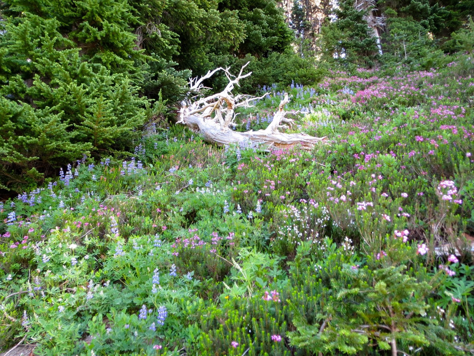
 The trail transitions between forest and open slopes, 
with a wide variety of wildflowers in bloom as you steadily climb uphill.
 
These clearings made good places to sit, enjoy the views and enjoy a snack.
Left: the Olympic Mountains that circle Royal Basin, our destination. 
Right: looking across Royal Creek to tall thin waterfalls across the way 

 
After 7 miles of hiking, we arrived at the north end of Royal Lake, 
we choose to hike the west side trail (on the right) to the other end of the lake for our lunch break.
 View of Royal Lake from the south end.
 After lunch, we continued hiking up the trail, here entering Lower Royal Basin
 Where there were more varieties of wildflowers and

Off in one corner, this waterfall coming off Mt Fricaba
The trail continues to climb, taking us to upper Royal Basin, the trail continues over the green hills
 to a basin with several ponds formed from snow melting, and views of Mt Deception
and the Needles, we soaked our feet here and had a snack.
 View looking over Lower Royal Basin, the trail winds between the mountain ridges.
 We decided there was enough daylight, that we could take the short side trail on the 
west side of Royal Lake to see the waterfalls that come down from Mt Clark.
 Then we hike back on the other side (east) of Royal Basin 
before heading home for more gorgeous views.
 This mother grouse hurried her chicks away before I could take a photo
Wonderful day in the mountains!

Sunday, July 21, 2013

Summerland hike on Mt Rainier

One of my favorite hikes. On the northeast side of Mt Rainier. 
A 8.4 mile roundtrip with 2000 ft of elevation gain.
The hike starts in the forest, about 1.5 miles in you get views of Frying Pan Creek 
 and Tamanos Mountaind (I think) 
About 2.5 miles in you cross Frying Pan Creek and begin to see the top of Mt Rainier.
The next section of the trail is through an open meadow of wildflowers
 as Mt Rainier appears to grow taller.
The last mile is steep switchbacks up to Summerland, we hiked shortly after most of the snow had melted, there were many fields of avalanche lilies in bloom.
I love the views of Mt Rainier at Summerland,
 especially when the wildflowers are at their peak
 even the marmots enjoy the fields here


Saturday, July 13, 2013

Wynooche Lake Loop Hike Washington

An interesting hiking trip. This 12 mile loop hike is low elevation,
 but the trail has enough up and downs for a total elevation gain of 1150 feet.
The trailhead is at the Coho Campground on the south end of Wynooche Lake. We parked at the day use are, and were happy to have the trail end here for a dip in the lake at the end of the day.
 We headed up the trail on the west side of the lake.
Below: This was one of the better sections of the trail. 
We spent much time climbing over, under and around downed trees. 
In some sections, the brush was so overgrown, we couldn't see our legs while walking.
There were lots of wildflowers and abundant Huckleberries, wild blueberries and salmon berries along the trail. I don't think any hikers had been on this trail for a long time. 
We were careful not to get caught up the abundant Devil's Club


Near the north end of the lake, the trail opens up for a gorgeous view of the foothills and southern Olympic Mountains. Seeing where the Wynooche River enters the lake, we were hoping the river would be shallow enough to ford. Otherwise, our choices would be to return the way we came 
or hike an additional 2 miles north to a bridge crossing.
 The river was deeper than we wanted, it would have been up to our mid thighs. 
We were fortunate, a passing boat stopped and gave us a ride across.
 The trail on the east side of the lake was in not much better condition. There were abundant tall cedar trees to keep us cool. About 3 miles from the south end of the lake there are some national forest campgrounds, so the trail was much improved those last 3 miles.
 View looking toward the Olympics from the south end of Lake Wynoochee:
 The dam that makes the lake possible:

Saturday, July 6, 2013

Crystal Peak Washington

An 8 mile roundtrip hike with 3100ft elevation gain.
Hike begins to climb immediately but the first 1.5 miles is in the cool forest.
 The trail splits at 1.5 miles, the left fork goes to Crystal Lakes, but we chose the right fork up to Crystal Peak. The trail has two long traverse climbs in the open hill side, with great views of Mount Rainier to the South looking up the White River.
 At the top of Crystal Peak we could see Crystal Lake and Sourdough Gap
 To the Southeast, Mount Adams
 to the Southwest, with the zoom lens, Mt St Helens