Drove up to Mt Rainier National Park to go snowshoeing today. I was hoping to do a loop, by hiking from Narada Falls to Reflection Lakes, up Mazama Ridge, over to Paradise and back down to Narada Falls. When I reached the point of having to break trail while post holing 12" with snowshoes for at least 3/4 of a mile uphill by myself, I decided to turn back to ensure I would reach Longmire before they locked the gate at 5pm. Overall, I hiked 5 miles with 1,200 ft of gain.
 View of Lane Peak from above Narada Falls, as I started out from the parking area at Narada Falls.
 Start of the marked trail up towards Reflection Lakes. There is a lot more snow since I was here 6 weeks ago.
 Even with some fresh snow from last night, the route from Narada Falls to Reflection Lakes was well packed down.
 I opted to go to Reflection Lakes via Inspiration Point. Along the closed Stevens Canyon Road, I had a fabulous view of the western Tatoosh Peaks.
 Mt Rainier from near Inspiration Point
 The route via Inspiration Point goes by two avalanche slopes. I was comfortable going this way in the morning before the sun hit this side of the slope, as the temperature was in the 20s and the avalanche risk was moderate below tree line today.
 closer look at Eagle and Chutla Peaks in the Tatoosh Range
 A look back at Mt Rainier as I continued beyond Inspiration Point.
 I was the first person to Reflection Lakes this morning, but I saw some critter had beat me out on the packed trail earlier this morning.
 Sun shining behind Pinnacle Peak before it was covered in clouds.
 First view of Reflection Lake
 Mt Rainier across Reflection Lake, once I left the packed down trail, I was post holing at least 12" in fresh snow.
 From Reflection Lakes, I headed up the trail via Inspiration Saddle.
 At Inspiration Saddle, I could glimpse Mt Rainier through the trees. Here, I headed east up the High Lakes Trail. From here the route is not marked.
 I was happy to see that the route had been broken the day before by another snowshoer. I was hoping they had gone all the way to the junction of the 4th Crossing Trail, but they only went about 1 mile before turning back.
 It was so quiet and peaceful on Mazama Ridge, I was up here by myself, until I passed two other snowshoers as I was coming back down. I could see the clouds had almost completely covered Mt Rainier.
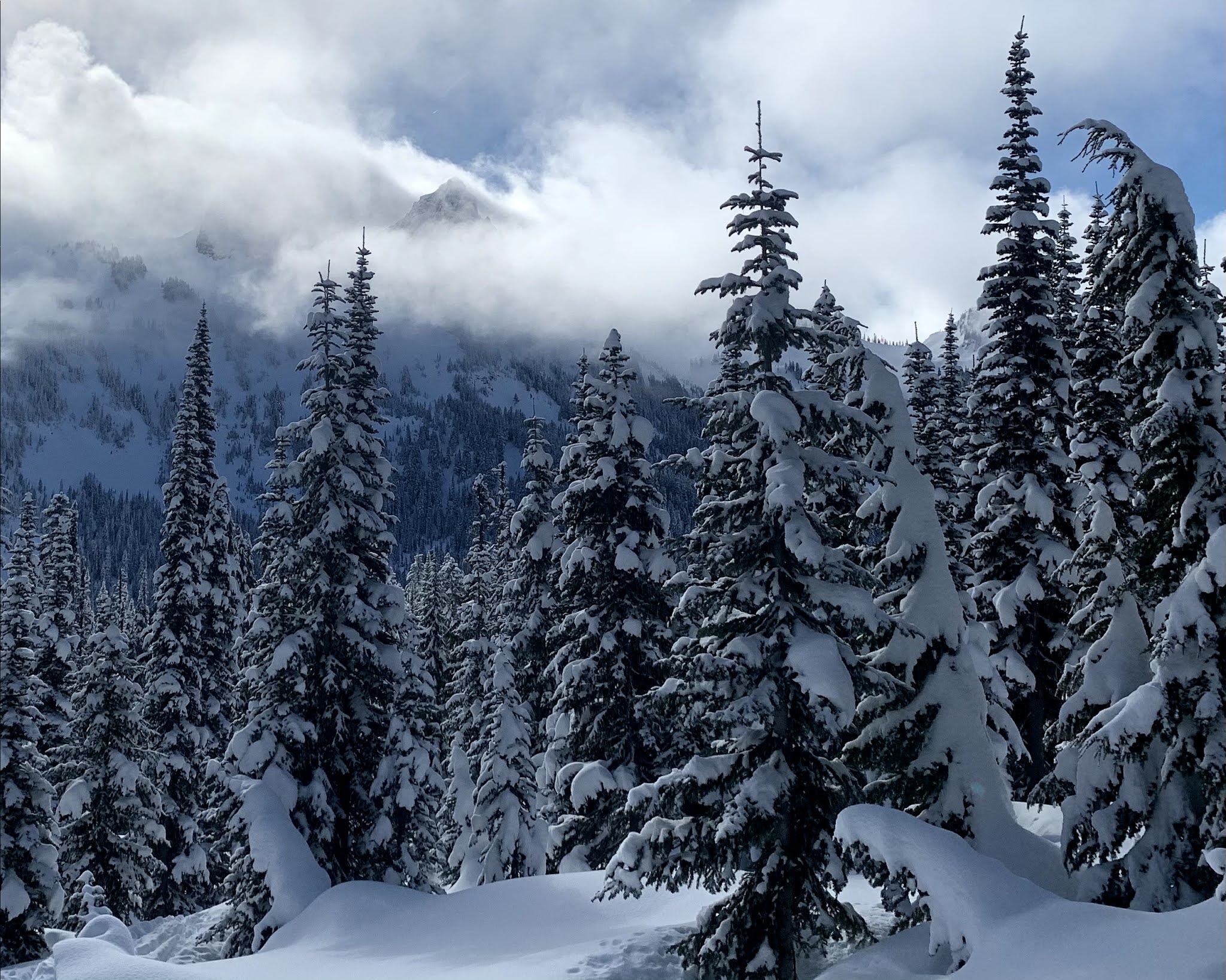 I enjoyed watching the clouds moving across the landscape.
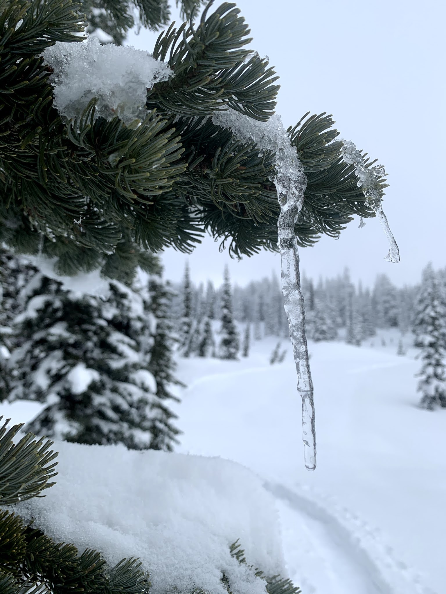 icicles on tree branches
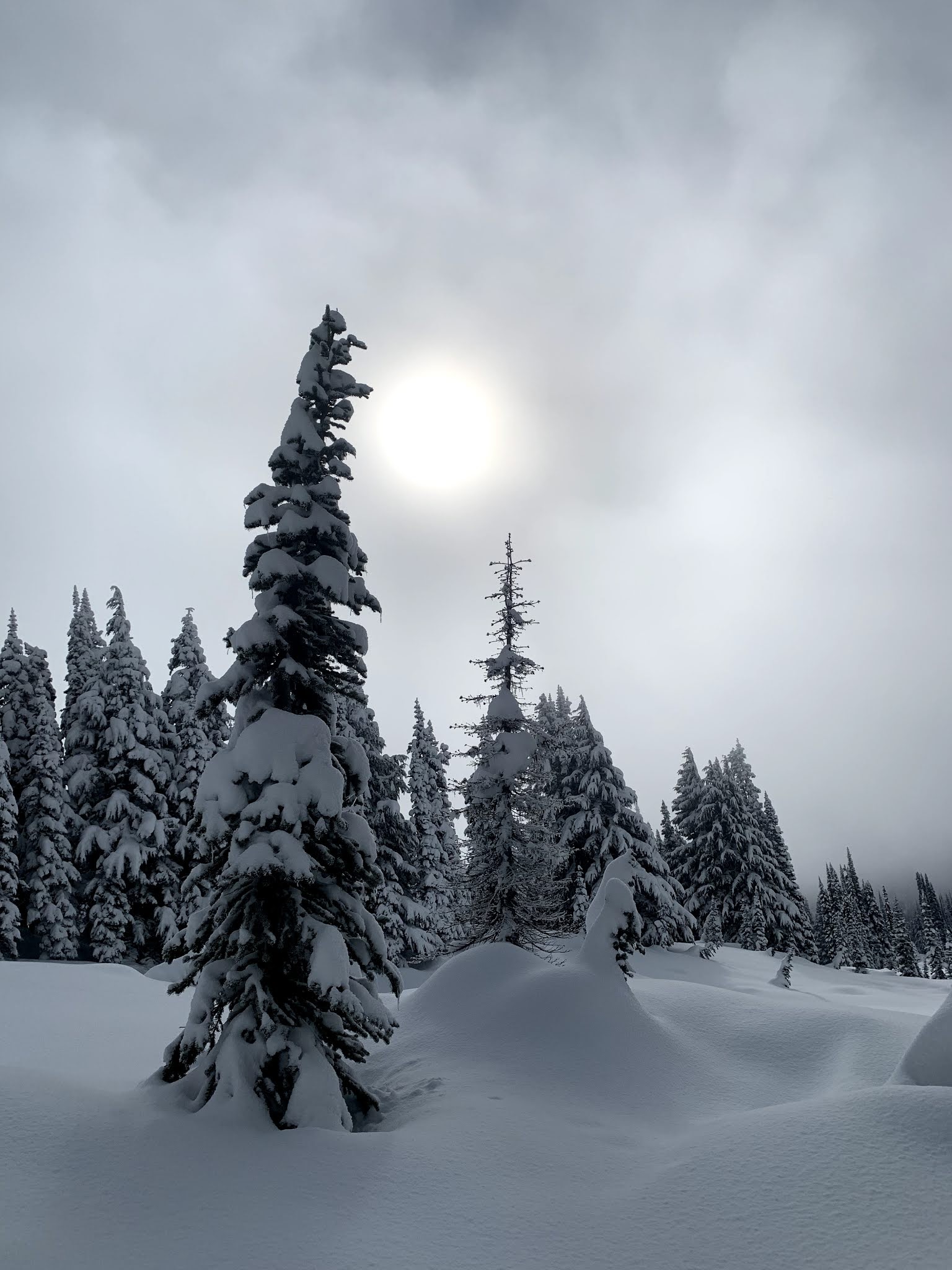
 clouds covering Mazama Ridge
 sun trying to break through the clouds
 Pinnacle Peak being surrounded by clouds
 clouds on Mazama Ridge
 enjoying the beautiful snowy Mazama Ridge
 Instead of trying to break trail in deep snow by myself, I turned back and stopped at a viewpoint along Mazama Ridge for a break. I was able to see the top of Mt Rainier through the clouds for a brief moment.
 Heading back down Mazama Ridge into the clouds.
 Before the last section of trail back to Narada Falls, I stopped to view the Paradise River above Ruby Falls.
 The marked trail from Narada Falls to Reflection Lakes, does not go near Ruby Falls, so I broke trail to get a view of Ruby Falls.
 Ruby Falls
 I took the short trail down to Narada Falls before leaving.