
We drove up to The Summit East at Hyak (Snoqualmie Pass) to do the Mt Catherine Loop on The Summit at Snoqualmie Nordic Trail System. From where we parked, this was a 10 mile loop with 1,700 ft of gain. We saw many people hiking up and skiing down the ski slopes at Hyak, but did not encounter hardly anyone on the loop trail. We met the groomer early on, who told us he was mainly moving the trail signs, and one nordic skier after we had gone 2/3 of the way around the loop. The majority of this "trail" is in the forest, but there were several areas with nice mountain views.
 We opted to go clockwise around the loop, which is about 5 miles up the closed Cold Creek Forest Road. We stayed off on the far edges of the groomed trails.
 Before long we had this brief view of Keechelus Lake before returning into the forest.
 Overall, we passed 3 areas where there was a risk of avalanches. With the avalanche forecast of low today, we were not too concerned.
 It was lovely to see the fresh snow on the trees and trail from last night's snow.
 View looking up at Mt Catherine as we went around the loop.
 The clouds moved all around the peaks throughout the day. Here we had a nice view of a nearby ridge as we continued up Cold Creek Road. For a mostly cloudy day, we had nice views.
 icicles hanging off small branches by a tiny creek
 Tinkham Peak to the east
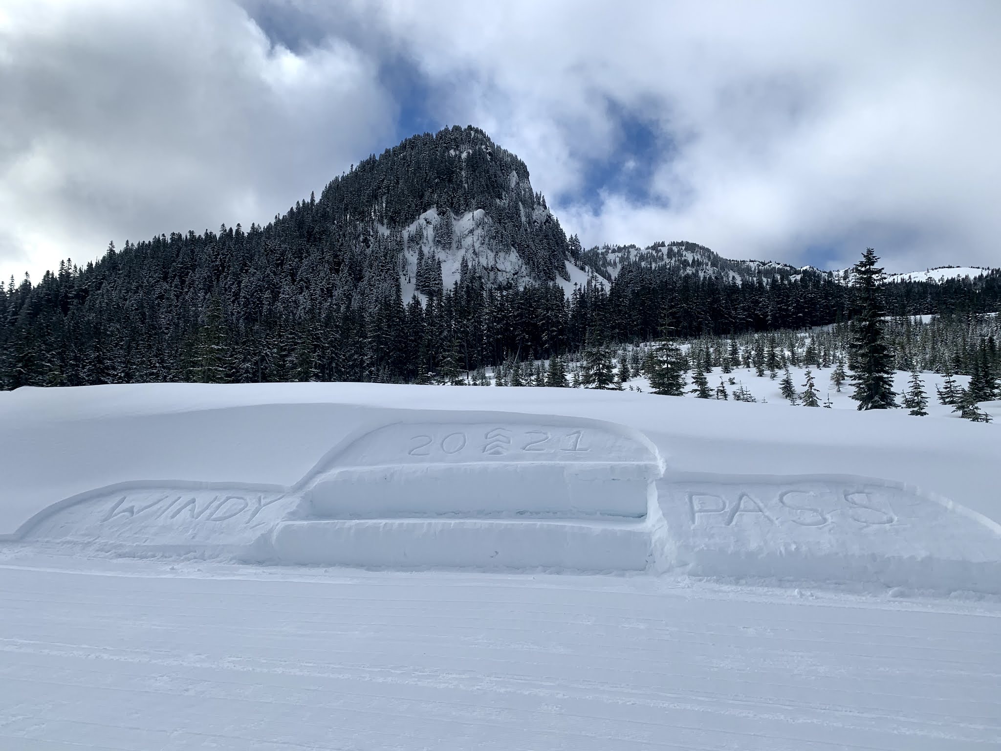 About halfway around the loop and after 1,300 ft of gain, we reached Windy Pass on the PCT.
 After Windy Pass, the Mt Catherine Loop continues on the Ripsaw Trail, along here, we had our first view of Granite Mountain to the northwest.
 Here, I think we are looking up towards Silver Peak to the west.
 Part way down the Ripsaw Trail, we took the Vista Trail option, which runs roughly parallel to Ripsaw for 0.9 mile. This had not been groomed since the snow last night, so we broke trail off on the side.
 We found a nice spot out of the wind to take a lunch break. We could see some peaks across Snoqualmie Pass through the clouds. We hope to redo this loop on a clear day.
 More peaks, these are to the north across Snoqualmie Pass.
 Olallie Creek
 View to the west: McClellan Butte, Bandera Mtn and Mt Defiance (and maybe Pratt Mtn)
 zoom of McClellan Butte
 more peaks to the north, including Snoqualmie Mtn and Guye Peak
 more icicles
 Another view to the north as the loop meanders along
We had a closer view of Granite Mtn, and could see the fire lookout on the top.

zoom of another peak to the north


This side of the loop had so many mountain views! Soon after this, the trail began to climb up about 400 ft to Grand junction.
 After Grand junction, the Mt Catherine Loop follow the Outer Loop to Creek Run back down to Hyak. We looked for and followed the signs that said Easiest Way Down.
 more views to the north
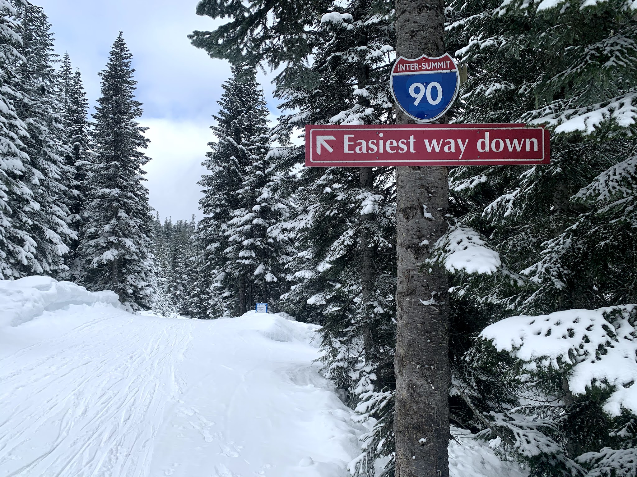 continuing down the Easiest Way
 As we neared Hyak, we could see across to the north of Kendall Peaks and Rampart Ridge.
 Back at Hyak, we enjoyed this loop today!!!
No comments:
Post a Comment