We drove out to Southeast Washington in the scablands area to visit Palouse Falls State Park. The overlook of the falls is right next to the parking area. We did some hiking on the unofficial trails outside of the park for a total of about 2 miles.
In the morning the sun was not in the best position for photos,

so we headed out on a trail that would take us down to Palouse River upstream from the falls. I was happy to visit her in the winter when the rattlesnakes are hibernating.

The trail was a bit steep heading down towards the river.
We saw several marmots out enjoying the sun today.
Wide angle view of the Palouse River cascading down stream towards the falls. This is called Squaw Falls or Upper Palouse Falls. It has a 20 foot drop.


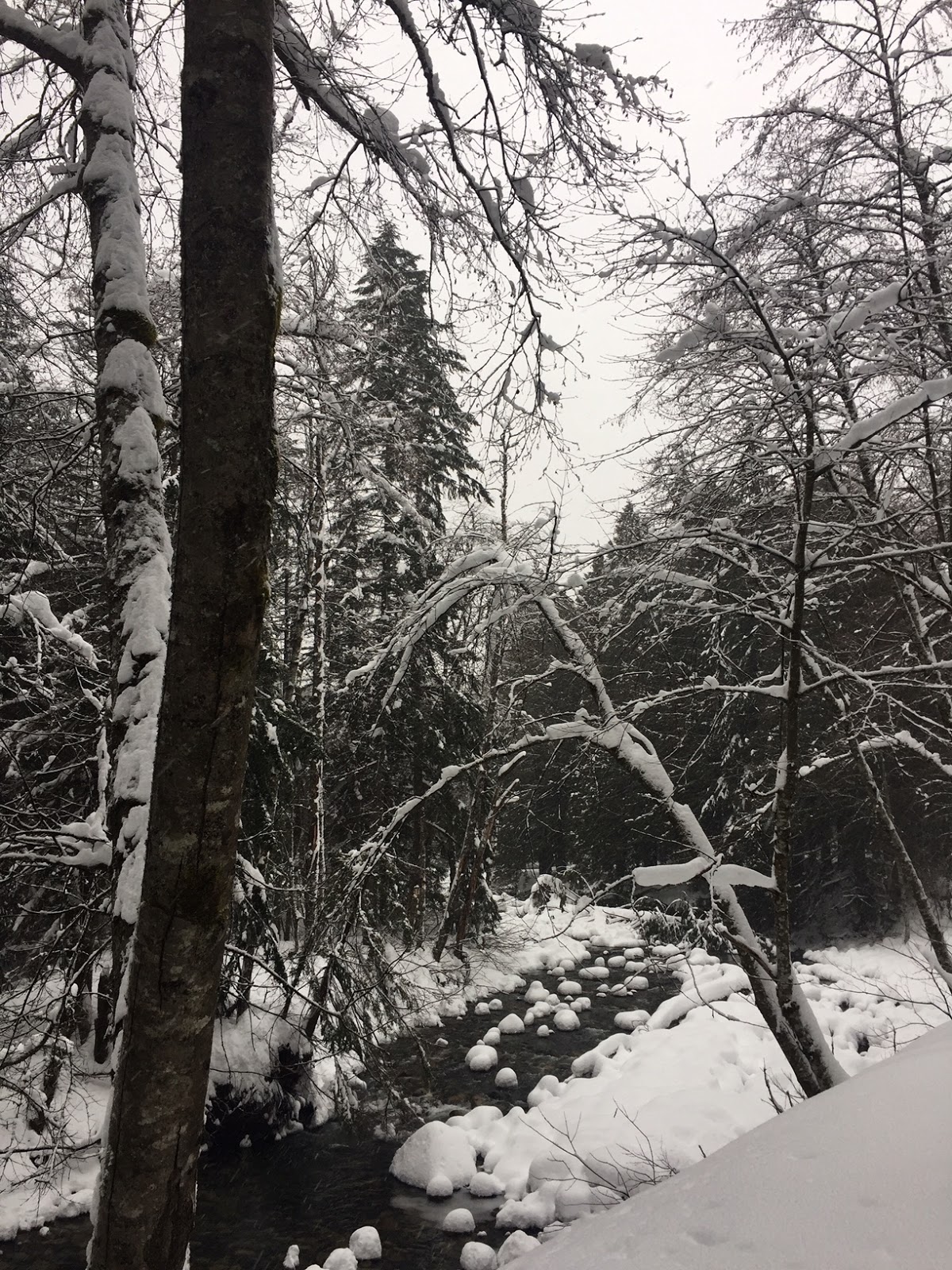
There was ice along the waters edge, but fortunately, very little ice on the trail
Looking back at Upper Palouse Falls as we hiked down towards the top of Palouse Falls.
icy rocks along the river's edge
The trail we followed along the canyon cliffs. A marmot kept peeking out from a hole in the cliff, he was to fast for me to get a photo.
There are some interesting rock formations (Castle Rock) above the falls. We followed the boot path to the left to reach the top of the falls.
Wide angle view looking down the canyon, the falls are behind Castle Rock.

I was thankful we were at the falls while there were so many interesting ice formations.
Wide angle photo from the top of the falls.

Carefully, looking down at the top of Palouse Falls.
We returned back along the way we had come. When we reached the plateau, we took the path that was closer to the edge. Wide angle view looking down at Upper Palouse Falls and the Palouse River where we had just been hiking.

There are signs warning you there is no trail straight off the cliff edge.
A series of photos of Palouse Falls as we followed this trail back to the original viewpoint near the parking area.
To the left of this wide angle photo you can see Castle Rock which we walked behind to reach the top of the falls. The parking area is to the far right in the photo
There is a long fence as you get closer to official viewpoints

Palouse Falls is the Official Waterfall of Washington State.


 About 1/3 of a mile up the trail, a short spur trail leads to this beautiful pool.


 At the trail split, we first went to the left where a bridge overlooks the middle section of the falls,


 I enjoyed our walk along the South Fork of the Snoqualmie River today.


