Saturday, December 31, 2016

Mt Si

 I joined a friend to celebrate her 101st hike of the year by going up Mt Si in North Bend. We probably hiked about 1/2 way up before finding the trail slippery and using our microspikes.
 I enjoyed the dusting of snow over the forest.
 The trail wasn't crowded today, and the snow made the forest quiet.
 Along the way, there is a parting in the trees and we could see down into the valley below.
I enjoy forest walks. Lots of interesting textures, highlighted by the snow.

Icicles dripping off old logs.

These little snowmen seemed to be wishing us a Happy New Year!

Very limited visibility on top.


 The rocks were easier to climb with the snow on them.
Even without a view, the snow created a lovely landscape. (pano)

 There were lots of gray jays flying around.


Friday, December 30, 2016

Mt Walker

 Drove out to Quilcene to hike to Mt Walker. The road up to Mt Walker is closed in the winter and the parking is right off of Hwy 101. We found the 1/4 mile road walk up to the trail head to be very slippery.
 The 2 mile trail up to the north viewpoint is a series of switchbacks climbing up 2,005 ft. About 1/3 of the way up the trail was very slick and we put on our microspikes. It also began to snow.
 The light snow covered flora was very pretty.
There was no view to be had today.

This is a popular trail, so it is common to see Gray Jays up here.

 We decided to go ahead and hike the 0.5 mile over to the south viewpoint and back. Although there was no view today, I enjoyed the snow covered landscape and the mossy trees.


Wednesday, December 28, 2016

Heather Lake

 We drove up to Mountain Loop Highway just past Verlot to Hike up to Heather Lake. This is a 4 mile round trip hike with 1,100 ft of elevation gain. The trail was mostly snow covered with well packed snow. We found it slippery and used microspikes for traction. We also used our snowshoes once we were up at the lake to hike around where the snow was not packed down.
The trail goes through a pretty forest.
There were several small streams running that created bare dirt/rock patches along the trail.

The snow got deeper, the higher the trail climbed.


 There were a couple of breaks through the trees where we could see nearby hills.


First look at Heather Lake between the trees.
Pano of Heather Lake from the northeast shore

 We snowshoed over towards the far southern shore, being careful to watch for small streams and ponds hiding under the snow.


There were some large snow covered boulders on the south shore.
Pano from the south shore. We did not see a safe place to cross the water on the south side, and did not want to go up the steep slopes behind the lake.

 We continued back the way we came, then continued across a bridge over the outlet to the lake..


Pano from the northwest shore of Heather Lake.
 Some snow laden trees:


Sunday, December 25, 2016

Paradise/Mt Rainier Snowshoe

We stopped at Longmire in Mt Rainier National Park while we waited for the gate to open the road to Paradise (a search and rescue operation was going on in the morning).


At Paradise, we snowshoed up to Glacier Vista, then came down to the Deadhorse Creek Camp area, and continued to snowshoe down a ways as we had this part of the mountain all to ourselves this morning. Then headed back to the main parking area. Our trip is highlighted in yellow.


 It was 14F when we started, but with no wind and the sun shinning it did not feel too cold.
Wide angle picture of Mt Rainier and Panorama Point as we neared Glacier Vista.
 While we were enjoying the views, the clouds moved in, eventually completely covering the mountain from our view.

 Panorama view of the lower area of Paradise and the Tatoosh Range to the south.

 As we passed the Deadhorse Creek Camp area and continued downhill, we did not see another person.
 A beautiful winter wonderland.
 We took our time, enjoying the snow covered trees and fresh snow.
 So peaceful.
 We saw one set of tracks that had been made before the last snow.

Lots of lovely icicles on some of the trees.


Thursday, December 22, 2016

Wallace Falls and Wallace Lake

Beautiful sunrise seen on the ferry ride from Kinston to Edmonds this morning. Mt Rainier and the Cascades in the distance to the east across Puget Sound.
Drove up to Wallace Falls State Park (near Gold Bar on Hwy 2) to hike up to the waterfalls, over to the Lake and back down another trail for a 9.25 mile loop hike with 1,500 ft of elevation gain.
 We hiked up the main trail, where there was soon a nice view of some peaks to the east. We then took the Woody Trail that follows the Wallace River and leads to the waterfalls.
 0.25 miles from the trail head is a short spur trail to view Small Falls.
 One of the areas where the trail is close to the Wallace River.


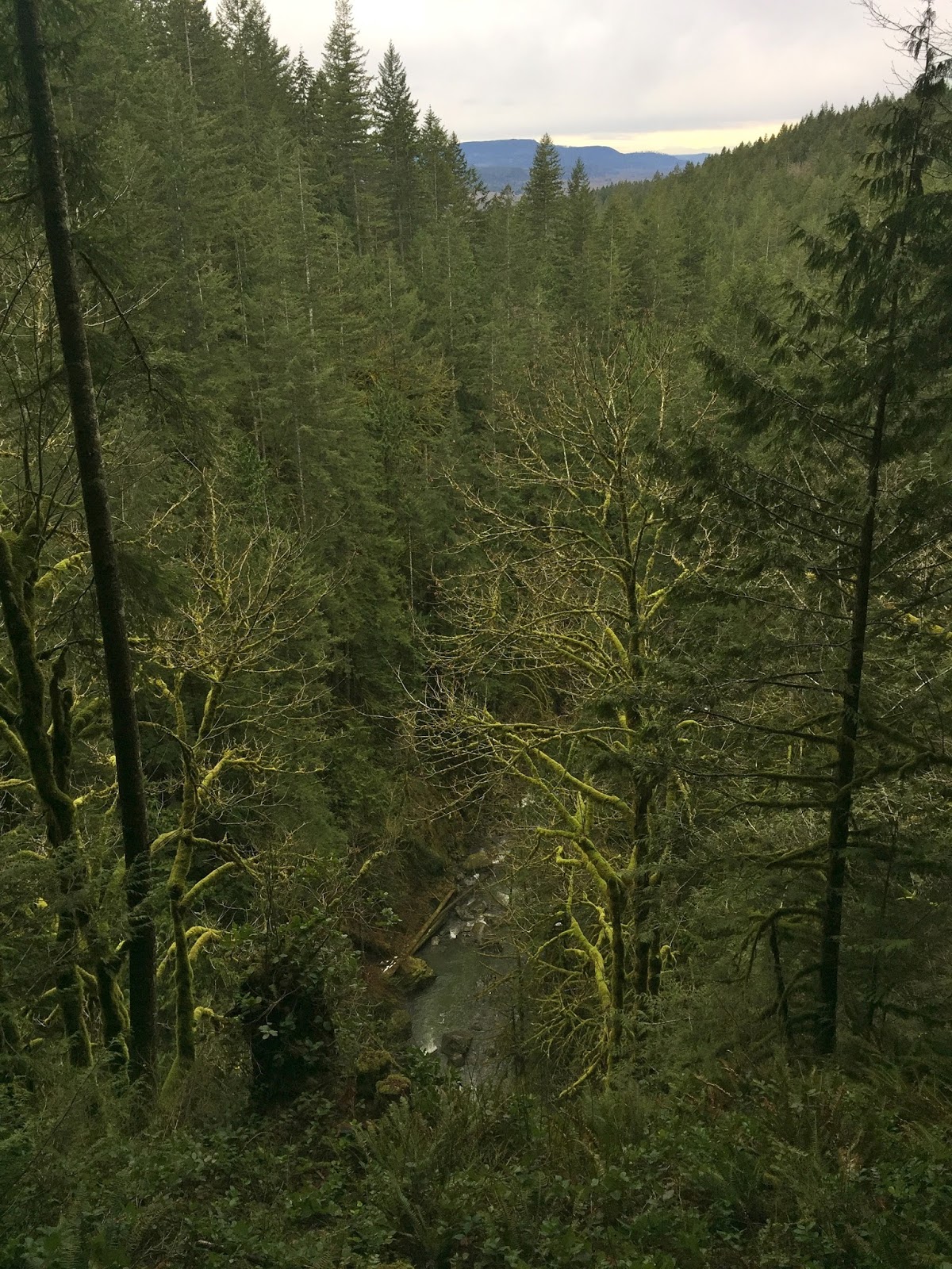
Watching the fork of the Wallace River that comes down from Wallace Lake to join the main Wallace Falls on a bridge crossing the river.

 Lots of beautiful greenery along this trail.

 A view point overlooking the valley below and the Olympic Mtns far in the distance.

1.3 miles past Small Falls is the view to Lower Wallace Falls (25 ft drop) with Middle Wallace Falls in the distance.

 Another 0.3 miles takes you to the viewpoint of Middle Wallace Falls (81 ft drop)

Another 0.65 miles leads to view of Upper Wallace Falls (265 ft drop).


From here there is a short 0.1 mile trail through the woods leading up to the Upper Grade Trail. There are blue diamonds on the trees marking the way.

2.3 miles along the Upper Grade Trail leads to Wallace Lake. We found the snow to increase in depth as we got closer to the lake, but no post holing.

 Along this trail we had a nice view of the valley below and the Olympic Mtns far in the distance.
 We saw some fresh bobcat tracks in the snow.
 Wallace Lake, we found a nice picnic table to enjoy the view and our lunch.
 We returned via the Greg Ball and Woody Trail for 4.1 miles back to the trail head.