Wednesday, July 30, 2014

Elk Meadows Hike on Mt Hood Oregon

A Beautiful view of Mt Hood as seen from the drive north. We met our Aunt Carolyn to go hiking to Elk Meadows before continuing home.
This hike is a little over 6 miles with about 1,200 ft elevation gain.


Most of the hike is in the forest, we passed lots of wildflowers and berries along the way. There were several water crossings, with the logs over Newton Creek being the most treacherous. Mt Hood in the background.

 We hiked the Elk Meadows Perimeter Trail.
Ttaking time to enjoy the wildflowers in the meadows.


 We enjoyed glimpses of Mt Hood through the trees.
 And ate lunch at Elk Meadows. Great hike and a
 welcome break from the long car drive home.
Here are some of the wildflowers and berries we saw on the hike today:


Tuesday, July 29, 2014

Black Crater Oregon Hike

Today's destination: hiking to the top of Black Crater in the Central Cascades of Oregon. Here Black Crater is seen from the Dee Wright Observatory in the 65 square mile lava flow at McKenzie Pass.

Happy to have another hike in the Three Sisters Wilderness!
The hike to Black Crater is an 8.5 mile round trip with a 2,300 ft elevation gain.

 The trail begins in the woods and begins climbing right away.

 We did pass a large rock field which had this beautiful ripe berry bushes in it.


 The forest thins out as the trail nears the top of Black Crater.
We crossed a couple of snow fields near the top. Mt Jefferson & Mt Hood seen in the far distance.
 We were thrilled to pass through this beautiful meadow near the top of the crater. Hummingbirds and butterflies danced through the air.
 Near the top of Black Crater.
 Climbing up one of the two large mounds on top of Black Crater.


Climbing up the higher of the two mounds.


On the highest point of Black Crater! 

From Black Crater looking south:  Broken Top, South Sister, North Sister, and Middle Sister peeking over the shoulder of North Sister on the right.

Panorama south to north: Broken Top, South Sister, North & Middle Sister, Belknap Crater, Mt Washington, Three Fingered Jack, Mt Jefferson, Mt Hood
 While we were on the top, we saw a thunderstorm over Broken Top, we hurried down the trail and were halfway down before the storm caught up with us.
Here are some of the wildflowers we saw on the mountain today:


Monday, July 28, 2014

Obsidian Trail Summer Oregon Hike

Our hike was in the Obsidian Limited Entry Area of the Three Sisters Wilderness, we made sure to secure our hiking permits beforehand. This hike is 11 miles with about 1,800 ft of elevation gain.
We began our hike with the Obsidian Trail. The trail starts in the woods, it was nice to have shade on a hot summer day.


We enjoyed the variety of wildflowers along the way, including the bear grass in bloom.


After three miles of hiking and 1,050 ft of elevation gain, the trail crosses a lava field. We saw the Obsidian Cliffs to the south, the trail would soon take us hiking above these cliffs.


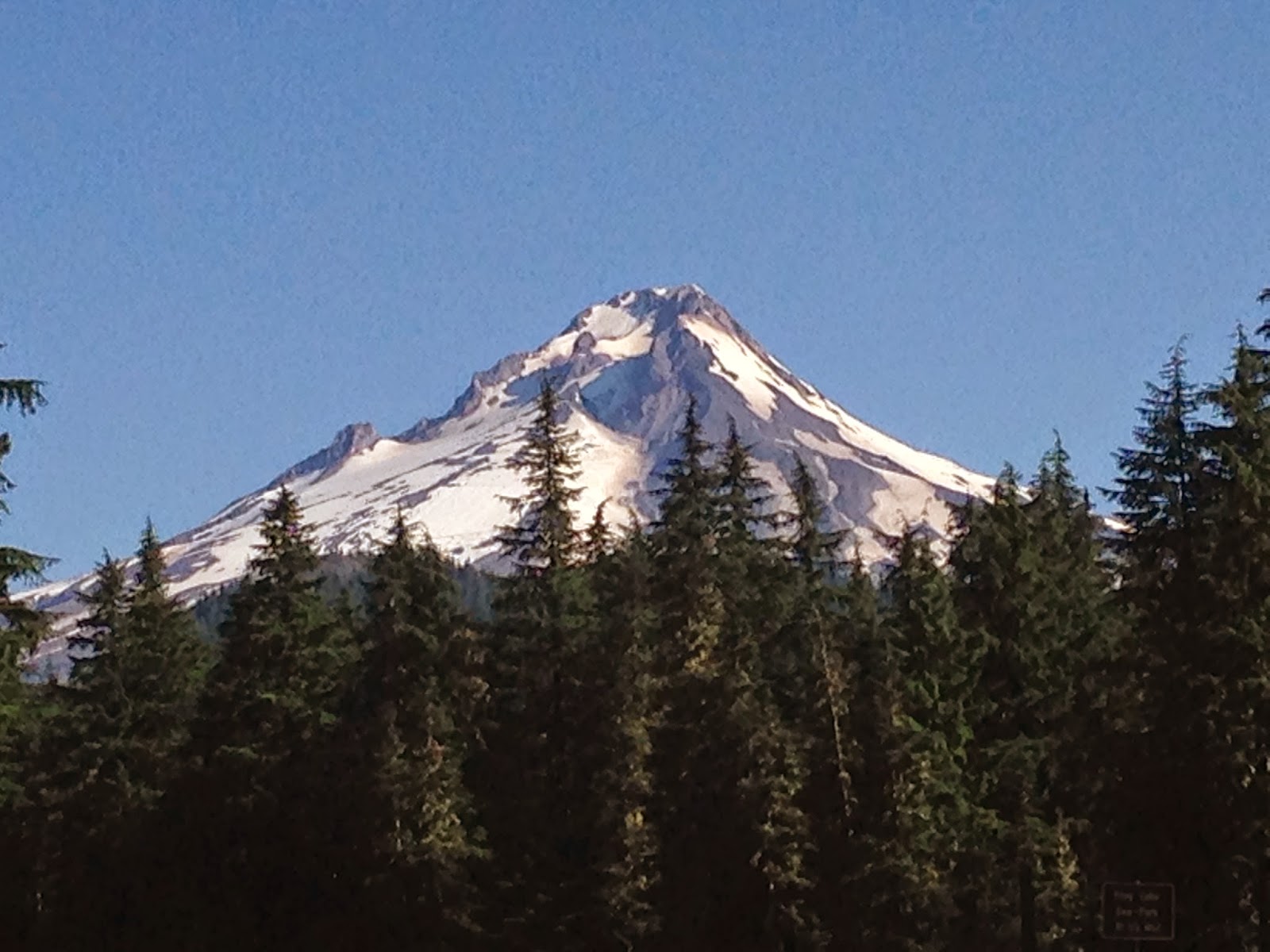
As the trail continued over the lava field, we caught a view of North Sister.


And as the trail climbed, we also saw Middle Sister to the right of North Sister.
It was amazing to see this new tree growing right out of the rock.
At the end of this lava flow, we reached theWhite Branch Creek and a beautiful filed of wildflowers.
Across this meadow, 3.6 miles from the trailhead, the trail splits. The left trail, Glacier way joins the PCT (Pacific Crest Trail) in 0.7 miles. The trail straight ahead is the continuation of the Obsidian Trail going almost 2 miles to join the PCT further south near Obsidian Falls. We choose to continue on the Obsidian Trail.


As the Obsidian Trail goes over the Obsidian Cliffs, the trail is covered with obsidian, sparkling in the sunlight.


The trail goes through a mixture of forest and fields, giving us glimpses of Middle Sister.


5.5 miles from the trailhead, the Obsidian Trail joins the PCT,


About 0.1 mile north on the PCT, there is a short spur leading to Obsidian Falls, the perfect spot for a lunch break.


Near the falls, we saw this large obsidian boulder, sparkling in the dappled sunlight.


We continued hiking north on the PCT, entering the Sunshine Meadows near Glacier Creek
We crossed a couple of snow fields, saw younger hikers swimming in one of the tarns.
The Sunshine Meadows are a beautiful mixture of obsidian and wildflowers.
To the west, we had a fabulous view to the northwest of Mt Washington, Three Fingered Jack & Mt Jefferson.
About 1.5 miles along the PCT, we turned onto Glacier Way Trail to return to the Obsidian Trail by White Branch Creek, having enjoyed a nice loop over the Obsidian Cliffs and the PCT.


Here are some of the wildflowers and fungus we saw on this hike today: