Wednesday, October 30, 2019

Alpine Lookout

 Hiked up to Alpine Lookout via the Round Mtn Trail on the east side of Stevens Pass. This was a 10 mile round trip hike with an overall elevation gain of 3,100 ft.
We only saw one other hiker today.
 The trail gains elevation quickly, and goes through a burned section. Here we could look out and see the ridges and hills to the east of Lake Wenatchee.


A little over a mile from the trailhead, the trail joins the Nason Ridge Trail (a mixed use trail).
 From here there was mixed snow and bare trail.

0.25 mile to the west along the Nason Ridge Trail, there is an excellent view spot looking down to Lake Wenatchee and over to Glacier Peak.

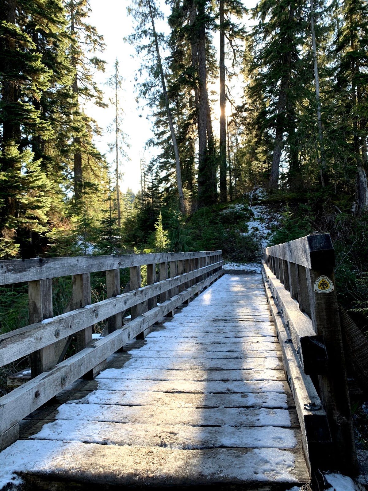
Up on the ridge we hiked through snow where the trail was mostly in the shade.

 The areas that are in the sun, were mostly snow free. On the distant ridge is where Alpine Lookout is located.


About 3 miles from the trailhead, the trail narrows and there are great views.

 Along the ridge, the trail would open up to some views, ahead are the peaks near Stevens Pass.

 A 1/2 spur trail leads off of the Nason Ridge Trail going up to Alpine Lookout.


View to the west from some boulders before reaching Alpine Lookout

 Alpine Lookout as seen from the trail on the west side of the ridge


Pano from the lookout looking North: peaks in the Cascades including Glacier Peak, Lake Wenatchee to the far right
 Pano from the lookout looking Soutth:  including peaks in the Enchantments, peaks near Stevens Pass

zoom of Glacier Peak

zoom of another peak

zoom of peaks near Stevens Pass, and the tip of Mt Rainier in the far distance

zoom of peaks in the Enchantments

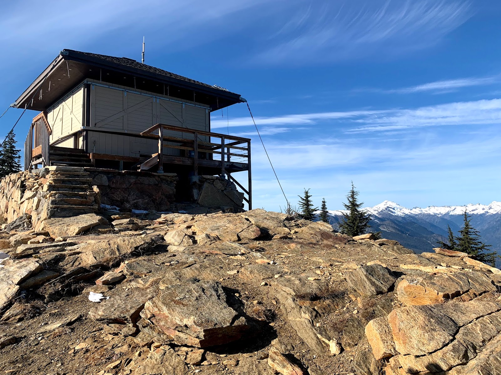
Alpine Lookout from the other side


 We wandered around the ridge, so many great view points.


The views were so fabulous today, we spent over an hour up here.

 Hiking back down, the sun lit up one side of the shore around Fish Lake below.
 We didn't notice the few larches in the burn area near the beginning of the trail until we were hiking back down in the late afternoon sun.

 Lovely alpenglow as the sun was setting.


I loved how the setting sun lit up this tree near the trailhead.

Monday, October 28, 2019

Railroad Grade

We drove up to Mt Baker National Recreation Area to hike the Railroad Grade Trail, 7 miles round trip with 2,000 ft of elevation gain. A bit over half way up we put on our microspikes as the trail was quite slippery.


 The trailhead is the start of 3 trails. There was good signage along the trail, making it very clear which way to go.
 Fun to see part of this trail is along the Pacific Northwest National Scenic Trail.
This bridge is near the beginning of the trail.

 view from the bridge


We had a brief glimpse of Mt Baker as we hiked through a meadow.
 Survey Point rises up from the meadow along the trail.
In the morning the trail was a mixture of frost and ice, in the afternoon it was muddy.

The suspension bridge is removed every fall, but we were able to cross Rocky Creek on this tipsy board.

 some icicles along the trailside
 About 2 miles up the trail we began to reach the open meadows and view of the peaks to the west of Mt Baker

 Up to the split in the trail, the snow was well packed down, as we continued along the Railroad Grade Trail, there were fewer and fewer boot prints.
 In the morning the snow was very firm and we did not post hole.
 Looking across the meadow to Park Butte and the lookout on top

 zoom of the lookout on Park Butte


The top of that ridge below Mt Baker is the trail
 I found the snow covering most of this narrow trail a bit intimidating, this was a slow portion for me.

 We only saw one set of footprints before us on this ridge, and later met this hiker on her way back. She was the only other person we saw on the Railroad Grade part of this trail today.


So happy we choose this hike today, gorgeous views! And so quite and serene. We were blessed that the winds did not start until we were almost back to the car.


Pano from Park Butte to Mt Baker:

Pano view to the south, Glacier Peak in the far distance:

 zoom of the Easton Glacier on Mt Baker

 I was even slower hiking down this ridge.


near the end of the ridge, looking back up towards Mt Baker and the gathering of clouds.
 Frozen pond below Mt Baker