 The Obstruction Road off of Hurricane Ridge in the Olympic National Park opened last week, so we headed out for a fabulous wildflower hike. We saw lots of wildflowers in bloom on the drive up to Hurricane Ridge and thousands of avalanche lilies along the Obstruction Road, along with other flowers and marmots scampering pass.
From Obstruction Point, at the end of Obstruction Road, we choose the Badger Valley - Grand Valley Loop Hike. This is a 9 mile hike with an overall gain of 2,700 ft all on second half of the hike.
Panoramic view from the parking area: On the left, Lilian Ridge (the way we will return) between Badger Valley and Grand Valley, and to the right, many of the Olympic mountains.
 The Badger Valley Trail begins 0.3 miles off of the Grand Ridge Trail toward Deer Park.
There was a small amount of snow along the Grand Ridge Trail.
Panoramic View looking down toward Badger Valley where the trail descends. The top portion of the trail is a steep descent over loose rocks.
The top portion of the trail is steep, but less steep than the Grand Valley Trail, so easier on the knees.
To the south, we could see lots of water running down from the melting snow.
We saw pussy willows in bloom and lots of marmot burrows, but no marmots in Badger Valley today.
About 1 mile down the trail is a cutoff trail up to the Grand Ridge Trail and Deer Park, we continued down Badger Valley
The trail then enters the forest and alternated between forest and meadows as it continues down.
There were many interesting trees to capture the imagination.
more meadows filled with wildflowers
a large meadow with thousands of shooting stars in bloom
As the trail continued it's descent, the trees seemed to grow taller and taller.
About 3 miles from the start, we crossed a log bridge over Badger Creek. The trail has descended about over 2,100 ft and now begins the climb up to Grand Lake (about 800 ft in 2+ miles)
Today, we saw lots of water running from the snow melt. In the forest we would see trillium, calypso orchids, avalanche lilies and much more in bloom.
There were chocolate lilies beginning to bloom as well.
About 3.5 miles from the start, we crossed a large log over Grand Creek.
Many mossy covered streams along the way. A couple of places we could hear waterfalls nearby, but the trees were to thick to get good views.
About 4.9 miles from the start, we crossed another log over Grand Creek.
The trail continued to climb toward Grand Lake, passing many fields of avalanche lilies.
About 5.25 miles from the start, we found a side trail to the campground at Grand Lake, we took the side trail to sit by the lake and enjoy our lunch.
Panoramic view of Grand Lake from camp site #6
After a lunch break, we continued back to the trail around the lake
At the north end of the lake, the trail turns to the west, and toward the junction with the Grand Valley Trail
Up through meadows filled with flowers
 We had a late start today, would have a long drive home and we had all hiked to Moose Lake before, so at the junction, instead of heading south to Moose Lake, we began the hike up the Grand Valley Trail to Obstruction Point.
The trail would continue to alternate between open meadows and forest areas.
and continue to climb, this section ascends 1,500 ft in 2 miles. Looking down at Grand Lake nestled in the north Olympics.
Along the steepest section of the Grand Valley Trail, we stopped to enjoy a deer taking its time along the trail ahead of us.
 Higher up on the trail, we were able to look down over a ridge line to see Moose Lake far below. Moose lake is only 1/2 mile north of the junction of the trail arising from Grand Lake.
Panoramic View as we continue to ascend up the Grand Valley Trail.
From high above Grand Valley on Lilian Ridge, panoramic view looking west to south, we're now able to see more of the Olympic mountain peaks.
For awhile, the trail travels along the top of Lilian Ridge giving amazing views, even on this overcast day. Looking west, Obstruction Point trailhead is down the far side of this ridge.
 And directly west, we could see Glacier Peak (zoom), both of these peaks lie far to the west across Puget Sound in the Cascades
 On top of Lilian Ridge there is a spur leading along the ridge to the south, we choose to continue to Obstruction Point.
High up on Lilian Ridge among the rocks, we continued to see wildflowers blooming, and watched the skies darken over the peaks.
There was still another steep section to climb before we returned to the trailhead.
Continuing up on our way to Obstruction Point. We would cross a few small snow patches.
 When we returned to our car, we were greeted by this deer. We saw many more deer and marmots along the Obstruction Point Road as we drove out this evening.
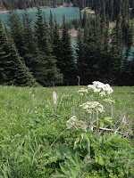
Some of the many wildflowers we saw on our hike today:


