Monday, January 30, 2023

Teneriffe Falls

We drove out to North Bend and the Mount Is Natural Resource Conservation Area to hike up to Teneriffe Falls from the Teneriffe Falls Parking lot. This 5.6 miles round trip with 1,585 ft of gain. We only saw about 12 other hikers today. Most of the trail is in the forest and there was no snow along the trail this morning.

We saw some large hoar frost beside the trail.

The first mile of the trail is fairly flat. We spotted Mt Teneriffe through the trees. 

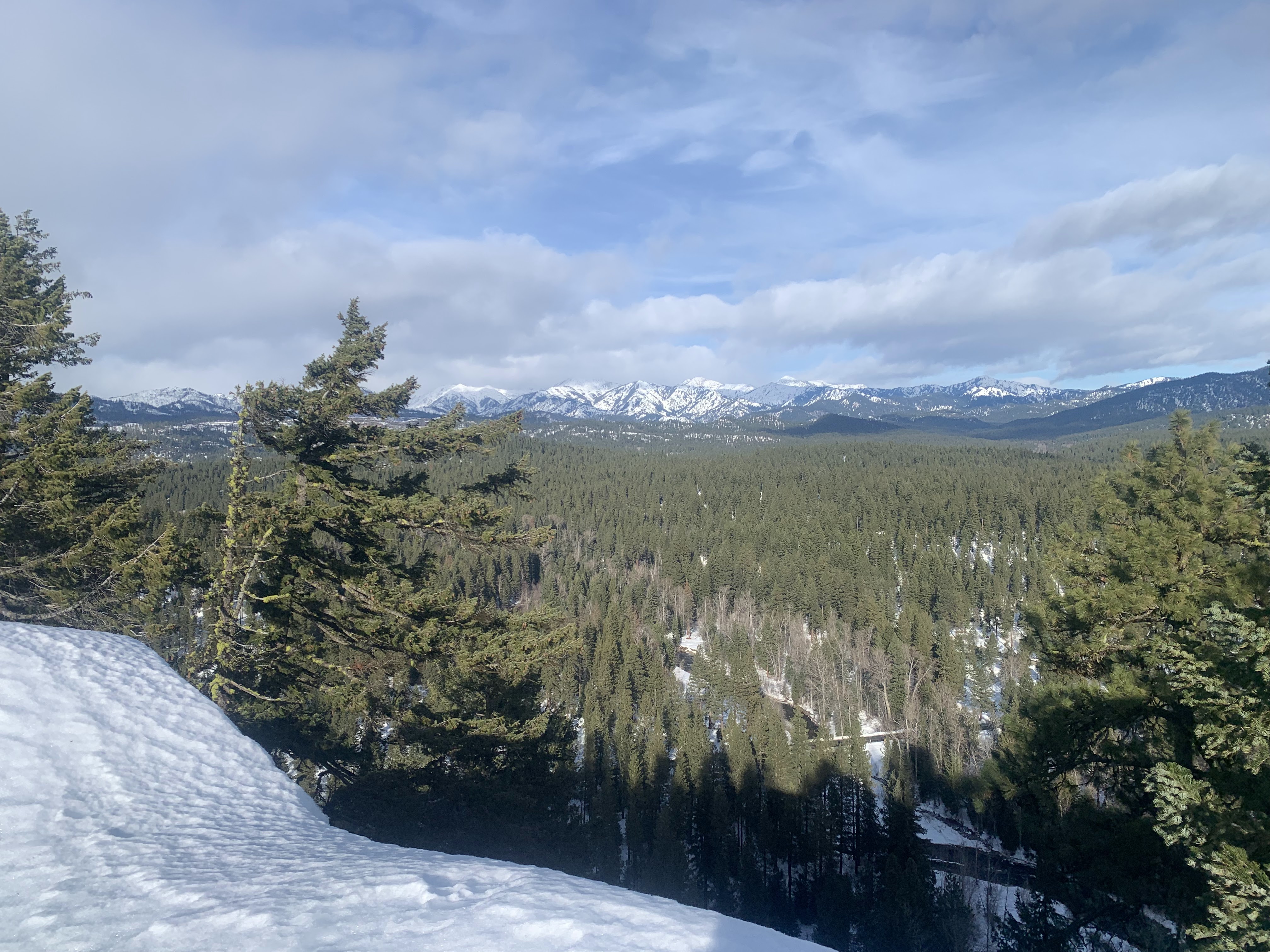
There were a couple of open areas as we hiked up the switchbacks. Another local peak in the distance.
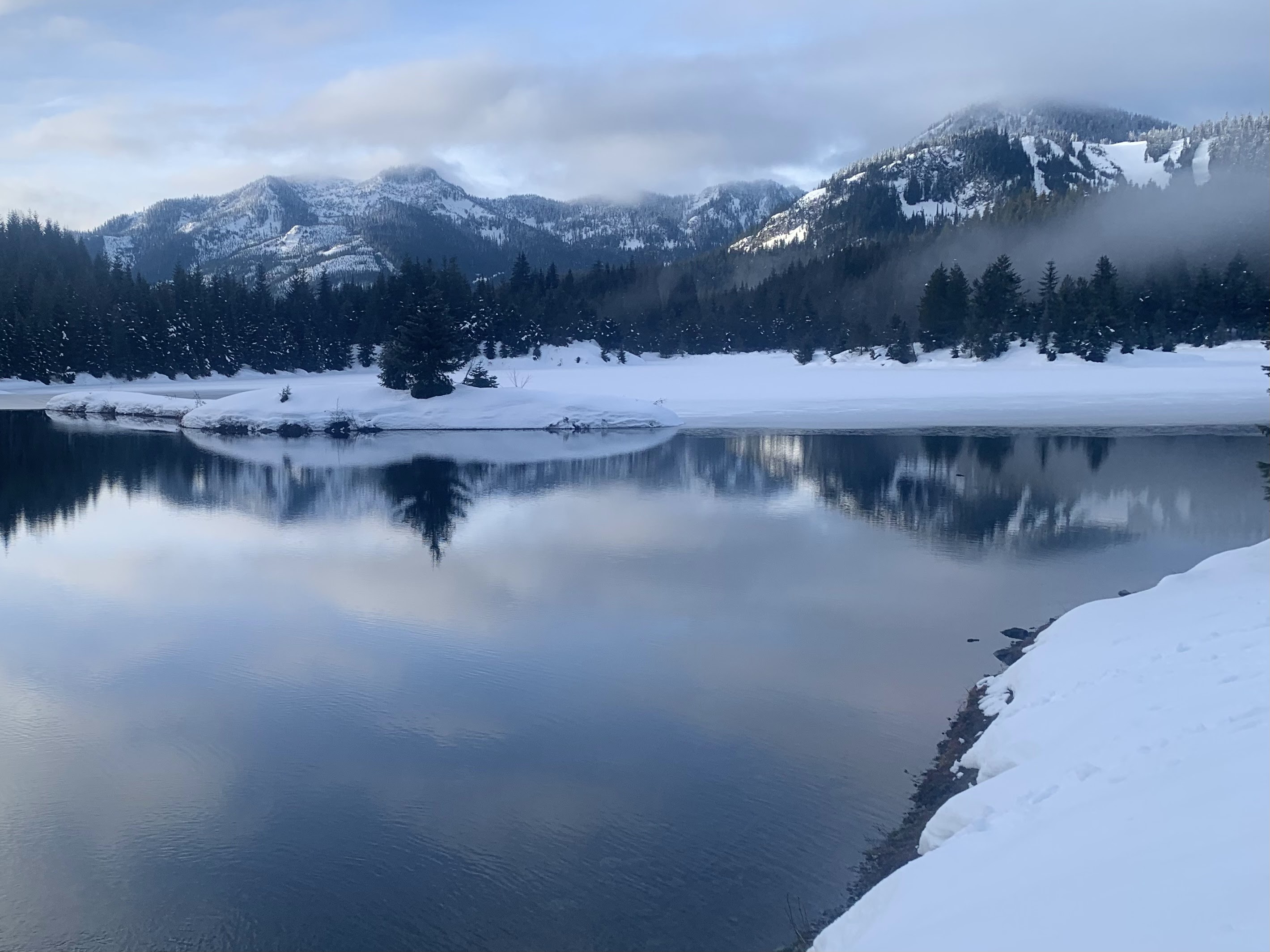
View looking towards the east towards Rattlesnake Ledge, and
Mt Rainier in the far distance (zoom).
We saw many icicles in the rocks and moss along the trail.


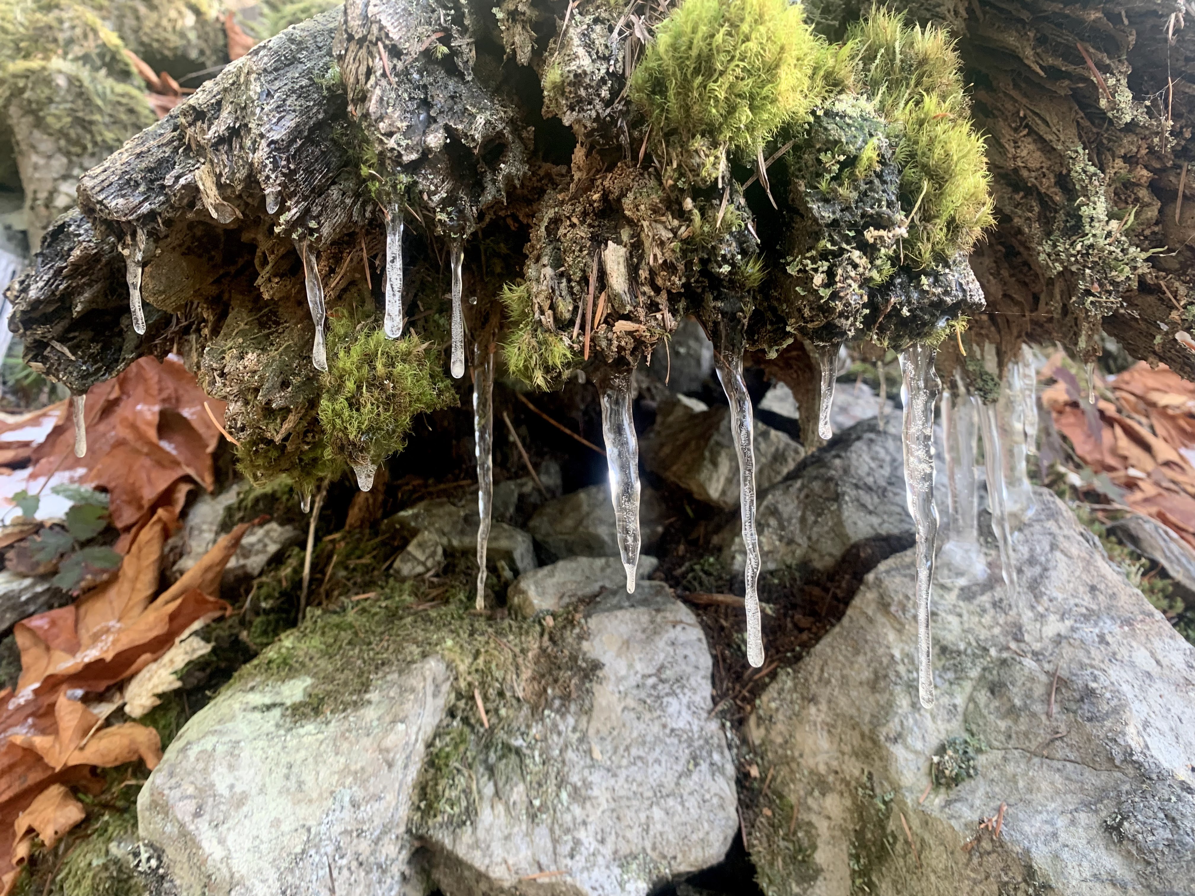
View of Lower Teneriffe Falls through the trees.

I went down a boot path, until it was too steep for me to comfortably continue, the lower portion of Lower Teneriffe Falls.

Teneriffe Falls was beautiful with the ice. As the sun was on the upper section, we saw several ice falls.

View of the falls from another spot

Panorama of Teneriffe Falls, the tallest drop is 226 ft, with an overall drop of 414 ft


Wednesday, January 25, 2023

Gold Creek Pond and Heli's Pond

This morning I drove tot he Gold Creek SnoPark at Hyak to hike out to Gold Creek Pond and Heli's Pond. My route today was 4.5 miles and the snow was well packed down, so snowshoes were not needed. I did not see any other people until I was well along the closed road heading back to the parking area. It was amazingly quiet, serene and beautiful this morning. I hiked up the closed forest road and turned into the closed parking area to head around Gold Creek Pond clockwise from the south side. View of Gold Creek looking upstream from the bridge.

Just past the bridge, this is the view looking downstream along Gold Creek.

The south end of Gold Creek Pond is completely covered with snow, looking northward.

The very north/northeastern part of Gold Creek Pond was not frozen and was a beautiful place to take lots of photos. Looking southwest:

View along the east side of the narrow peninsula into the pond

View along the peninsula looking southwest, and

the view looking northeast out on the peninsula.

Views looking southwest and westward as I continued going around Gold Creek Pond,


From the east side of Gold Creek Pond, I took the Gold Creek Trail up to the closed road, and continued northward for about 0.7 miles to the turn off to Heli's Pond There were some peekaboo views of the nearby ridges.

View of Heli's Pond looking southwest. There are signs stating the bridge is not safe and not to cross. There was enough well packed down snow on the north side of the bridge to safely cross to the other side of the pond.

View of Heli's Pond standing in front of the bridge looking north. I could see a distant snowy peak.
zoom of the peak, I think it is Chimakin Peak

Views as I continued going clockwise around Heli's Pond


Tuesday, January 24, 2023

Cheese Rock

After our morning snowshoe, we decided to head up to Cheese Rock and drove over to the snopark area in the Western part of the Teanaways. This was 3.3 miles round trip with 330 ft of overall gain. View looking upstream of the West Fork of the Teanaway River from the bridge over the river.
This was a very pleasant snow hike in the forest, we didn't see any other people until we were almost back to the bridge, where a couple was out with their dogs.
The route was well packed down, so we did not need snowshoes.
Cheese rock near the end of our route.
View of Cheese Rock from the side, I did not take photos from the more "holey" side as I did not like the graffiti on it.
Beyond Cheese Rock is a narrow ridge with views of the distant Teanaway Peaks
Waling along the ridge

Views from the ridge today:


Large boulder along the ridge
We returned the way we came, view looking downstream of the West Fork of the Teanaway River from the bridge.


Indian Creek Snowshoe

We drove out to the 29 Pines SnoPark in the Teanaways to snowshoe up Indian Creek (or the ridge between Indian Creek and Jack Creek. Our route was 4.5 miles with 800 ft of gain. From the SnoPark, we walked 0.6 miles back down along the road. We missed the turnoff to the closed road going up the ridge at 0.3 miles from where we parked. We didn't see any other people on our trip this morning. 
We saw what looked like a connector route to the closed road, put on our snowshoes and headed up this way.

There was a small creek to cross before reaching the closed road, my companion waded across the creek, I was able to jump across,

when I landed, one foot went into a hole and I slipped into the snow. Fortunately, I did not fall backwards into the creek. We decided when we completed this ridge hike we would not return this way.

It was easy to follow the closed road up along the ridge.

Besides an old set of ski tracks and a set of footprints, we followed what looked like coyote prints for quite a ways.


Up at the end of the ridge, there is a large interesting rock formation.


Although the day was cloudy, we could see some snowy hillsides through the trees. 

On our way down, we were able to go cross country to join a connecting closed road to the original road we began on, to make a bit of a loop.
Further down, we saw what appeared to be either large coyote or maybe small wolf prints in the snow.


Another peekaboo view on our way back down. Our snowshoe was a bit slow as the snow kept sticking and clumping to the bottom of our snowshoes. We got a good leg workout on this short trek.