Thursday, April 26, 2018

Rodney Falls and the Pool of the Winds

Our final hike of the day was to Rodney Falls and the Pool of the Winds on Hamilton Mountain at Beacon Rock State Park on the Washington side of the Columbia River.
This is a 2.5 mile round trip hike with 440 ft of elevation gain.  We were glad most of this hike was in the shade of the forest on this hot spring day.

We hiked straight up to the viewing area at the Pool of the Winds. Rodney Falls has a 50 ft droop into a pool before continuing down the cliffside. We were thankful for the spray and breeze that came down through this rocky channel.
A vertical pano of the Pool of the Winds.


Hardy Creek flowing downhill from the Pool of the Winds.

Vertical pano of Rodney Falls from the bridge over the middle section of Rodney Falls


\
On our way back down the trail, we took the short spur to Hardy Falls, it has a 90 ft drop, the trees obscure the view of the bottom of the falls.

There were several small streams cascading down alongside of the the trail.


Some of the wildflowers we saw in bloom today:


Mosier Plateau

 For our second hike today, we choose the Mosier Plateau a 3.5 mile hike with 600 ft of gain. The trailhead is located in the city of Mosier.
There were balsamroot in bloom at the beginning of the trail.
 A short ways up the trail is an overlook of Mosier Creek Falls.
 Soon after the falls, the trail climbs steeply uphill in a series of swithbacks with several sections of stairs. The hill was filled with wildflowers.
 On top of the plateau, we saw lots of wildflowers, here the trail begins to wind downhill for about 200 ft.
The views and wildflowers were wonderful.

 There were once a couple of houses up on the plateau, these tulips were probably from their yards originally.


Looking north across the Columbia River to Coyote Wall on the Washington side.
We were grateful for the breeze and rare shady spots on this hot spring day.


Mitchell Point

 Our first hike along the Columbia Gorge was up to Mitchell Point off of exit #58 on I-84 in Oregon at the Mitchell Point Trailhead. This is a 2.2 mile round trip hike with 1,000 feet of elevation gain.
View of Mitchell Point from the parking area.
The trail goes consistanly up. Most of the first 0.9 miles is in the forest. There were a couple of open meadows filled with wildflowers.
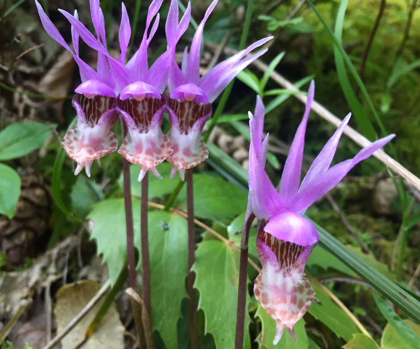
 We saw 30-40 Calypso Orchids in bloom along the trail today!


Several switchbacks crossed an open scree field. Be careful on the loose rocks.
 A view of the Columbia River and Drano Lake through the trees.
 Balsamroot was in bloom at the saddle.
 The last 0.2 miles goes up a steep ridge, which gets more narrow the further up you go. There were many loose rocks on this portion of the trail.
View of the Columbia River to the west, as we continued to ascend Mitchell Point.

 Almost to the top, the ridge continues beyond what you can see here.


Pano of the Columbia River looking north (from almost the very top). We could see the very top of Mt Adams over the closer peaks of Dog, Auspurger, Underworld, Green and Bald Mtns.


I think it took me longer to go down this ridge then to hike up as I was worried about slipping on the loose rocks and dry dirt.


Wide angle view of the Columbia River from the overlook at the parking area by the trailhead.

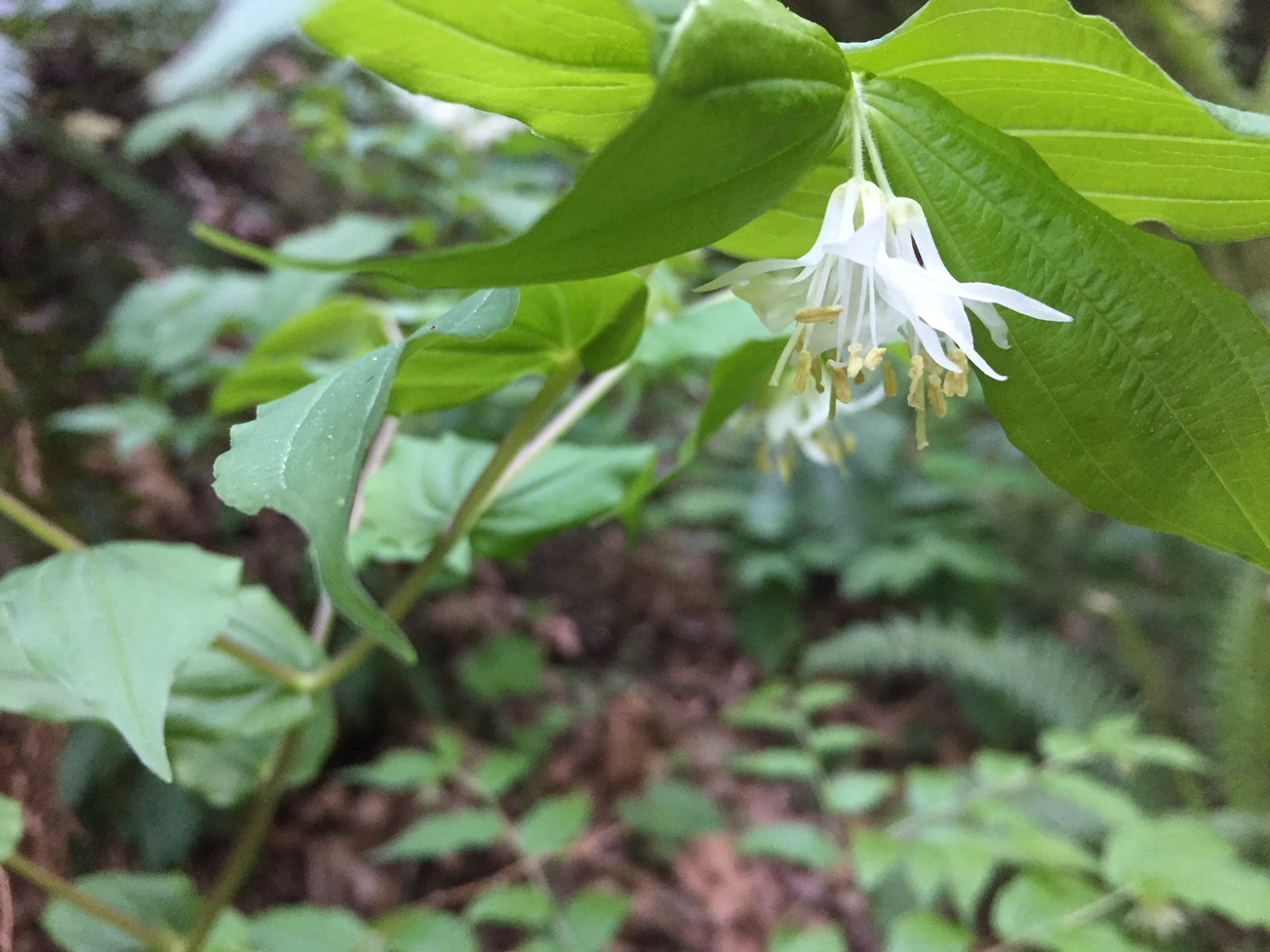
 Some of the other wildflowers we saw along the trail today:


Starvation Creek Falls

On a beautiful Spring Day, we decided to do some short hikes to waterfalls and wildflowers. We did a quick stop at Starvation Creek Falls, which is off exit 55 onI-84 in Oregon at Starvation Creek State Park. A short 0.1 mile round trip trail takes you below Starvation Creek Falls, a 190 ft two tiered waterfall.
 Creek below Starvation Creek Falls.
 We crossed the creek to get a side view of the falls.
More side views of Starvation Creek Falls.


Here are a few of the wildflowers we saw in bloom along the trail.