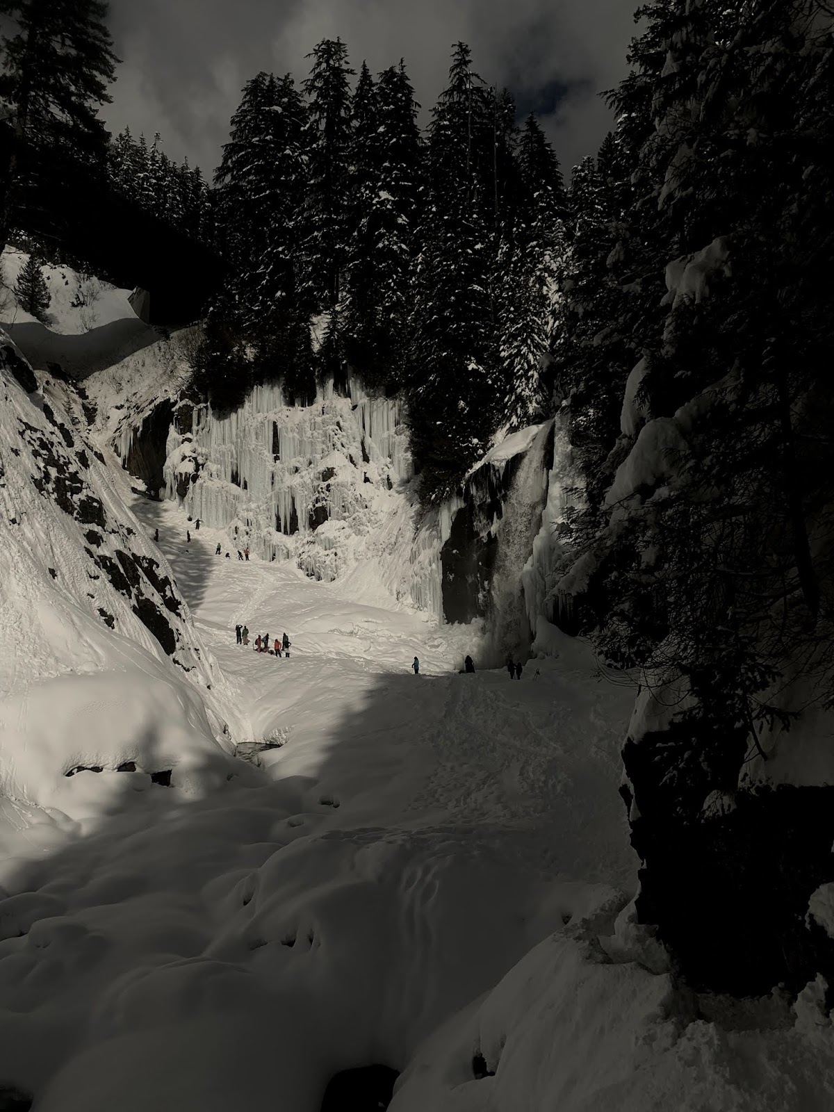
Forecast was for mostly sunny skies at Paradise this afternoon, so we drove up to Mt Rainier. The roads were icy and the gate at Longmire did not open until 10 AM. On our drive up we stopped at Narada Falls, and using micro spikes, we hiked the 0.2 miles down to the falls. So pretty with all the frozen ice.

We then continued up to Paradise and snowshoed over to Mazama Ridge. This was the clearest view we had today in the park.
The creek at the beginning of 4th Crossing.

About a foot of fresh powder to snowshoe through.
The sun only broke through the clouds for a minute.
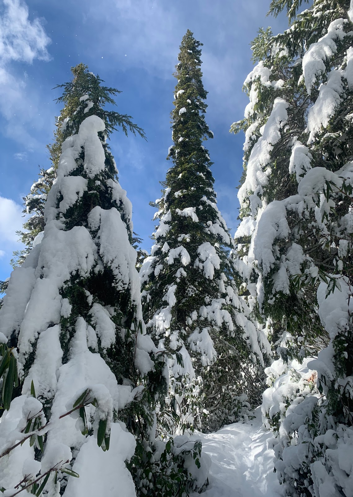
Enjoying the gorgeous snow covered trees.
As we neared the top of Mazama Ridge, the clouds began to descend.

We continued about 1/2 mile up along where the Skyline Trail would be.

As the clouds became thicker, it was more difficult to continue due to lack of depth perception. We stopped for a lunch break and waited to see if the clouds would lift. They didn't, and we decided it was not safe to try to navigate this narrow ridge with the poor visibility so we returned back down.

Nearing Paradise, it was still socked in the clouds.

We continued past the closed Paradise Inn and snowshoed over towards Myrtle Falls.

This is the snowiest I've seen Myrtle Falls, it's hard to see the falls under all the snow.
Close up of me standing on the bridge above the falls.

Trail to the bridge above Myrtle Falls
View from the bridge, looking back towards the Myrtle Falls viewpoint.
Even in the clouds, Mt Rainier is a gorgeous park!

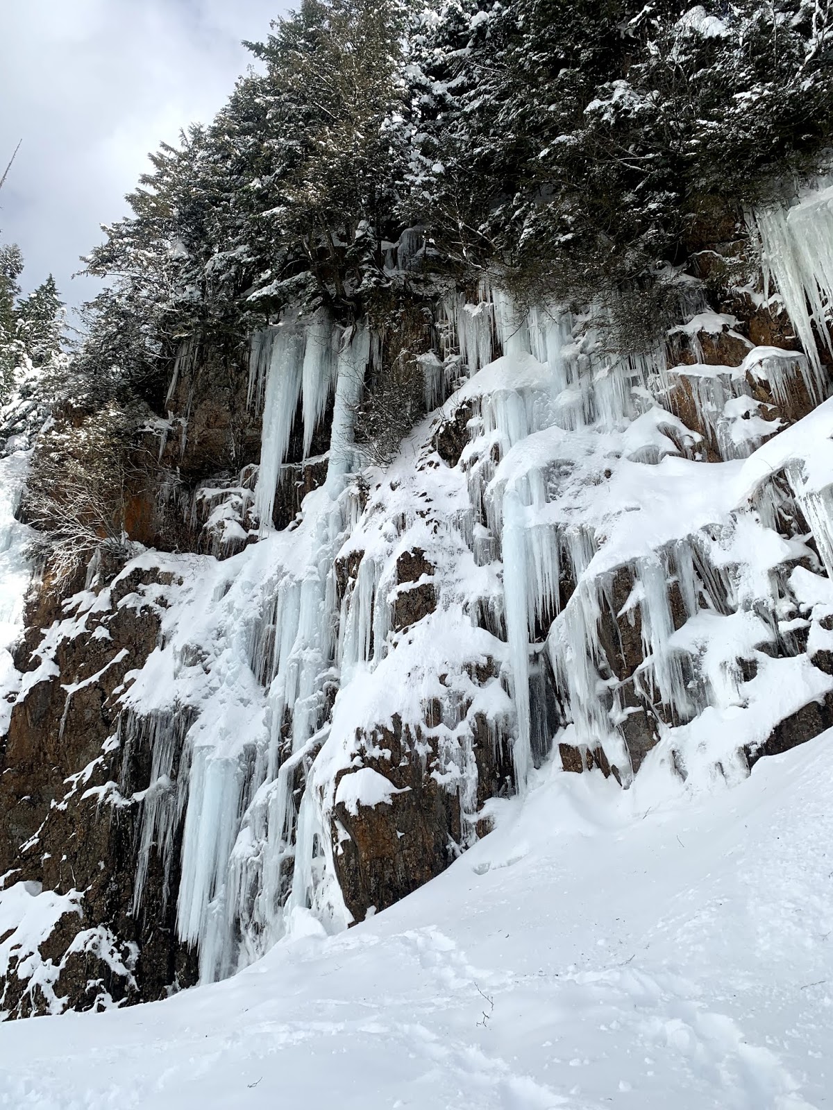
As we drove back towards Longmire, we stopped at Christine Falls.
Icicles and small waterfall along the roadside.
Another view of this small waterfall.

There were lots of icicles near Christine Falls.
Christine Falls as seen above the road
Christine Falls underneath the road/bridge.


 From the north viewpoint to the south viewpoint is 1/2 mile each way, the snow here was not packed down.There were a few boot tracks, I tried to stomp down the areas between the boot impressions to start making a packed down trail.
 South Viewpoint, Mt Rainier was hidden by the distant clouds, but we could see the Seattle skyline, Quilcene Bay, Hood Canal and Puget Sound. The wind died down while we were here, we were able to enjoy the views and our lunch in the warmth of today's sun.