Wednesday, January 30, 2019

Kendall Knob

 The Kendall Knob is near Kendall Peak Lakes (basically the same trail). I did not go to the lakes, but did go up and enjoy the beautiful views from Kendall Knob on a gorgeous winter day. The trailhead is at the first SnoPark across I-90 from Hyak on the east side of Snoqualmie Pass. The route up the Knob is on a close forest service road, so is fairly easy to follow. (The route to the lakes are off of the closed road).
Staying on the road (not taking any shortcuts), this was a 7.8 mile round trip with 1,700 ft of gain. The route was well packed down, and icy this morning so I used micro spikes for the entire hike.
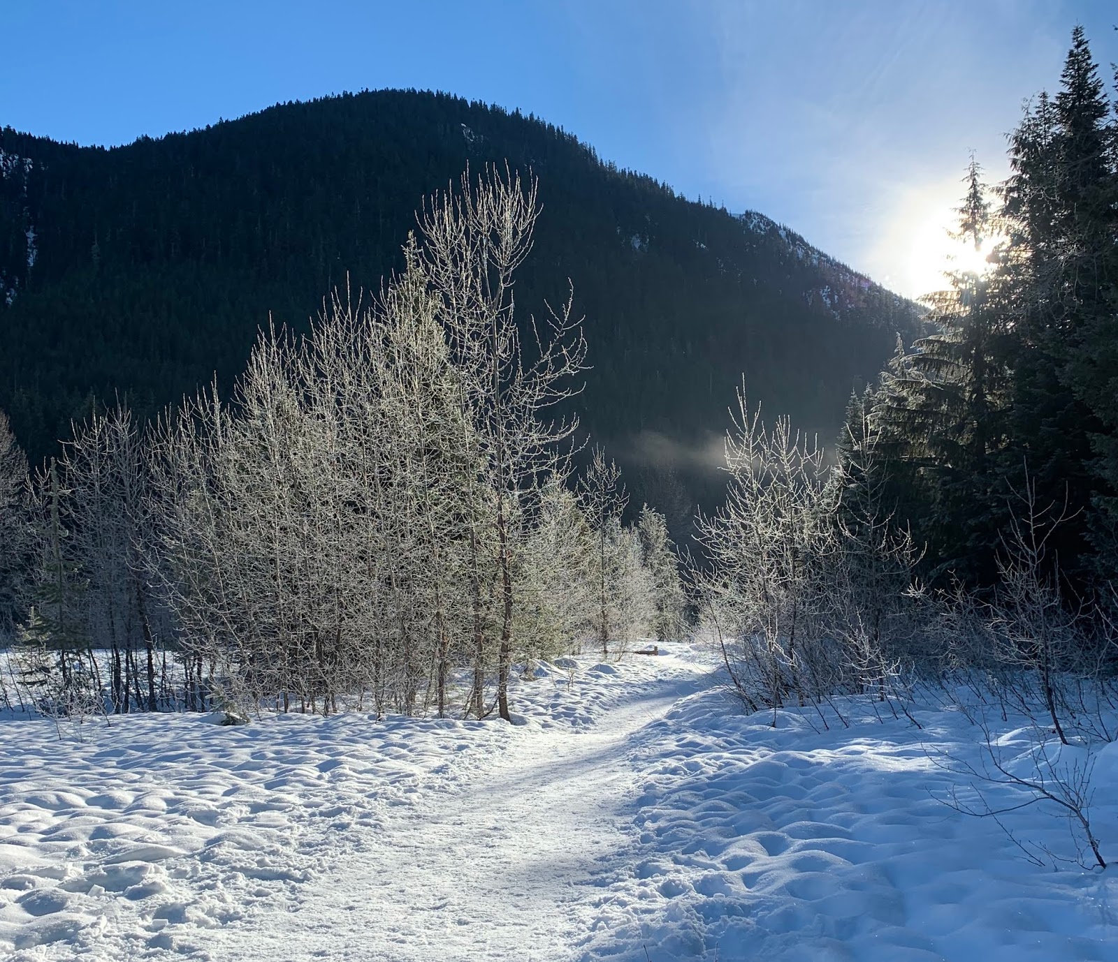
The moon was setting and the sun beginning to rise as I started out. At the beginning of the trail a bridge crosses over this creek (looking east).


I was still in the trees while the sky was peak, so gorgeous even though I had not yet reached a viewpoint.


Loved the many icicles hanging off of this tree near some running water


As the road climbs up the side of the mountain, there are some open areas with views. I could see that Snoqualmie West was covered in fog as I hiked under beautiful blue skies.


Further up, begin to see the Kendall Peaks


Closer look at the Kendall Peaks, the lakes are in the forest below the peaks.


The road takes a sharp turn towards the east,

 and ends at a nice clearing on Kendall Knob!


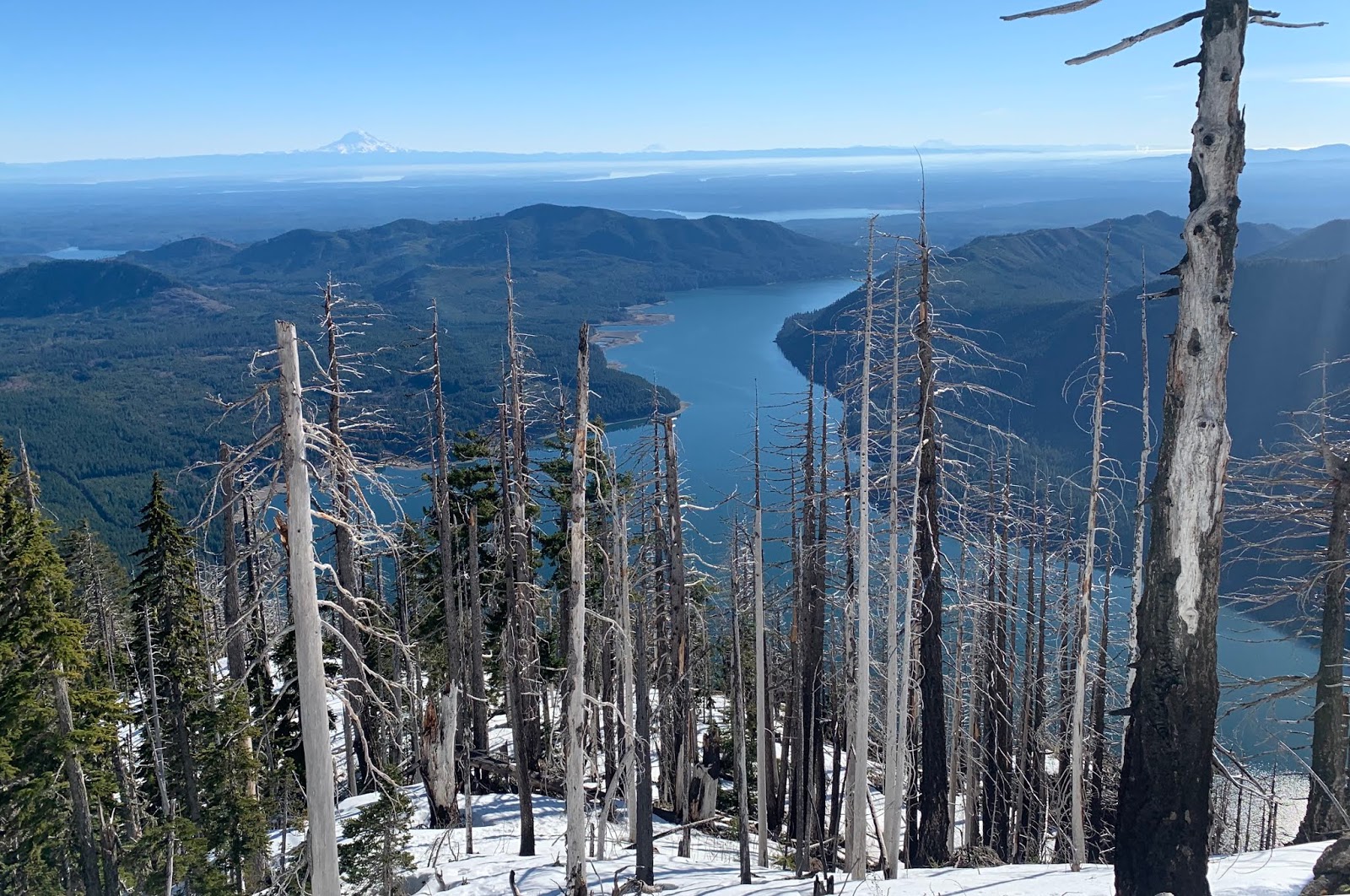
Pano looking east to southeast: Rampart Ridge, Keechelus Lake, and Mt Rainier peeking over some south Cascade mountains

 As I was returning down the road, I noticed another view of Mt Rainier peeking over the Cascades, that I had missed on the way up.
 Back near the trailhead, this time looking west at the bridge.


Tuesday, January 29, 2019

Mount Rose

Beautiful day to get a good conditioning hike up Mount Rose. We decided to go up down the short loop side, as we heard we wouldn't need snowshoes that way. Not many hikers do the full loop in the winter time. This route is 5.8 miles round trip with 3,500 ft gain.
The first section is 1.1 miles with 1,190 ft gain up to the Mt Skokomish Wilderness border. The second section is 0.7 miles with 1,060 ft gain up to Horsecamp and the start of the border loop. The third section is 1.1 miles with
1,250 ft of gain to the summit.
We didn't see any other hikers out on this trail today.


There are two short bridges crossing the creek near the parking area. A downed tree lies between the two bridges.

There are a few benches along the first section of the trail. On the way down, for the first time, I noticed I could see Mt St Helens above the clouds, between these trees near one of the bridges that was off to the side of one of the switchbacks.


First section done, the next section is the steepest part of the trail.

We didn't see any snow or ice all the way up to Horsecamp, th end of the second section. Here we took the shorter, steeper trail up on the left, heading clockwise on the loop.


Began to see snow at 3,500 ft, not too long after this the snow became consistent and icy in the morning, so we donned our micro spikes.


In the snow, we saw two different colored route markers, and a few different routes taken by previous hikers the snow. I'm certain that every time I've come up Mount Rose, it has been by a different route. No worries as we are always safe, and always make it back down.
Shortly before the last steep up to the summit, there is a broad tree covered ledge that allows for great views.

A couple of views looking  south southwest out over Lake Cushman, and in the distance: Hood Canal, Puget Sound; and Mts Rainier, Adams and St Helens.


As we headed up we could see Mt Washington and Mt Elinor to the east.


Pano from part way up the final 200 ft up towards the summit
Pano from the summit rock looking southwest to northwest


Lake Cushman was a beautiful shade of blue today.


We needed to be careful during our lunch break as the gray jays are very aggressive here.


The snow was very icy on this top section, but I kept stopping to soak in the views as I carefully came down.


Roadside waterfall not far from the trailhead.

Saturday, January 26, 2019

Gold Creek Pond

We took our granddaughter on a winter walk to Gold Creek Pond on the east side of  Snoqualmie Pass (in the winter a SnoPark Pass is needed to park along the access road). It is about 1/2 mile from the snopark area to the trailhead at Gold Creek Pond. The entire route was well packed down, we did not need snowshoes.


We started out as the sun was lighting up the top of the nearby peaks.


We went clockwise when we reached the loop that goes around Gold Creek Pond. View from the bridge over Gold Creek looking east.


Gold Creek Pond from the picnic area.


Views from the far side of Gold Creek Pond.


Gold Creek as we neared the end of the loop.


The sun lighting up the frosty trees as we returned past the closed summer parking area.


Friday, January 25, 2019

Palisades Winter Hike

We drove up Hwy 410 to the trailhead for the Palisades Trail (a pullout along the highway 1/4 mile past the Skookum Falls viewpoint). This trail can be done as a 15.9 mile loop hike. We hiked for 9 miles round trip, going out to the three viewpoints above the palisades, with 2,000 ft of elevation gain. Although there was a caution sign warning of hazards due to the wildfire in 2017, we did not see any burnt areas in the section we hiked.

About 1/2 mile up the trail, cross Dalles Creek on rocks in the creek. From here the trail is switchbacks up to the top of the palisades.


This is a lovely forest with lots of moss covering rocks and boulders.


About 1 mile from the trailhead, look for a short spur trail leading to a good view at the base of Lower Dalles Creek Falls.
The trail continues up going past large moss covered cliffs. In the morning there were icicles hanging from the moss

A steep wooden staircase is near the end of the steep section of this trail.


Dalles Creek near the top of the stairs.


A small wooden plank crosses Dalles Creek here and the trail climbs more gently along the top of the palisades for the next several miles.


About 2.5 miles from the trailhead, is the first of the viewpoints. From here we could see Sun Top Mountain and further to the west, Skookum Falls.


Some small plants along the edge of the viewpoint


The trail soon reenters the woods. About 1/2 way between the first and second viewpoints we had some icy snow over the trail.

Wide angle view from the second viewpoint. (about 3.5 miles from the trailhead). We could see the top of Mt Rainier peeking over the hills and Sun Top Mountain. We decided to take a lunch break here, enjoying the sun and views.
View of Sun Top Mountain under this bent tree a little further along the second viewpoint.

About 1/2 mile past the second viewpoint, we encountered consistent snow. It was well packed down.
Here the trail goes through a harvested area with young trees, giving us views of Mt Rainier to the south.


A bridge crosses Snoquera Creek, and the trail returns out to the edge of the palisades.


Pano from the third viewpoint (about 4.5 miles from the trailhead). Nice view of the top of Mt Rainier and Sun Top Mountain.
Looking east up the White River Valley. Down below is the local airstrip.


Here we watched the clouds gatherer the top of Mt Rainier.


Another view of a lenticular cloud settling over Mt Rainier as we returned down the trail.