One of the views we had driving up the Middle Fork Road near North Bend.
There are several hikes in the Middle Fork Valley. We choose the Middle Fork Trail up to the Dingford Creek Trail. One can hike anywhere from 1/4 mile to joining up with other trails and have fabulous views. We ended up hiking about 13.7 miles with 200 ft of elevation gain.
The trail starts by crossing a bridge over the Middle Fork of the Snoqualmie River. We were the first ones over the bridge this morning and would not see any other hikers all day.
View upstream from this bridge
View downstream from the bridge.
After crossing the bridge, we took the West Fork trail to the left, going upstream.
We soon had fabulous views of Garfield Mountain.
We would see Garfield Mountain through the trees quite a ways along the trail.
The trail goes through a lovely second growth forest.
About 3/4 mile along the trail, we passed under Stegosaurus Butte.
There are a variety of types of trees growing here.
We would have lots of peek a boo views of snowy peaks along the river.
About 4 miles or so down the trail, we saw this fork (we later learned it was a section of the trail that had been washed out). We decided to head down to explore a bit.
There were some gorgeous river side views.
Pano looking east:
Some other river side views further down this old section:
Back up on the main trail, we had a large bridge crossing
with a view of this cascading creek.
About 5.8 miles from the trailhead, the trail forks. To the left, down to the Dingleford Creek Trail. To the right, continuing on the Middle Fork Trail with options to go to Snow Lake, Goldmeyer Hot Springs, or up to Dutch Miller Gap and beyond. We headed down to the Dingleford Creek Trail.
The trail crosses over the Middle Fork of the Snoqualmie River.
from the bridge, view downstream:
view upstream
Beautiful forest! As we were at our turn around time, we stopped here for a late lunch and

a brief walk down to the river edge, looking back at the bridge we just crossed.

As we returned back to the trailhead, we enjoyed how the views changed in the late afternoon sun:
Garfield Mountain in the late afternoon
Back at the bridge near the trailhead
SaveSaveSaveSaveSaveSave


 A winter wonderland


 a brief walk down to the river edge, looking back at the bridge we just crossed.
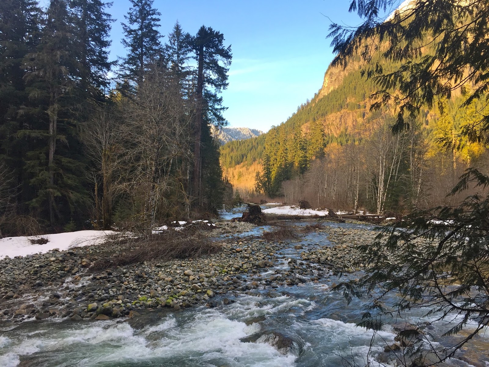 As we returned back to the trailhead, we enjoyed how the views changed in the late afternoon sun:


 Before heading up the trail, a short ways down the road, there is a nice view of Lake Cle Ellum. (This may be the summer trailhead parking area)


 Finally, we could see the summit between the trees. It is a steep climb to the top, we were glad there was fresh snow.
 Part way up, we began to see Mt Stuart in the distance to the north west.
 At the top, being careful to avoid any cornices.

 The trip down was much quicker, and we enjoyed snowshoeing into the views!