 We hiked up to Shriner Peak today in Mt Rainier National Park. This trail is on the east side of the park off of Hwy 123, between the 8 - 9 mile marker signs. The trail is 9 miles rt with about 3400 ft elev gain.
The trailhead is on the east side of Hwy 123 (across the road and south of the parking area). This trail starts in the forest and begins to climb right away. The first 2 miles or so, skirts the south side of Shriner Peak, climbing the entire way.
Most of the strawberry plants are still in blossom, but we did find a few ripe berries to snack on.
After a switchback and now heading west, the trail opens and you can see Mt Adams starting to rise behind a ridge to the south.
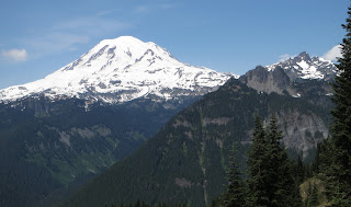
And, about 1/2 way up, at 2.5 miles you begin to see Mt Rainier to the west.
The trail switches back and forth, entering an open rocky slope while continuing to climb. The beargrass is just beginning to bloom here.
As the trail switches back and forth and continues to rise, you can see more of Mt Adams to the south (zoom shot) and
Mt Rainier to the east
 The trail next goes in and out of wooded areas and open meadows. Looking down and the meadows from above.
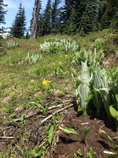
The snow has recently melted, with very few snow patches to be seen. We saw both avalanche lilies and
glacier lilies along the trail today.
 There were several ground squirrels to be seen.
Finally, with only 1/4 mile left of the trail, the fire lookout can be seen atop Shriner Peak.
 The fire lookout is a great place to admire the 360 degree views and to eat lunch.
Panorama from the lookout to the west: Mt St Helens (vey hazy) Mt Rainier, Double Peak,
Cowlitz Chimney
Panorama from the lookout looking to the south: William O Douglas Wilderness, Goat Rocks and Mt St Adams, other end of Shriner Peak where there is a campgroundPanorama from the lookout looking north east:
Large purple pine cones on a tree growing by the fire lookout
Mt Rainier through the fire lookout
After a leisurely lunch, we headed back down the trail. This time the trail headed west, with great views of "the mountain"
 I never tire of looking at "our mountain"
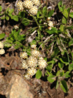
Some of the many wildflowers we saw today:


No comments:
Post a Comment