The trail starts at the east end of Sunrise Point and stays on the ridge for a short while. Here is the view from the morning looking down into the clouds. On the way out, we would have a view down to Sunrise Lake.
Then there are a few switchbacks leading down the ridge to the spur trail to Sunrise Lake at 0.5 miles (we decided to wait and to that trail on our way back out, hoping for better weather). We would run into several down trees on the trail today.
The trail descends about 500 ft before leveling out on the way towards Clover Lake.
Pano of Clover Lake reached at 1.5 miles from the trailhead.
After Clover Lake, the trail steeply climbs and descends a low ridge. Looking down to a meadow below this ridge.
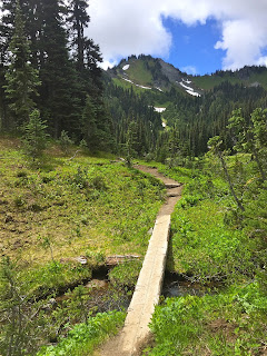
We walked through pretty meadows, crossing several streams.
At 2.5 miles from the trailhead, there is a 0.6 mile trail with 300 ft of elevation gain up to Hidden Lake.

We had a couple of beautiful water crossings on the trail.

As we were going up the trail, we could see either Tom or Harry Lake down below (the one that isn't right next to the trail).
Pretty pond near Hidden Lake.
Reflection in Hidden Lake.
Pano at Hidden Lake:
 Back down on the main trail, we soon passed the other lake (Tom or Harry).
At 2.9 miles from the trailhead, there is a very short spur to Dick Lake and Dick Lake Camp.
The trail then took us through a very large meadow with a large pond. The wildflowers are just beginning to bloom here.
View of the meadow with the Sourdough Mountains.
Pano at Upper Palisade Lake (reached at 3.5 miles from the trailhead):

From Upper Palisade Lake, the trail continues north for about 0.1 mile,
Where the "maintained" trail ends with an overlook of Lower Palisade Lake. There is a boot track down to Lower Palisade Lake, but we opted not to hike down today.
With the clouds lifting, we had different views on the hike back to Sunrise Point. Good visibility of the Sourdough Mountains in the large meadow. It was not clear enough for us to see the Cowlitz Chimneys to the south.
 On the ridge headed back up to Clover Lake, we could the ridge we climbed up to Hidden Lake earlier in the day.
On the spur trail heading down to Sunrise Lake, Dege Peak in the distance on the left.
Sunrise Lake from the lake shore
 As we the trail climbed back up to Sunrise Point, we were able to look down at the same place we stopped in the morning, this time, the low clouds were gone and we could see into the valley, Sunrise Lake and the Sourdough Mountains.
Some of the wildflowers we saw in bloom and other flora along the trail today:


No comments:
Post a Comment