
 I drove out to Brinnon on the west side of Hood Canal and to the end of the Dosewallips Road to hike the now closed part of the road up to the cataract section of the Dosewallips River, about 1/2 mile before the Dosewallips Campground. My route was about 12 miles round trip with about 1,200 ft of gain. I met 12 backpackers and 3 other day hikers on the trail today. The trail starts in Olympic National Forest. It is amazing how quickly this road has become more of a trail.
 About one mile from the trailhead, there is a bypass going up and over a hill. Part way up the hill looking down on the Dosewallips River.
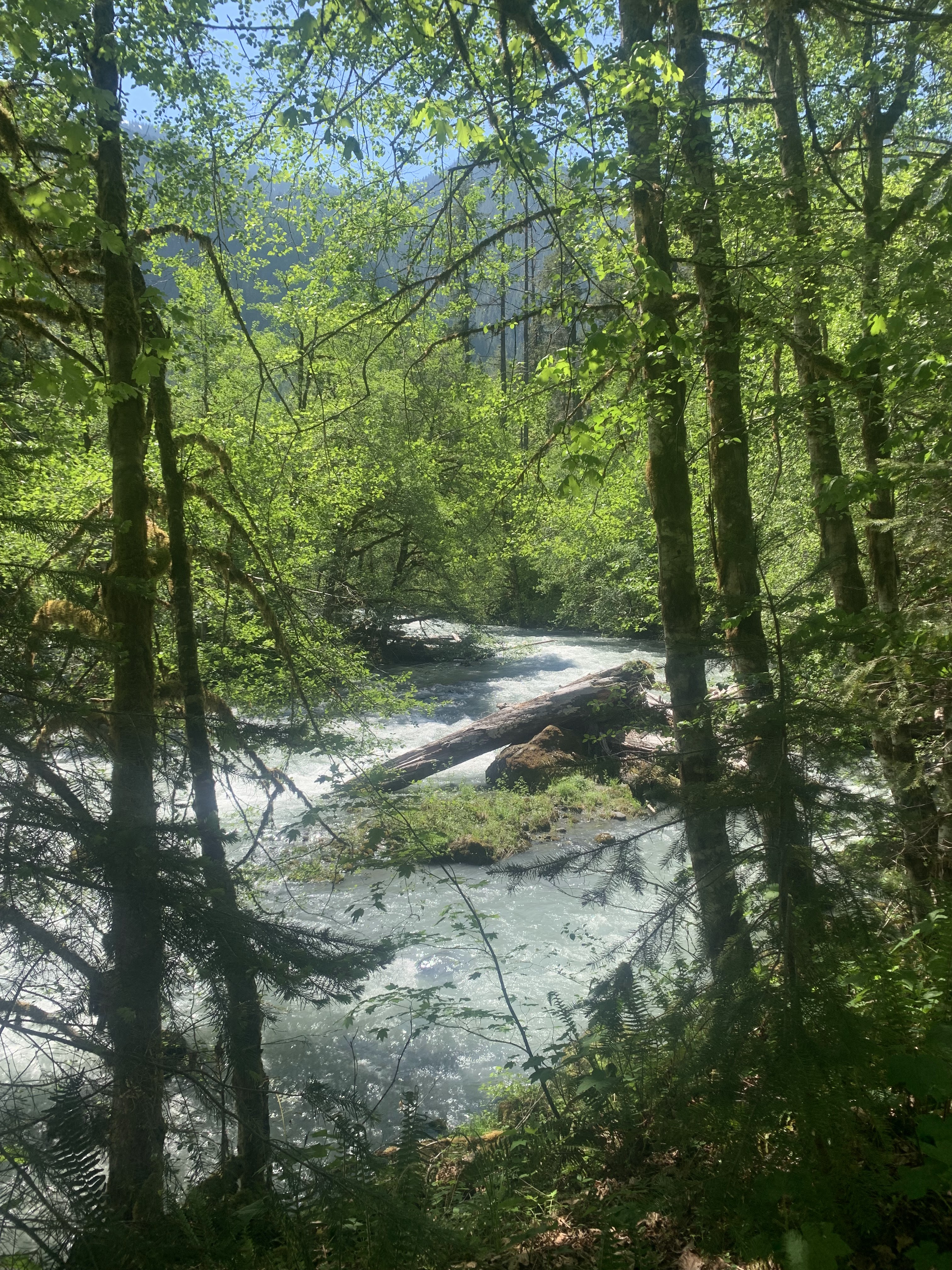
 There are many places where the river can been seen through the trees next to the trail.
 The water in the river and creeks are running high from the snowmelt after a week of hot weather.
 Stony Brook
 The rhododendrons are starting to bloom along this low elevation trail.
 Lots of lovely moss and fern underneath the trees.
 For a while the trail is high above the Dosewallips River.
 Unnamed creek crossing over the trail.
 Waterfall up in the forest of this unnamed creek (zoom)
 Bull Elk Creek from the bridge on the trail (I should have taken a picture of the bridge as it is deteriorating).
  Happy to see blue skies after a cloudy start to the day.
 Almost 5 miles from the trailhead, the trail enters Olympic National Park.
 Constance Creek from the bridge
 Hard to believe there was once a road here as there have been several rock slides and erosion.
 Views of the Dosewallips River through the cataract section:


 On my way up it was cloudy, so it was nice to see the sun shinning and blue skies on my hike back. Lovely views of the Dosewallips River through the trees.
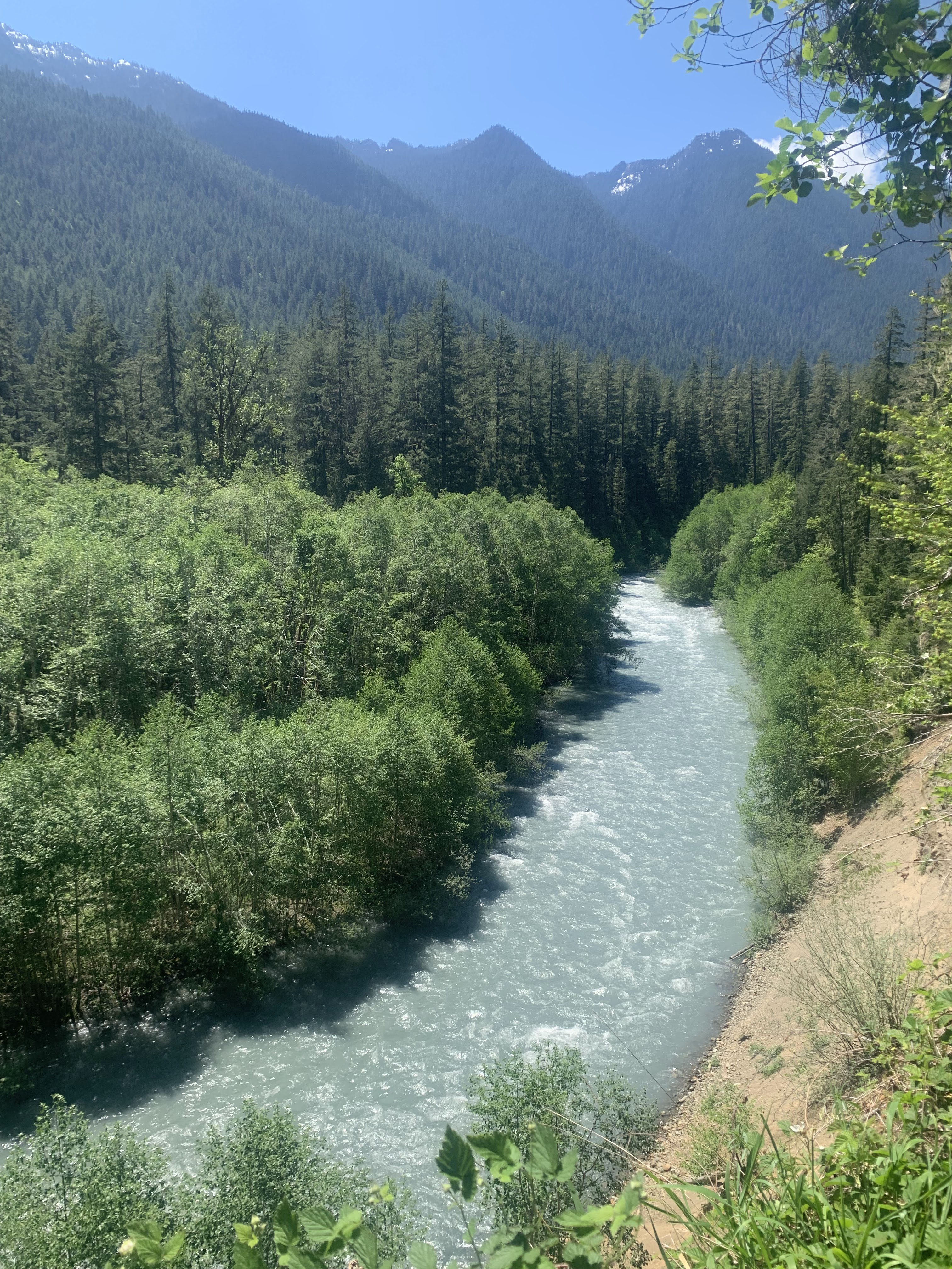 Up on the bypass trail over the hill, I took I side trail of view the Dosewallips River below, view upstream
 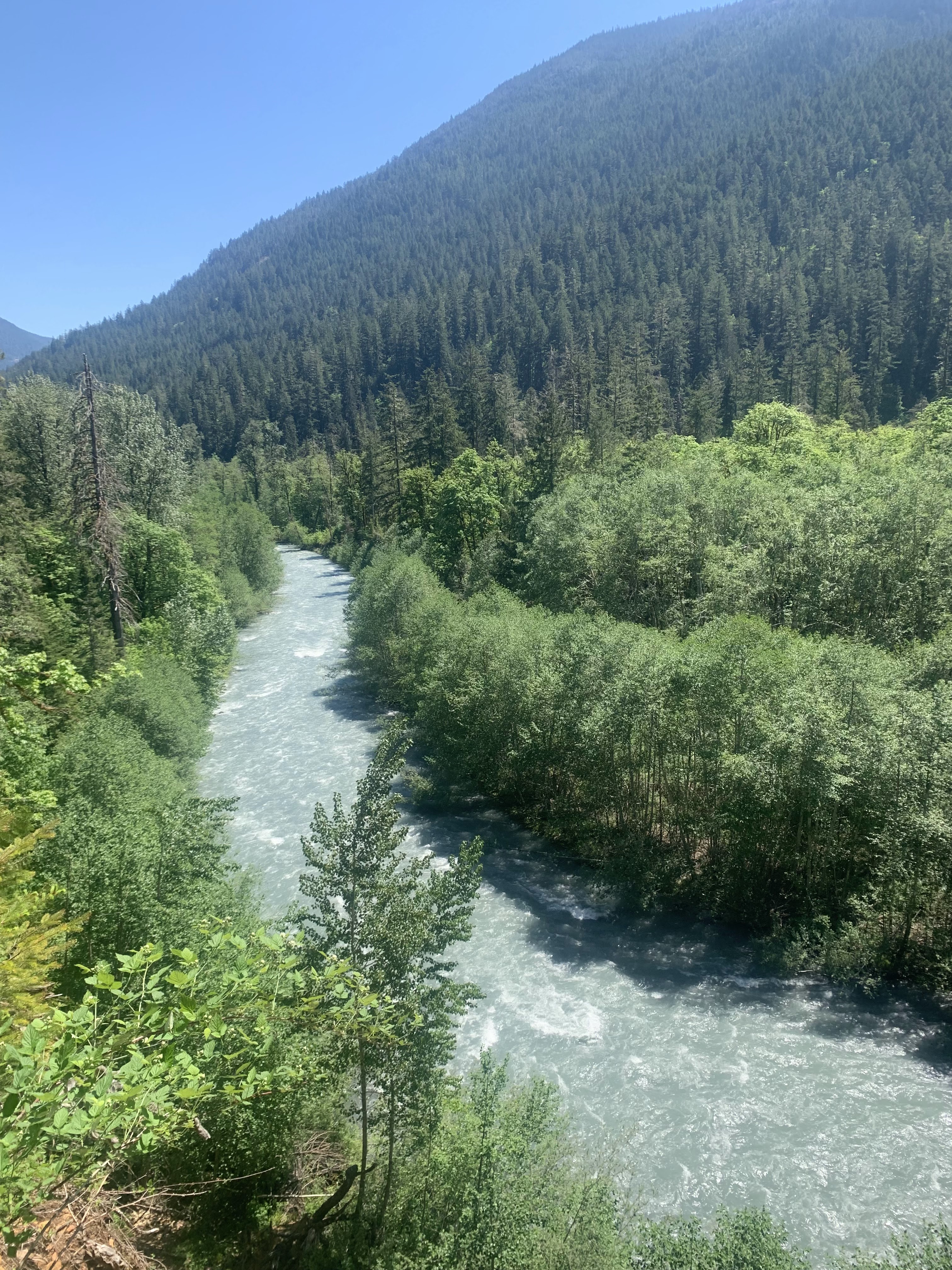 view downstream
some of the wildflowers and fungi seen along the trail today:


No comments:
Post a Comment