
 We stopped at Point Arena to do a short 2 mile round trip hike in the California Coastal National Monument this morning.
 We took the trail up on the bluffs, starting at the star on the map down to the south for a mile then returned the way we came.
 It was foggy when we started, but we could see the bluffs extending out into the Pacific Ocean. A seagull flew by as I was taking this photo.
Wide angle view of the first inlet we passed.

 Overlooking another inlet
 Another inlet
 It started to get foggier.
 We could see some caves along the bottom of the bluff.
 The further we hiked, the foggier it became.
 Before long, the fog began to lift.
 Some trees growing along the edge of the bluff.
Pano of a large sink hole on the top of the bluff.

 When the sun came out, the water turned a lovely shade of blue.
 The fog would roll in and out as we continued our hike, but it was never very thick for the rest of our time here.
So many inlets and promontories along these bluffs.

 Views near our turn around spot.
 We enjoyed watching the waves crash into the walls of the bluff.
 Pelicans and seagulls hanging out on the edge of the bluff.
 zoom of some of the arches under the bluff
 Small creek heading toward the Pacific Ocean
 small waterfall along the creek
 We had clearer skies on our way back.
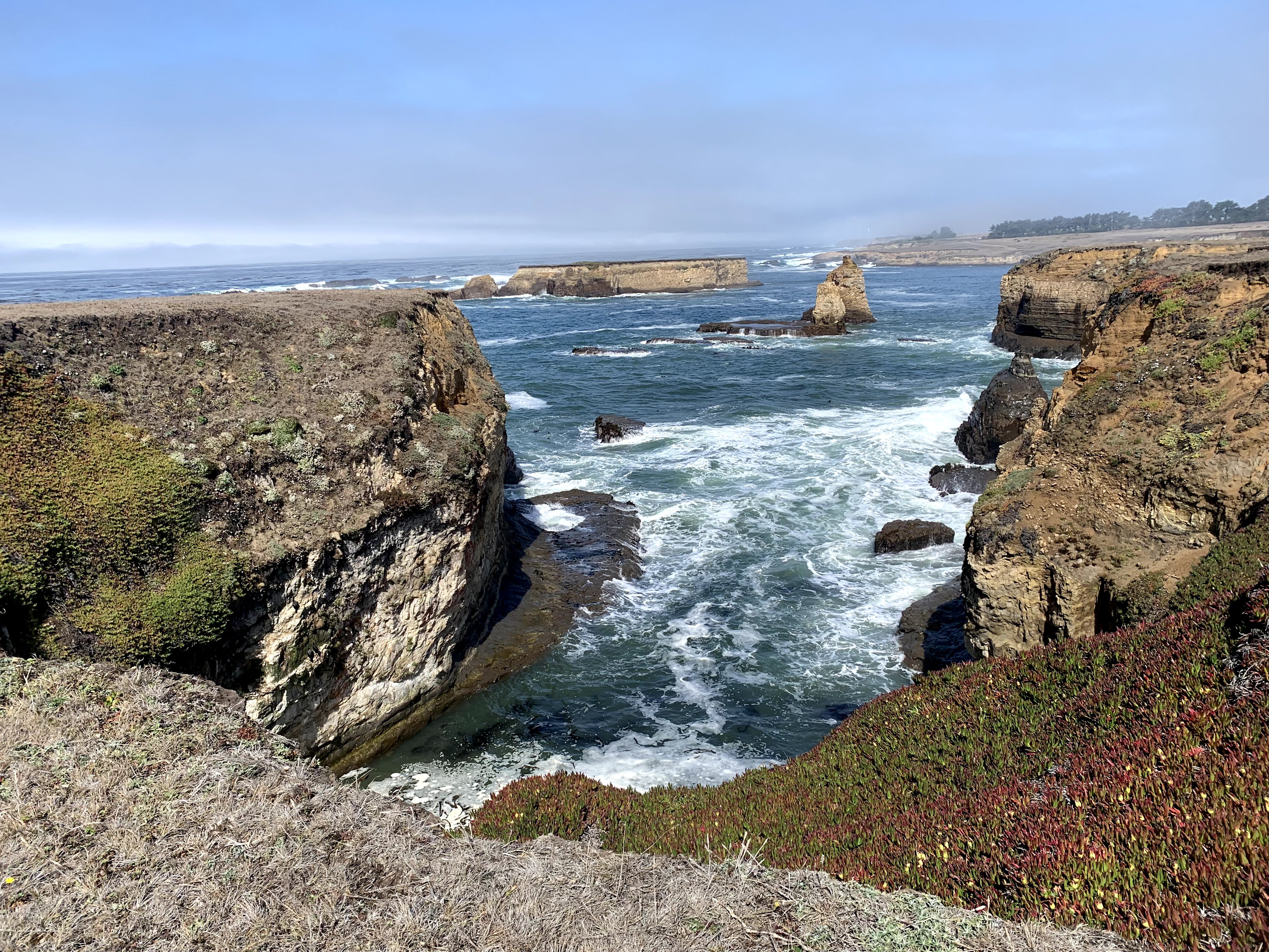
 A turkey vulture flew by as I was taking a photo of Sea Lion Rocks
 More views along the bluff trail


 Some views with the Point Arena Lighthouse in the far distance to the north.
 zoom photos of the Point Arena Lighthouse
 The Point Arena Arch
 More views as we neared the trailhead, so nice to see what was covered in fog earlier today.
 Looking towards the Point Arena Arch from the parking area.
a few wildflowers we saw up on the bluff today


No comments:
Post a Comment