From the parking lot, the trail descends briefly to cross Icicle Creek.
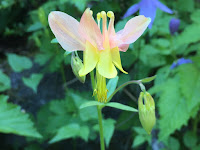
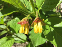
 Then the switchbacks begin, as the trail goes up (800 ft in the first mile) through an open rocky hillside filled with wildflowers .
Soon the trail enters the Alpine Lakes Wilderness and a pine forest as the uphill climbs a little less steeply. Snow Creek wall in the distance, we heard climbers going up this wall today.
A bit more than 2 miles from the trailhead, we found a nice spot along Snow Creek to take a short break.
The trail starts climbing steeply again with high rocky slopes towering above us.
The trail follows Snow Creek fairly close, but the forest hides the creek from view most of the way.
About 4+ miles from the trailhead, the trail crosses Snow Creek and climbs on a gentler pace up to Nada Lake.
We crossed a few snow patches.
There were lots of glacier lilies in bloom along this section of the trail.
Nada Lake is 5.2 miles from the trailhead (after gaining 3,600 ft). We found this beautiful spot to take a lunch break while resting our legs for the final climb of the day.
 The trail follows the eastern shore of Nada Lake, a nice level trail before climbing the boulder field at the south end of the lake.
Looking back at Nada Lake as we enter the boulder field.
The trail climbs up and across the boulder field 3 times.
We found the loose dry dirt sections between the boulders trickier than gong over the boulders.
Looking back and down on Nada Lake as we neared the final boulder crossing.
Our first view of Upper Snow Lake and McClellan Peak.
a small spillway separates Upper and Lower Snow Lakes
The spillway is the trail!
view of Lower Snow Lake from the spillway.
The Temple to the north.
another view of Lower Snow Lake
A gorgeous spot along Upper Snow Lake to relax before heading back down the trail.
Some of the many wildflowers we saw along the trail today:


No comments:
Post a Comment