 Drove to Packwood and up FSR 1260 in the Gifford Pinchot National Forest to hike to Packwood Lake. I hiked almost to the south end of the lake for a hike of 12 miles round trip with about 800 ft of overall elevation gain. This hike is in the forest, a nice way to keep cool on a sunny day. Early on in the trail, I had this peek of Mt Rainier through the trees.
 About 4 miles from the trailhead, the trail leaves the Goat Rocks Wilderness before reaching the lake in another 0.25 miles. View of Packwood Lake near the ranger house.
 About 3/4 mile from the ranger house, the trail re-enters the Goat Rock Wilderness. Another view along the lake.
 Before the trail reached near the south end of the lake, I found a boot path from a camping spot to the edge of the lake, where large downed trees in the lake provided a spot to look north towards Mt Rainier. It was windy and the water in the lake was choppy as I took my photos. I took my lunch break back on shore.
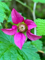
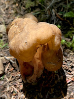
some of the wildflowers and fungi seen along the trail today:


No comments:
Post a Comment