The first 3 miles of the trail is mostly in the forest.

The rhodies were beginning to bloom along the early part of the trail.
There is a short section of switchbacks with views before Camp Windy (at 2.5 miles). Because of the clouds, we had limited views today.
Shortly after passing the junction with the Silver Lake Trail (3 miles), the trail gains elevation along switchbacks out in the open. On a clear day, all 5 volcanos in the Washington Cascades will come into view as you get closer to the saddle. Today, we only saw Mount Rainier above the clouds.
View of the Olympic Mountains from the saddle below Mount Townsend.
looking south from the trail up to Mount Townsend from the saddle
Trail up to Mount Townsend heading north
Pano to the west and north along the trail up Mount Townsend. The top of Mount Townsend in about 4 miles from the trailhead.
After taking a lunch break on Mount Townsend, we descended 1 mile back down and took the Silver Lake Trail.
The trail gains 100 ft before descending 600 ft down switchbacks on the west side of Welch Peaks.
Wide angle shot along the trail down to Silver Lake, beautiful ridge line across the way.
After passing the junction with the Silver Creek Trail, there were many snow patches to cross. These were soft enough that we didn't need traction, and firm enough that we did not post hole.
From the trail junction the trail gains 400 ft on the way up to Silver Lake.
Cascade along Silver Creek where the trail crosses the creek.
Silver Lake hides from view until the trail is almost at the outlet.
Even in the clouds, we enjoyed the views of Silver Lake. Here we are near the outlet.
View from the west side.
View from the south end.
After returning back to the Mount Townsend Trail and descending below Camp Windy, we found the clouds had lifted enough that we had a glimpse of the waterfall in the fog.
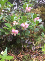
some of the many wildflowers we saw in bloom along the trail today:


No comments:
Post a Comment