We saw some fungi on the hike up through the woods.

About 1/2 mile up the trail a wooden bridge crosses Mason Creek at a small waterfall,
there is a few on McClellan Butte across I-90 from this bridge.
A little over a mile, the trail enters the Alpine Lakes Wilderness.
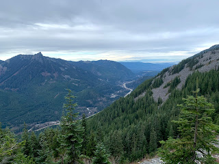
Further up the trail, there are some open areas where we could see McClellan Butte and other peaks across I-90.
Lots of lovely moss under the trees.

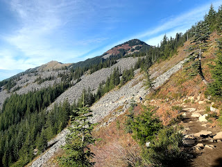
Before the trail split at 2.9 miles (go straight to head up to Bandera Mtn, turn left to go up to Mason Lake and Mt Defiance), the trail traverses an open slope. P3 and Mt Defiance in the background.
From here we could see Mt Rainier beyond the ridge to the south and
to the west the Olympic Mtns beyond Puget Sound.
 The trail goes over a ridge and descends about 120 ft to Mason Lake, going through this moss covered boulder area.
At 3.4 miles from the trailhead, we reached Mason Lake.
The trail meanders near the shore line before heading west towards Mt Defiance.
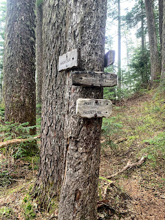
 The trail comes to a T, Mt Defiance to the left and Pratt Lake to the right.
From Mason Lake, the trail gains 1,384 ft over the next two miles, mostly in the forest.

The trail then traverses across the upper slope of Mt Defiance, crossing a talus field and then an open meadow.
To the east is Mason Lake, below Bandera Mtn.

To the west, another view of McClellan Butte
To the south, Mt Adams and Mt Rainier.

Watch for a spur trail to the right heading up Mt Defiance, this short 0.2 trail gains about 350 ft over loose rocks,
exposed roots and some slippery wet dirt.
 Amazing views from the top of Mt Defiance, lots of Cascade peaks to the north.
Kulla Kulla, Mason and Little Mason Lakes below to the east.
pano t the northeast:
pano to the south:
 to the far west: Puget Sound and the Olympic Mtns
nice view of Mt Rainier as we headed back down from Mt Defiance
watching the clouds gather around Mt Rainier to the south.
back at Mason Lake where lots of hikers were enjoying this beautiful fall day.
we saw some pine drops and some fungi along the trail:


No comments:
Post a Comment