Tuesday, November 26, 2019

Mt Si

 Hiked up to Mt Si this morning near North Bend. 8 miles round trip with 3,200 ft of gain.
Started in the dark and  was the first person up to the top.
The sun rose while I was still in the forest.

 Light snow on the ground from about 3,000 ft.
 A bit deeper snow from 3,300 ft up.
 About 3.5 miles from the trailhead, there is a little view, I was glad to see the sun was out.
 Some icicles on this boulder.
 View to the east from the bottom of the boulders.\


View to the south from the boulders, Mt Rainier in the distance.


There was about 6" of snow in the boulders, but it was easy to tell where the trail was under the snow.


More icicles on this large boulder.


The Haystack on Mt Si


View to the west from the Snoqualmie Valley Overlook

 Another view of Mt Rainier from the Boulders as I hiked back down.


 As I continued down the trail, it was nice to see the sunlight through the trees.
 Back below snow level.


Monday, November 25, 2019

Cooper River Trail

We drove up to the Salmon La Sac Campground on Road 111 to hike the Cooper River Trail up to Cooper Lake. We hiked on the trail by the lake through the campground up to the boat ramp, about 8+ miles round trip with an overall elevation gain of 800 ft.
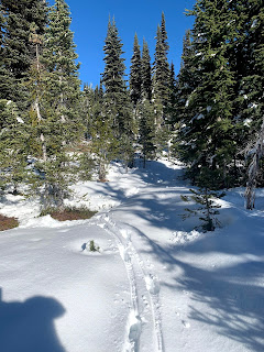
There was a bit of fresh snow from last night.
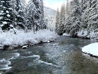
The trail follows along the Cooper River being close to the river at some places and a bit away from the river at others.
Peek-a-boo view of a distant peak.
We enjoyed the morning light
some views from along the river


Lovely sunlight on the trees
3 miles from the trailhead we reached the road at Cooper Lake, first we walked over the the bridge over the river.


view up river toward Cooper Lake from the bridge
view down river from the bridge
we then hiked on the trail that goes along Cooper Lake up the the campground.
view across the lake
we saw some snow geese taking flight from the lake
a few more lakeside photos along the trail


Thursday, November 21, 2019

Paddy-Go-Easy Pass

We drove out to the Salmon La Sac area to hike up to Paddy-Go-Easy Pass a 5.4 mile round trip hike with 2,700 ft gain.
There is a creek that runs across forest road 4330 that you have to drive across.
There were a few very large potholes along the road.


The trail starts gaining elevation from the beginning of the trail. This morning the first mile of trail was full of frost.


We saw frosty fallen leaves and
a little bit of fall color.

As the trail gains in altitude, we got some views. To the south we saw Hawkins Mountain, Tucquada Lake and Goat Mountain.
We started seeing snow on the trail at about 5,300 ft.
Nice view of Davis Peak and Cathedral Rock to the northwest.
Some nice rock formations near the pass.
From higher up on the trail, we saw Mt Ranger to the southwest.


zoom of Mt Rainier


Large snow covered meadow at the pass, the snow was about a foot deep.
Some elk tracks led through the woods to the other side of the pass.


more animal prints in the snow


Pano at the pass looking east: The Cradle, Eight Mile Mountain, Dragontail Peak and Harding Mountain.


another view of Davis Peak and Cathedral Rock as we hiked back down the trail.


Wednesday, November 20, 2019

Summit Lake

We drove up the very rough FR 7810 (near the Carbon River entrance of Mt Rainer National Park) to hike up to Summit Lake in the Clearwater Wilderness. This road has lots of potholes, ruts and exposed rocks for 6.8 miles.
The hike is 6 miles round trip with an overall 1,400 ft of gain.
The trail climbs up through the forest.
About 0.9 mile from the trailhead, the trail reaches a T junction at Twin Lakes(Bearhead Mountain behind the lake), turn left to go to Summit Lake.
The trail passes a small pond, then begins to climb up a ridge towards Summit Lake.


Along the ridge we had a peek of Mt Rainier through the trees.
There was a couple of inches of fresh snow.
Another frozen pond closer to Summit Lake.
2.5 miles from the trailhead we reached Summit Lake, We then hiked the loop trail around the lake, heading clockwise to go up the steep trail to the far end of the ridge on the opposite side of the lake, then descend on the gentler slope coming down the ridge back to the lake. The loop trail is about 1 mile.
Another view of the frozen pond near Summit Lake.
As we hiked around the lake, we saw this beautiful blue color in the lake.
Along the trail up to the ridge, we saw a boot track through the trees and found this lovely view of Bearhead Mountain and Mt Ranger.
Summit Lake to the north with views from Glacier Peak to Mount Stuart in the far distance, as we continued up the ridge.


Pano to the the south from the ridge top: Bearhead Mtn, Mt Rainier, the rim of Mt St Helens in the far distance and Copley Lake below.

To the northwest we could see clouds covering Puget Sound, distant Olympic Mtns and Mt Baker
As we hiked down the ridge, we had a fabulous view to the north from Mt Baker to Mount Stuart and many peaks in between.
Fresh snow on the trees around Summit Lake as we continued down the ridge.
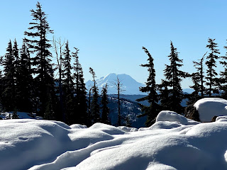
There is a boot track to this gorgeous view spot. Summit Lake with Bearhead Mtn and Mt Rainier.
Small frozen puddles near Summit Lake
Looking back at  the ridge reflecting in Summit  Lake.
another small frozen pond near Summit Lake

\\\\\\\\\\\\\\\\\\\\\\\\\\\\\\\\\\\\\\\\\\\\\\\\