
Hiked the east side of the Wonderland Trail at Mt Rainier NP from the Fryingpan Creek Trailhead to Box Canyon. About 16-1/2 miles with 4,100 ft of overall elevation gain. The smoke from the wildfires wasn't a problem for hiking but did obscure the views.
We started by 6:30 to beat the heat doing the majority of the elevation gain (up to Panhandle Gap) by 10.
Wonderful portion of the Wonderland Trail!!!

Nice gentle start hiking through a soft forest trail for a couple of miles on the way up to Summerland.
After crossing Panhandle Creek we encountered fields of asters and fireweed.
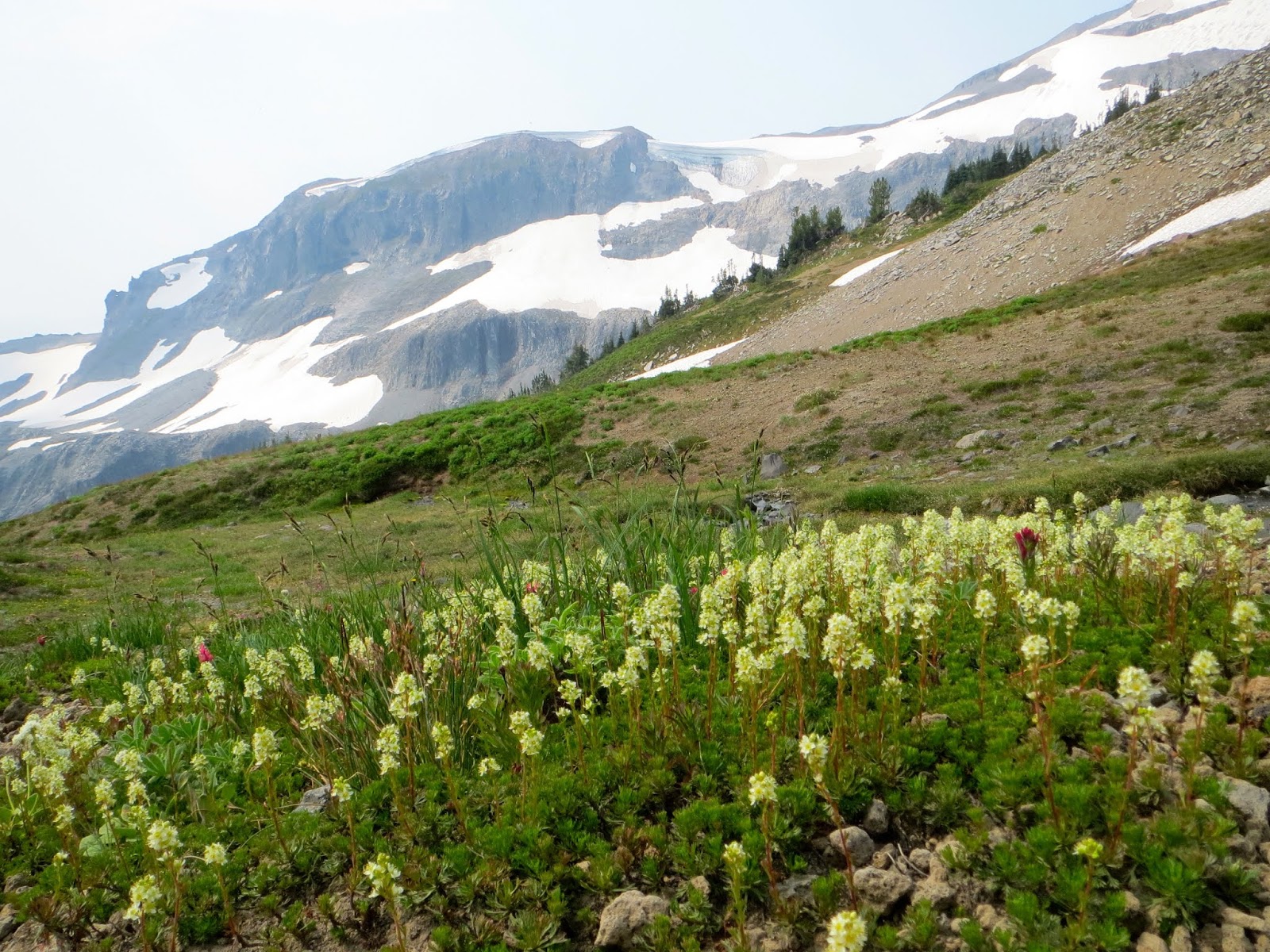
Skies around the top of Mt Rainier were fairly haze free in the morning. View from the north side of Summerland.
Lots of monkey flowers in bloom near Panhandle Creek on the south side of Summerland.
Heading southeast out of Summerland.
A bit further up the trail
We saw lots of marmots around Summerland, Panhandle Gap and Ohanapecosh Park. This is the only one who stayed still.
Commanding a great piece of real estate!
We saw the old log crossing had been washed below the falls on Fryingpan Creek.
View of Fryingpan Creek from the new log crossing.
Panhandle Gap ahead.
The trail winds around the north side of this tarn.
Vibrant green patch below Panhandle Gap
Snow patch below Panhandle Gap. We heard a hiker fell though the snow bridge over the trail, so crossed it lower down, then scrambled over the scree back up to the trail.
Amazing view to the west on Panhandle Gap, our trail far below.
Lots of haze to the east and south of us.
Several snow patches between Panhandle Gap along Ohanapecosh Park. Most were easy to cross with no exposure.
Trail heading south along Ohanapecosh Park.
I felt more comfortable wearing microspikes on this section because it was still a bit icy and had exposure.
Continuing south along Ohanapecosh Park.
There were some wildflowers in bloom on this high section of the trail.
Begining the steep descent down to Indian Bar
This upper section has great views of the waterfalls coming off of the Ohanapecosh Glaciers.
Fields of heather. Panhandle Gap in the far distance.
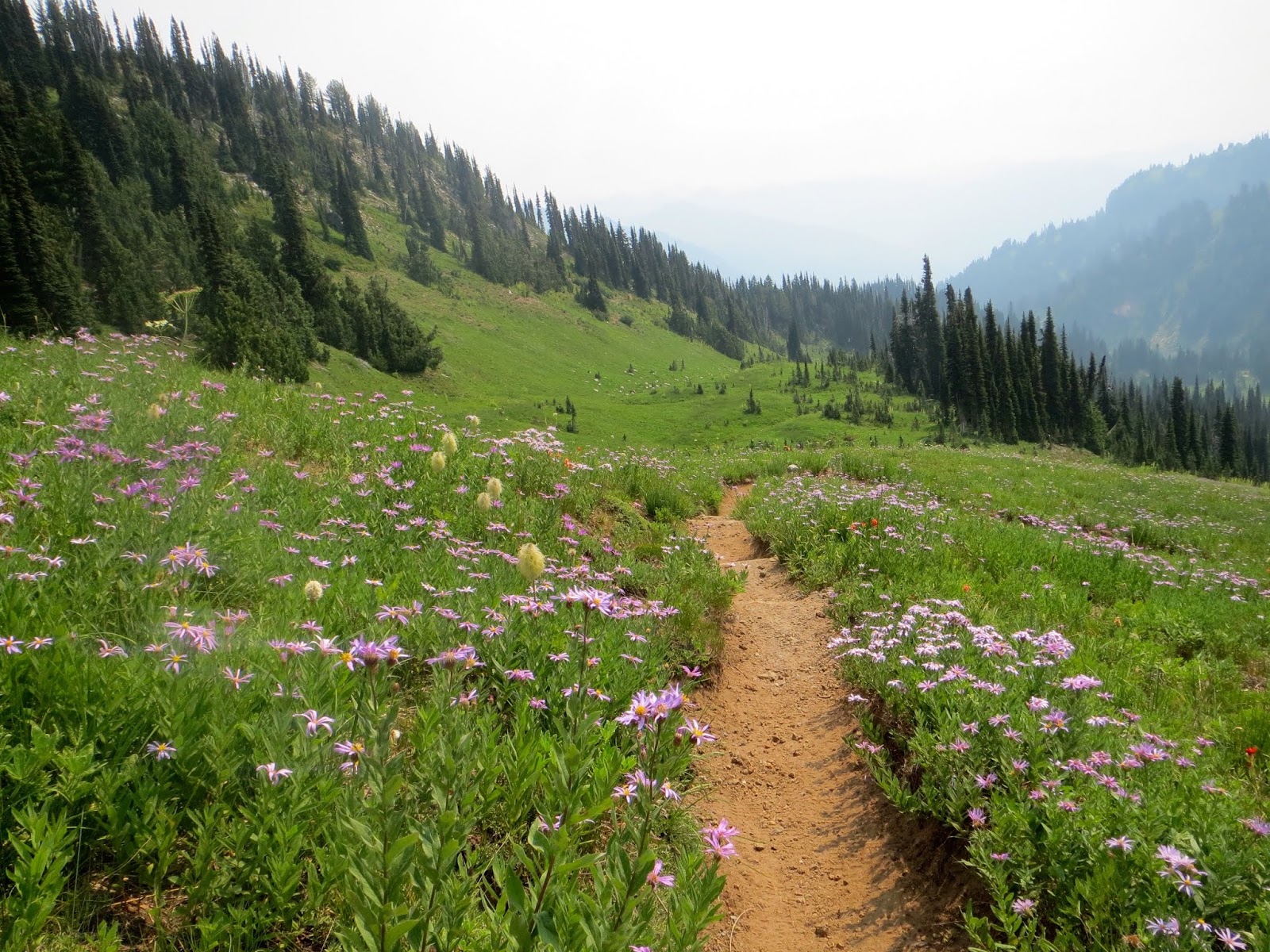
So many wildflower meadows as we continued down towards Indian Bar (seen below)
acres of purple asters in bloom
at Indian Bar, last place to resupply water until Nickel Creek 6.7 miles away
Bridge at Indian Bar, Wauhaukaupauken Falls
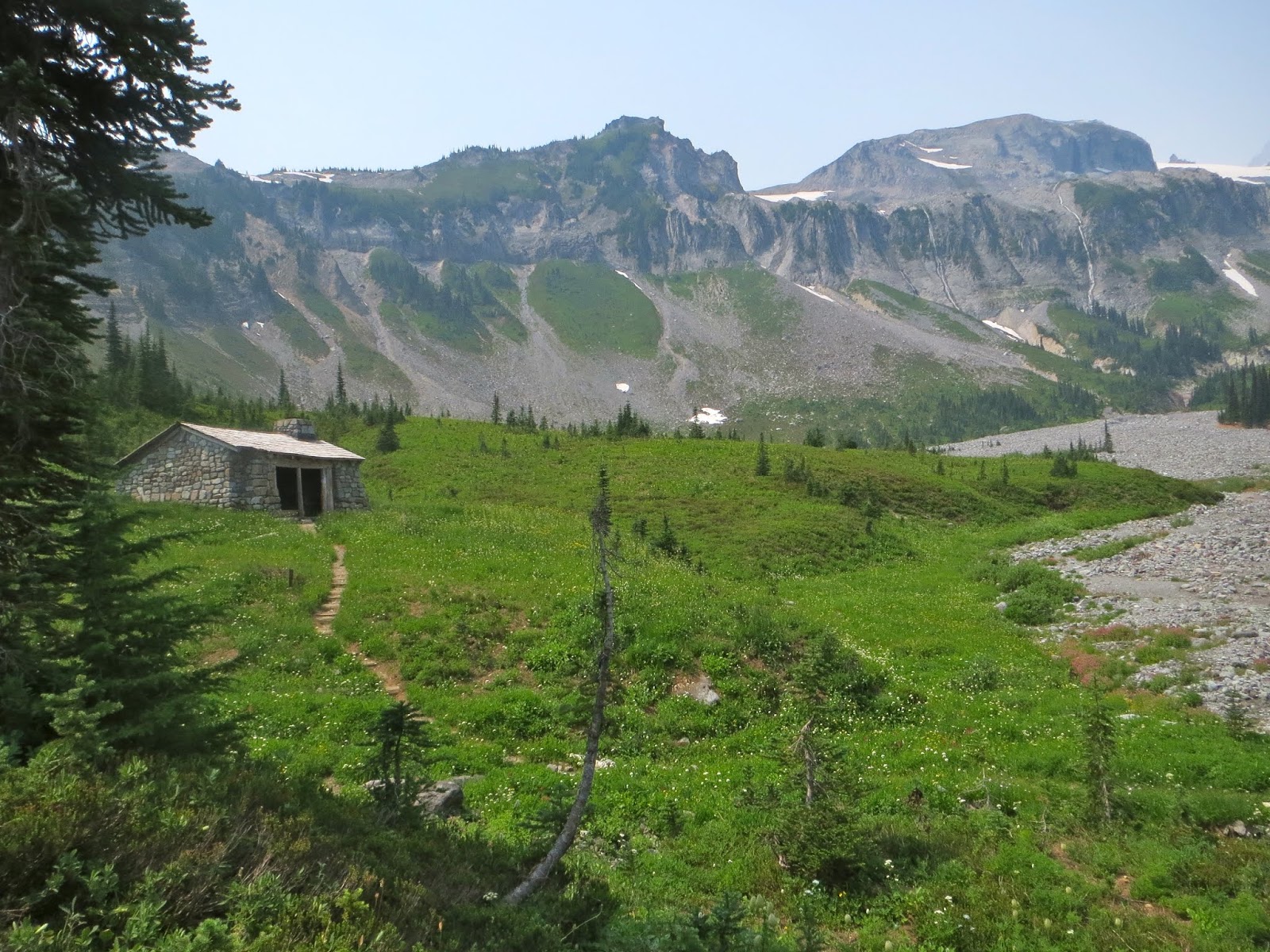
Shelter at Indian Bar
Gorgeous view through the rocks after crossing the bridge at Indian Bar
Steep climb (930 ft) out of Indian Bar continuing south on the Wonderland Trail. Was able to stop and enjoy the flowers along this section.
Top of Mt Rainier is hidden in the haze this afternoon. Indian Bar below.
Cowlitz Chimneys in the distance
Very hazy views of the top of Mt Rainier as we hiked along the Cowlitz Divide.
The trail meanders up and down for a while on the Cowlitz divide, the wildflower meadows were delightful!
No views of Mt Adams or the Goat Rocks in this haze today.
the only beargrass I saw in bloom today
miles of wildflowers along the trail
Last look of Mt Rainier before the trail descended into the forest. We were glad of the shade on this hot day!
Bridge at Nickel Creek, only 0.8 of a mile to go!!!
Some of the wildflowers we saw in bloom today:

 Hiked the east side of the Wonderland Trail at Mt Rainier NP from the Fryingpan Creek Trailhead to Box Canyon. About 16-1/2 miles with 4,100 ft of overall elevation gain. The smoke from the wildfires wasn't a problem for hiking but did obscure the views.
 Nice gentle start hiking through a soft forest trail for a couple of miles on the way up to Summerland.


No comments:
Post a Comment