The trail starts near the Visitor Center, I decided to hike it counterclockwise. The entire trail is in the forest and parallels the Ohanapecosh River.
View of Silver Falls from the east side of the trail.
Views from the bridge crossing the Ohanapecosh River.
Looking down the Ohanapecosh River from the bridge.
A short distance on the west side of the trail after crossing the bridge there is an overlook of Silver Falls.
The trail continues along the Ohanapecosh River above the falls for a short distance,
before heading south through the forest back to the campground.
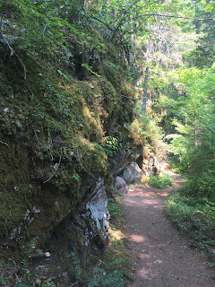
There were some interesting rock formations on the west side of the trail.

There were some vine maples on the west side of the trail, this will be pretty in the fall when the leaves turn colors.


No comments:
Post a Comment