Today we headed out to the east side of the Olympic Peninsula to hike the Putvin Trail to the Lake of Angels. The trail is located in the Hamma Hamma area (FS Road #25). The trail begins in the Olympic National Forest and ends in Olympic National Park. This is a steep 8 mile round trip hike with 3,400 ft of elevation gain. There are a couple of sections that require a brief scramble (hands are needed). The Lake of Angels is in a beautiful open basin between Mount Skokomish and Mount Stone.
The first part of the trail is in the woods. The trail alternates between climbing over roots and around boulders with
sections that are fairly level, with some ups and downs. The trail gains about 1000 ft in the first 1.5 miles, where it enters the Mount Skokomish Wilderness.
There are many tall trees,
and sections of the trail that narrows as it goes around large rocky walls.

We did see some fall color between the evergreens as the trail climbed toward the headwall.
There was a nice level section, before the trail began to climb up in earnest.
the second 1.5 miles climbs about 2,000 ft. But here we had great views of Jefferson Peak and Mount Pershing.

The trail was rocky, with lots of loose rocks.

The first scramble section had large roots we could hold on to.
The second scramble section was mostly rocky.
As the trail continued to climb, we had views across Hood Canal and Puget Sound to the Cascades, as far north as Dragontail and to the south Mt Rainier.


The trail leveled out for a brief section, and we could see over to Mt Skokomish
and as the trail climbed again, we could see over to the ledge where we would eventually to cross to reach the Lake of the Angels (to the right of Mt Skokomish)


we also saw where Whitehorse creek came down over the headwall into waterfalls, here is a zoomed in picture.
The trail became steep again as we neared the top of the headwall, parts of this section was wet, with water running down the trail.
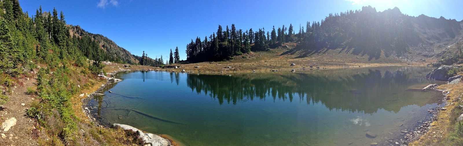
Over the headwall (about 3 miles from the trailhead), we reached a large pond, Mt Skokomish in the background.

Shortly after passing the pond, there is a makeshift bridge to cross.
About 0.2 miles later, the trail enters the Olympic National Park,( partial Panoramic view of the meadow, with Mount Stone to the right:)
ahead the last steep section up to the Lake of Angels. First, the trail drops down and crosses Whitehorse Creek (stepping on rocks), before going up about 400 ft.

There was some nice fall color along the way.

Part way up this section, looking back down to the meadow where we entered the Olympic National Park, and in the far distance Mount Rainier above the clouds.
We passed another pond before reaching

the Lake of the Angels, view from the east side of the lake.
From the west side of the lake, Mount Stone to the left:
From the north side of the Lake of the Angels, looking toward Mt Skokomish
Panorama from our lunch spot, Mount Stone behind the trees to the left, Mt Skokomish to the right.
Water flowing towards the Lake of the Angels (Skokomish River?)
We saw lots of fish swimming and jumping in the lake today.
The views are always a bit different on the way back down. Here Mt Skokomish now reflecting in the pond just above the headwall.

Large tree stump in front of Mt Pershing

Cloud seeming to blow out from the top of Mt Rainier in the distance.
Some of the fall color, plants and fungi we saw along the trail today:


 We did see some fall color between the evergreens as the trail climbed toward the headwall.

 The trail was rocky, with lots of loose rocks.
 The first scramble section had large roots we could hold on to.


 we also saw where Whitehorse creek came down over the headwall into waterfalls, here is a zoomed in picture.

 Shortly after passing the pond, there is a makeshift bridge to cross.


 Part way up this section, looking back down to the meadow where we entered the Olympic National Park, and in the far distance Mount Rainier above the clouds.
 the Lake of the Angels, view from the east side of the lake.


 Large tree stump in front of Mt Pershing
 Cloud seeming to blow out from the top of Mt Rainier in the distance.


No comments:
Post a Comment