We parked at the road turnout just past the Ronald Fire Station and walked a short ways along SR 903 heading up FS 116 (the first road on the right after crossing Newport Creek).
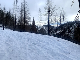
The road was bare of snow until just after the closed gate. We opted to wear snowshoes after reports of hikers post holing the past few days.
Follow FS 116 up for 1.7 miles to the Hex Mountain trailhead sign. The way was mostly snow covered with a few bare patches along the way.
In the early morning the snow was hard packed and icy.
The Hex Mountain trailhead.
View of Cle Elum Lake a short distance beyond the Hex Mountain trailhead along FS 116

The trail climbs more steeply after the trailhead sign. The route follows a ridge up to Hex Mountain
 If there aren't previous tracks to follow, it can be difficult to see the trail drops behind a large rock outcropping before continuing up Hex Mountain.
Pano view of Cle Elum Lake a short ways up the ridge:
After a while, the ridge takes a sharp turn to the east, continuing through a burnt forest
The last section up to the top of Hex Mountain is steep, and was icy this morning. You can see lots of post holing.
Pano from the top of Hex Mountain lookin north to east:
Pano from the top of Hex Mountain lookin east to southwest:
View to the west looking back down off of Hex Mountain
As we were descending, Mount Stuart came out from behind the clouds momentarily.

View of the inlet to Cle Elum Lake as we continued down the trail
The views of Cle Elum Lake and the surrounding hills are beautiful as we continue down the ridge.


No comments:
Post a Comment