The trail starts with 1.3 miles along the closed Hurricane Hill road.
Along the way there were some nice views. Here, looking north towards Hurricane Hill.
To the west, the north Olympics
To the east, Mount Angeles.
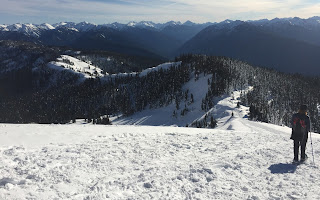
At the end of the road, is the "trail" to Hurricane Hill. A short ways up, the trail splits. On the left is a narrow, icy trail used by skiers. On the right, is up over the hill for hikers and snowshoers. Need to stay away from the cornices on the edge of the hill.
Pano from this hill, looking south towards Mount Angeles and the Olympic Mountains
Looking back, after going up a little further.
Wide angle looking north to east: Hurricane Hill and Mount Angeles
Wide angle looking west to north: western Olympics and Hurricane HillLooking back down, while going up Hurricane Hill
People gathered at the top of Hurricane Hill.
After a short break on top of Hurricane Hill, we decided to wander down to the east end.
Pano looking south, the view is endless.
Pano looking north from Hurricane Hill, Vancouver Island, Strait of Juan de Fuca, Port Angeles, San Juan Islands, Canadian Cascades, Mt Baker and Mount AngelesThere were some interesting frozen tree figures.
Heading back down off of Hurricane Hill, we took our time enjoying the warm afternoon and the gorgeous views.
3D model of the Olympics at the visitor center.


No comments:
Post a Comment