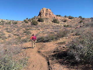
We drove up to the Sycamore Creek Trailhead on FR 22 off of Highway 87 to hike southbound on the Arizona Trail (9 miles round trip with 900 ft of overall gain). A lovely section of the trail in Tonto National Forest.

After a short walk down the closed FR 22, we crossed Sycamore Creek along the connector trail up to the Arizona Trail. view upstream

view downstream

We saw some wildflowers along the trail today.

Sun rising as we hike southward on the Arizona Trail.

We hiked by a variety of rocky peaks.

There was lots of quartz on and along the trail.

Southbound on the Arizona Trail

variety of peak views along the trail

Arizona Trail sign by Sycamore Creek about 2 miles from the trailhead.

Where we crossed Sycamore Creek, looking upstream,

and looking downstream.

more rocky peaks we hiked by

These old automobiles are in a wash right beside the trail. Wonder what their stories are.

Gate crossing, looking north

Next mile southbound along the trail after the gate.

We stopped where the trail crosses the mostly dry Boulder Creek for our lunch break and turn around spot.

We found a short section of running water, that appeared out of the boulders, before soon disappearing under the boulders again.

Some of our scenery as we returned northbound along the Arizona Trail.
Back on the connector trail to FR 22 we had to wait for a couple of cows to move away from Sycamore Creek before we crossed it.

Today was windy, so I only got a couple of wildflower photos.

 Drove out to North Bend to hike up to the Rattlesnake Ledges and decided to continue on to the East Peak on Rattlesnake Mountain. Overall we hiked 9 miles round trip with 2,588 ft of gain. Our best view was looking up at Rattlesnake Mountain from the parking area.
 Watching the rain make patterns in the water at Rattlesnake Lake.
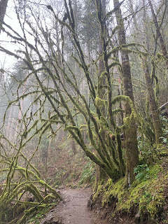 Green moss and hiking in the fog, typical winter hike in the Pacific Northwest.
 After two miles, we reached the lower ledge. For a brief moment we saw Rattlesnake Lake before the clouds thickened and obscured the view below.
 Middle Ledge is 0.2 miles further up the trail.
 view from the Middle Ledge was very foggy
 Another 0.2 miles took us to the Upper Ledge, the view here was foggy as well.
 We decided to continue another 2 miles up the trail to the East Peak of Rattlesnake Mountain. Around 2,900 ft, we had consistent hard packed snow on the trail.
 Near the top we had some lovely fresh snow, reminding us we are still in the middle of winter.
 At the half snow buried bench at East Peak we had a very brief peek of a snowy peak across the valley, before it was completely covered by clouds.
 This tower is on the top of East Peak.