Friday, January 29, 2016

Lake Angeles Winter Hike

 Wonderful hike to Lake Angeles today in Olympic National Park on a cloudy, misty & snowy day. This hike is just south of Port Angels. 7 mile rt with 2,400 ft of elevation gain.
 This hike is in a lovely forest.

We crossed over creeks,


 hiked past huge boulders,


interesting crannies,

holes through trees,

all along a well defined trail.


We saw huge trees, some covered in lichen, most with moss.


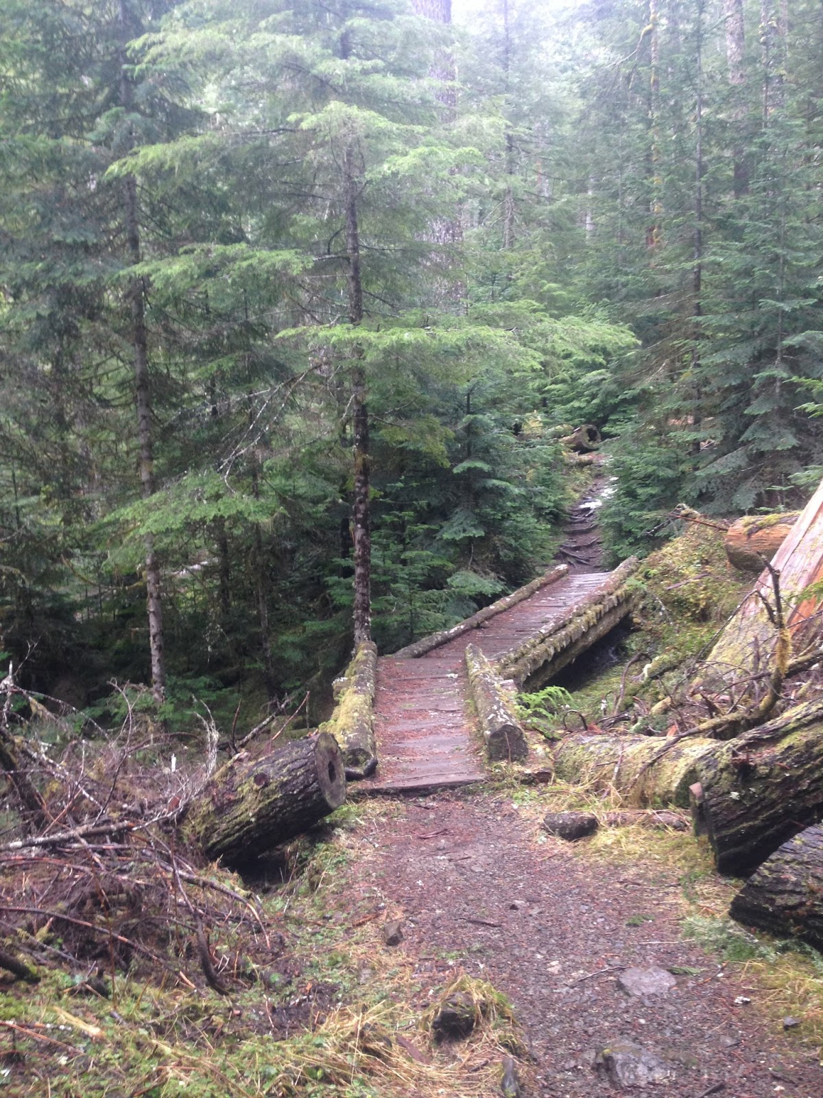
 Walked over wooden paths,
 and log bridges.
 Watched the sun break through the trees,
 and then it began to snow, transforming the trail and trees around us.
 We did not need our micro spikes or snow shoes today, as we enjoyed the fresh snow, continuing upwards.
 As we got closer towards the lake, we were walking in a small stream along the trail.
 Just before 3 miles, and at 4,288 ft of elevation, we reached a small pond. Here the trail levels off, before descending towards the lake.
 Other hikers coming down, had told us it was a "blizzard" up above and they were unable to see the lake. We decided to continue on the hike and, as we got closer, the sun came out,
 as we arrived at the campground near the lake.

 We were blessed to have a momentary clear view of the snow covered Lake Angeles nestled in Klahhane Ridge.
wide angle view of Lake Angels near the lakeshore:


 I walked towards the outlet of the lake, wondering if there would be a better view. I did not want to cross the creek in the winter, and the clouds came back down. I was able to see part of the lake near the inlet without snow.

Beautiful trees with fresh snow.
 The snow returned as we began our hike back to the trailhead.
 The snow level continued down to about 2,400 ft, much lower than when we started.
Ennis Creek seemed fuller on the way down,  beautiful!


Back at the trailhead, very happy hiker!


Monday, January 25, 2016

Reflection Lake via Narada Falls Snowshoe

Met a lovely young woman, who wanted to try snowshoeing. We headed up to Mt Rainier National Park and did the Reflection Lake trail from Narada Falls parking area. We took the route via Inspiration Point on the way out, and returned via Inspiration Saddle for a 3+ mile trip with about 500 ft of elevation gain.
It appeared that more water was flowing in the Paradise River compared to when I was here last month.
 The small falls along the Paradise River.
 With a moderate avy risk today, and being early in the day (still frozen hillsides), we choose to snowshoe along the Paradise Valley road view Inspiration Point on the way to the lake. Mt Rainier was covered in clouds, but we had views of the Tatoosh Range.
 Beautiful view looking west, down the valley where we had driven up on the road.
 This was the first time, I had seen Narada Falls while looking down from the road.
View looking across Reflection Lake from the south shore, Mt Rainier still hiding under the clouds. We had the morning at Reflection Lake to ourselves today!

Pano looking across Reflection Lake to the east.

 Looking south, up towards Pinnacle Peak.

 As the day was warming up, we decided to play it safe and take the route through the trees up to Inspiration Saddle on our way back to Narada Falls.
A beautiful day to snowshoe through the woods.


 Lots of interesting trees bent down under the weight of the snow.


We snowshoed for quite awhile before seeing others on the trail today. The trail was so quiet and magical.
As we continued along, we began to see the clouds lift off the mountain.


 Further along, we had a gorgeous view.
 The trail dropped us back down to the Paradise Valley Road in a section where there is no avy danger.
 So nice to have the sun higher in the sky and the days lengthening!
 Heading back where there were clear views of the Tatoosh Range and
 of Mt Rainer.
 I loved this combination of snow and moss covering the tree branch.
On our drive out, we stopped to view Christine Falls.
Upper Christine Falls:
Lower Christine Falls

 water cascading down to the road

Friday, January 22, 2016

Ranger Falls and Green Lake Winter Hike

 Went up to the Carbon River Entrance of Mt Rainier National Park for a hike with Ranger Shawn and Biologist Danny for an informative nature walk up to Ranger Falls and Green Lake. Hike was about 10 miles rt with 1,300 ft of elevation gain.
We had a bit a rain on and off the first hour or so, but it was nice for the rest of the day.
The first part of the hike is 3 miles on the old Carbon River Road. Lots of beautiful trees.

 Lots of trees have come down in the big Fall and Winter storms. Volunteers have been working on removing some of these trees from the road.


However, there are still many downed trees to go over and under, these were the biggest ones we had to get over/under.
 I love all the different variations of nurse logs we saw today.
 These nurse log was over one of the streams.
 We learned how to tell the difference between douglas fir, spruce, and hemlock trees (along with many other things).
 A beautiful large nurse rock!
 The Carbon River has been eroding the road. Not sure these trees will be here much longer.
After walking along the road for 3 miles, we reached the trailhead to Ranger Falls and Green Lake.
 Just a small amount of patchy snow on the lower part of the trail.


More downed trees along the trail, some had been here for a long time.


Lots of beautiful creeks running down the hillside besides the trail.


 About 1 mile up this part of the trail we reached the short spur trail to Ranger Falls.
 Beautiful falls, so much running water today.
 Soon after Ranger Falls, we ran into consistent snow on the trail. It was pretty well packed down, with a slushy layer on top, so we did not need to use snowshoes or traction today.
 Some interesting lichen and mold
 Wooden bridge crosses Ranger Creek shortly before reaching Green Lake.
 Ranger Creek
 Green Lake covered with snow.
On the way back down, the sky had cleared up for a great view of the Carbon River.