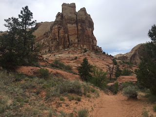
 We stopped to view the Paria Badlands, about 4 miles down a dirt road between Page, Arizona and Kanab, Utah. This is near the old Paria Township. The colors of the badlands here a gorgeous!
Pano from west to north
Pano from north to east

 As we neared the falls, the trail splits in to: to the left, the trail descends down to the bottom of the falls; to the right, the trail heads to where Calf Creek drops down to the falls. We choose to first hike down to the left.
 We then returned to the trail split and continued to where Calf Creek drops into the falls:
 There creek forms some shallow pools on its way to the falls

 Soon, the creek and trail go around a bend, here there are many beaver dams in the creek
 This canyon seemed like a miniature Zion Canyon, with the greenery at the bottom and the high colorful canyon walls. We saw trout swimming in the creek, lots of butterflies flittering about and hawks soaring overhead, all the while, a myriad of bird songs accompanying our walk.


