
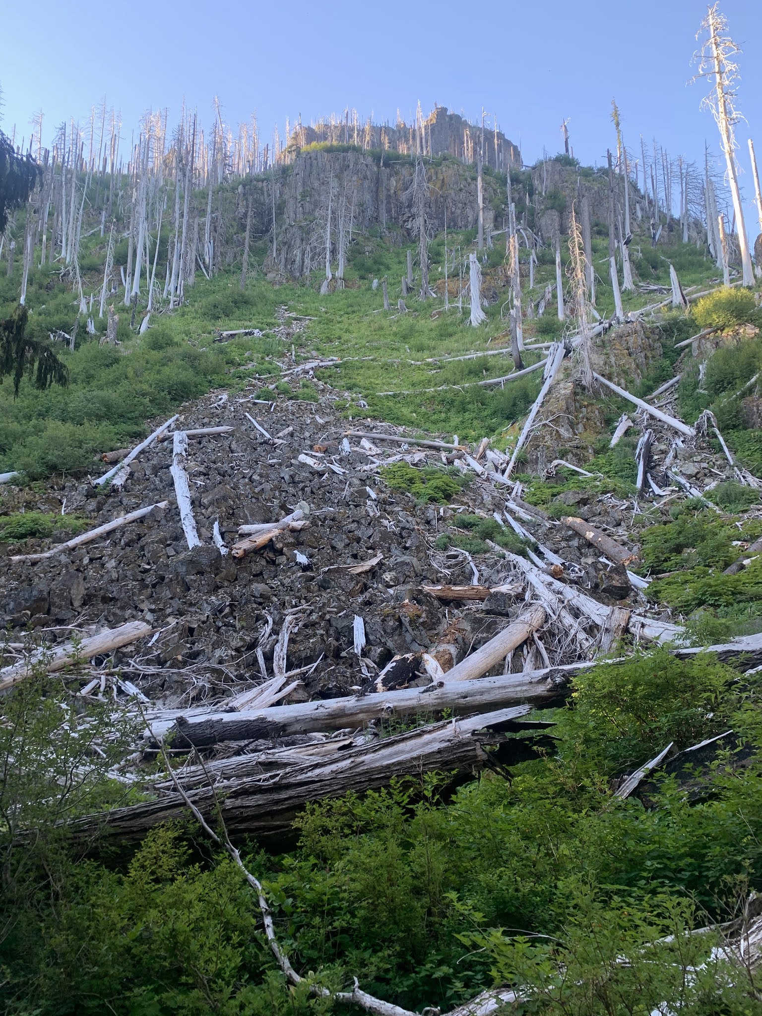
 Our fourth and final day bacpacking on the Northern Loop was from James Camp through Berkley Park to Sunrise, 12.7 miles with 2,000 ft loss and 4,000 ft of gain. This was our toughest and warmest day, so we broke camp and hiked out before 7 am. The trail descends mostly in the forest 1,300 ft in 2.5 miles. Here we are looking up towards Redstone Peak.
 On reaching the West Fork of the White River drainage area, we saw Lower Van Horn Falss near the bottom of Van Horn Creek. We were happy to resupply our water as there would not be another fresh water creek until we reached Berkley Park in another 5-1/2 miles.
 The bridge over the West Fork of the White River was in great condition and high enough above the water, that the bridge was dry.
 Walking through the lower elevation of this trail, we found lots of ripe blueberries (and fresh bear scat).
 The trail then climbs 2,500 ft through the nice shady forest up towards Grand Park in 4 miles.
 Here I saw my first gnome plants!
 Near the upper portion going up toward Grand Park we saw some arnica in bloom.
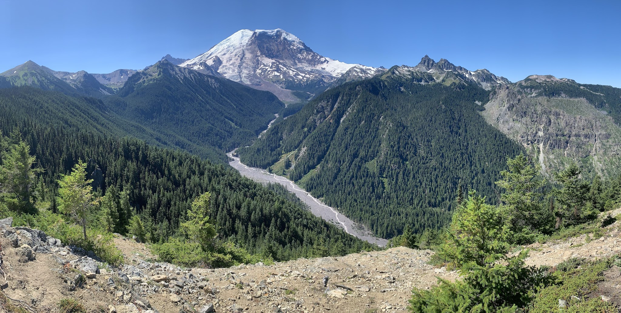
One of my favorite views of Mt Rainier, is here on the Northern Loop Trail, about 0.3 miles before joining the Lake Eleanor Trail through Grand Park. Here we can see areas we have hiked though the past 3 days. Straight ahead lies the Winthrop Glacier and to the right, Carbon Glacier.


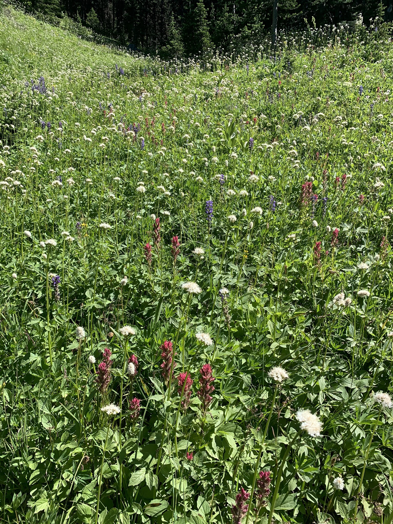
gentian is blooming in Berkley Park


Looking north from the Sourdough Ridge Trail, in the far distance: Mt Baker, Glacier Peak and Mount Stuart


