 Drove up the Westside Road In Mt Rainier National Park to hike up to Gobbler's Knob, 12.6 miles round trip with 2,565 ft of elevation gain. Due to chronic flooding from Tahoma Creek, the road is closed about 3 miles up. (In the winter, the road is closed almost the from the beginning). The morning started very cloudy. Nice fall colors at the base of Mt Wow at the start of the road walk.
 Hike 3.8 miles up the Westside Road up to Round Pass. There was one bright spot of color among all the evergreen trees.
 From Round Pass, the trail is 0.9 miles to Lake George.
 Patrol cabin at Lake George
 From Lake George it's 2.5 miles to the top of Gobbler's knob. The trail goes around the north shore of the lake.
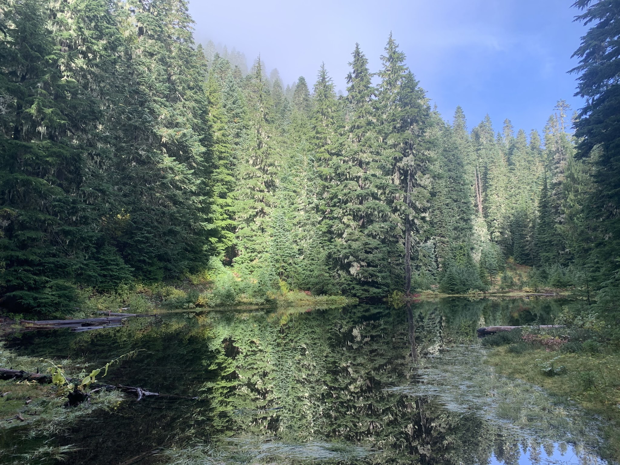
 About 0.8 mile up this trail, there is a pretty pond.
 Log over the outlet of the pond.
 View of the pond from the outlet.
 At 1.1 miles from Lake George, the trail splits. To the left, the trail that will leave the park and head down to Goat Lake. To the right, the trail continues up another 0.4 miles to the top of Gobbler's Knob.
 View of the fire lookout on top of Gobbler's Knob
 At first, it was too cloud to see Mt Rainier from the top of Gobbler's Knob, but as I took a lunch break, the clouds began to move.
 This was probably the best view of Mt Rainier while I was up on Gobbler's Knob.
 slightly zoomed in photo
 zoom of near the top of the mountain
 another zoom of near the top of the mountain
 Below to the southeast is Lake George and Tahoma Creek

Below to the west is Goat Lake

As I was hiking down along Gobbler's Knob, I could see Mt Rainier starting to disappear into the clouds again.

Sun light breaking through the clouds as I continue down Gobbler's Knob.

Another view of Lake George

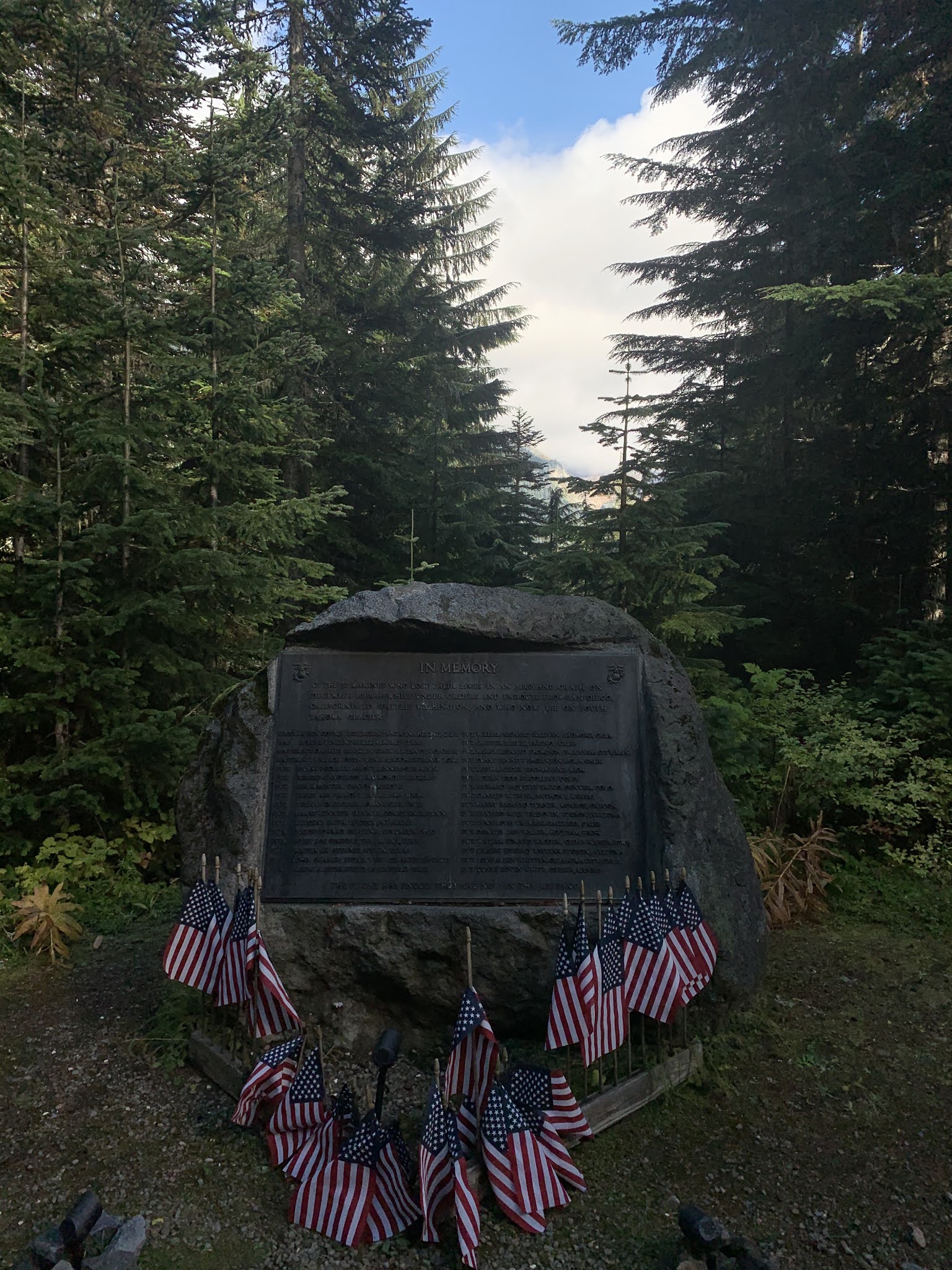
Back at Round Pass, turned to the left about 100 yards to see the Marine Memorial.

And then the long walk back down the Westside Road. The fall colors seemed brighter in the sunshine.

Tahoma Creek was running very fast.

Fall color at the base of Mt Wow
some of the fungi along the trail today:

 We drove out to Blewett Pass and up FSRs9716 and 9712 to hike Tronsen Ridge. We hiked 7.5 miles round trip with 1,565 ft of elevation gain (most on the way back). Along the trail, a few western larches were just beginning to turn golden. We did see some golden larches along the forest road. With the recent snow fall and the cold weather, the forest roads were icy.
 The official southern Trailhead is 0.8 miles from where the recommended parking is along a jeep path.
 The trail goes through an old burn zone.
 Icicles hanging from the trail sign, it was 21 degrees F when we started hiking. From the trail sign, the trail is mainly down hill along Tronsen Ridge.
 Sun rising through the burned trees.
 Along the ridge line, we had a view of Mt Rainier to the southwest, it was mainly covered in clouds.
 To the west, we could see the peaks in the Teanaway and the Enchantments.
 zoom of Mount Stuart
  and to the northwest, Glacier and other Cascade Peaks.
 zoom of Glacier Peak
 zoom of other peaks to the Northwest
  The trail drops down along the sides of the ridge, going through a lovely forest of mixed conifers. Nice moss growing on this old stump.
 A Western larch beginning to turn golden
 a frosty pine tree
 We followed a boot path up on a rocky out cropping to enjoy the views.
 Looking up at the rocky out cropping from the trail below.
 A touch of fall color along the trail
 We did not hike all the way to the north end of the Tronsen Ridge, but found a sunny spot with good views to stop for a lunch break before heading back. View to the south: Mt Rainier in the clouds to the Teanaway and Enchantment Peaks.
 View to the northeast from our lunch spot
 Hiking back up Tronsen Ridge, here is the rocky out cropping where we took the boot track.
 Trail along Tronsen Ridge
 Back where we had our first view of Mt Rainier, now cloud free. Diamond Head on the left.
 zoom of Mt Rainier behind some frosty trees
 back in the burn area as we hike back to the car


