Tuesday, January 19, 2021

Teanaway Butte via Jungle Creek


We drove out to the SnoPark at 29 Pines in the Teanaways to snowshoe up to Teanaway Butte via the closed Jungle Creek Road. This was about 11.5 miles round trip with 2,100 ft of gain, most in the last 1.5 miles. We hadn't seen any trip reports from this winter so we brought our snowshoes. We found the entire route well packed, so ended up carrying our snowshoes and wearing micro spikes. There was a beautiful sunrise as we left the trailhead.
We soon headed west, crossing a bridge over the North Fork of the Teanaway River.
Most of the route is up the closed Jungle Creek Road in the forest. For the first 4.25 miles, the road gains about 1,000 ft.
We decided, to stay on the road until it ends at Liars Prairie. Some people choose to go cross county earlier from where the road meets the Way Creek Trail. After looking at a topo map, we opted to continue the end of the road at Liars Praire and go around the false summit on the south side, eventually joining another closed forest road for a short while to its end and continue to the top of Teanaway Butte. There were several different snowshoe tracks going in different directions. We did find a set that went in the same direction we had planned on.
Part way up the cross country route, we looked back and could see Earl Peak in the distance. 
When we reached the short road section on the south side of Teanaway Butte, we entered the burn area from the Jolly Mountain fire of a few years ago. Here, we had a beautiful view of Mt Rainier to the southwest.
zoom of Mt Rainier
The very last bit up Teanaway Butte is steep!
From Teanaway Butte, we had a nice view of Mount Stuart
zoom of Stuart
the top of Teanaway Butte
pano to the west and north: Mt Rainier to Mt Stuart with many Teanaway Peaks in between:


view to the southeast


After a gorgeous lunch break, we headed northeast, back down Teanaway Butte 


Once we returned to the Jungle Creek Road, it was a long 5 miles back to the car. The snow had softened a little, and we did some occasional post holing, not enough to put on our snowshoes. Here we were walking alongside Jungle Creek.
some icicles
Lovely frost on beaches


a small pond near the road


Wednesday, January 13, 2021

Lost Lake Snowshoe from Crystal Springs SnoPark

With the avalanche danger at high today, we looked for a route that was rated as very low avalanche risk. Going up to Lost Lake near Keechelus Lake from the Crystal Springs SnoPark via the groomed snowmobile routes was our goal. We did not see any avalanche slopes along this route until after the end of the groomed route up at Lost Lake. This is a highly used area on the weekends. Since we were going up on a weekday on a snowy day we only saw 1 skier at the beginning of our day, and 1 snowmobile passed us as were well on our way. back to the snopark. There were a few skiers starting out on the trails as we returned to the SnoPark, so we had the majority of this route to ourselves today. 10 miles round trip with 800 ft of elevation gain.

Near the very beginning of the ski routes from the SnoPark is a very short side route for snowshoers, it was nice to be in the forest and off the groomed trails for a short while.


The first 3-1/2 miles along the groomed closed forest road, was fairly flat. We saw lots of standing water off to the side of the road from the recent heavy rain storms.


Meadow Creek


The majority of the route looked like this, a groomed snowy forest road in the forest. We were happy to be far from the avalanche slopes.


At the Y in the road just before Lost Lake, we took the road to the left, on the east side of Lost Lake. The grooming stops at this beautiful viewpoint of Lost Lake.


Just past the end of the groomed road, we saw evidence of a recent avalanche. Here we are at 3,200 ft.


There were some nice rocky cliffs on the last mile or so up to Lost Lake.


A little less than 2 miles from the SnoPark area is this route to the dam at the east end of Keechelus Lake. 


Signs on the trees showing the snowmobilers that they may encounter skiers, snowshoers and dog sleds on this portion of the groomed trail.


Our route today


Thursday, January 7, 2021

Hex Mountain Snowshoe

We drove north of Rosyln to snowshoe up to Hex Mountain (a 7 mile round trip with 2,600 ft of gain). We had some time constraints today and with all the new snow we reached 3 miles out with 2,000 ft of gain before needing to turn back. We have done this hike before and will do it again, so we were not disappointed . It was wonderful to be out on a sunny day after this past week of winter storms! The closed road the trail begins on was full of snow, even before the gate. The sun was lighting up the hills behind us as we began.
Two young women had begun before us, breaking trail. We started carrying our snowshoes for the first mile, then the snow was deep enough that I put on my snowshoes.
By the time we reached the trail sign (1.7 miles up the road) the snow was very deep. We met the young women coming down, they hadn't reached the top as they also had time constraints. The trail was not packed down but their previous tracks helped!
In the morning we enjoyed the blue skies! Looking towards Hex Mountain.
The trail goes through a burnt forest from a fire a few years ago. We spotted a couple of hairy woodpeckers searching for food.
My friend wanted a good workout today, so she lead the way. There was well over a foot of snow on this part of the trail. (On the way down, we saw where someone had come up without snowshoes or skis. There boot prints sunk down through out snowshoe track about 18" or so. They had turned around and left)
Red Mountain behind me
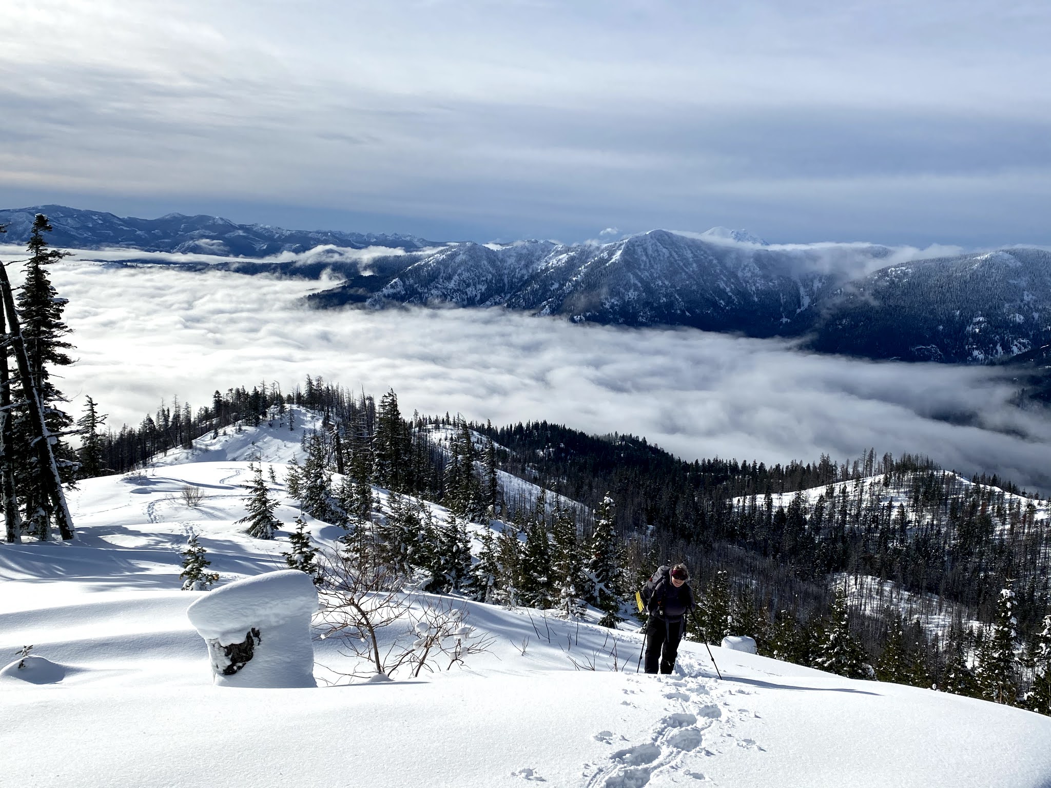
Cloud were covering Cle Elum Lake below, Red Mountain and Mt Daniels in the distance to the north.
As the clouds moved around, we would catch glimpses of Cle Elum Lake.
Some nice color in the sky to the east.
Panoramic view to the south, here we reached the area where the two young women had stopped.


We were now breaking trail, and realized we did not have time to reach the top of Hex Mountain today. We continued up until the trail goes back under the trees on the last ridge. Mt Rainier peeking over the ridge to the southwest.
Clouds over Cle Elum Lake are starting to rise.
So peaceful in the deep snow, we reached 4,400 feet. We are about 1/2 mile and 600 ft from the top of Hex Mountain. Here the sun was warming up the snow on the trees and with water dripping down on us, we decided to head down to a flat open area to take a lunch break on our hike back down.
So beautiful snowshoeing back down into the view.
By the time we sat down for lunch, we were engulfed in the clouds. We would be mostly in the clouds for our hike back down to the car.
Cornices forming along the east side of the ridge.
The fog and fresh snow gave a beauty to the burnt forest.
We met several people skiing and snowshoeing up the trail, so from our lunch spot down, the route was very nicely packed down. (but not yet packed down well enough for those without floatation devices).
Behind us, the cloud lifted enough for another look at Hex Mountain. 
We enjoyed our time on the trail, a gorgeous peaceful day!


Tuesday, January 5, 2021

Amabilis Mountain Snowshoe

We drove up to the Cabin Creek SnoPark, east of Snoqualmie Pass, to snowshoe up Amabilis Mtn. To go to the top is a 9.5 mile round trip. Because the trail was only groomed for 2.5 miles and we broke trail in deep snow for 1.5 miles, we only did 8 miles round trip today with 1,600 ft of gain.  We didn't see any other snowshoers and a few skiers out this morning.
We made sure to stay to the far right of the groomed trail, staying off the skiers area.
Most of the trails are in the forest, it was beautiful with fresh snow on this mostly cloudy day.
The green moss and lichen on the trees was beautifully set off by all the white snow.
The sun tried to break through the clouds for a brief moment.
There were some trees bent over the road from all the heavy snow. We shook the snow off the trunks to help them stand up off the route.
Gorgeous views even in the thick clouds.
At the "Y" after 2.5 miles, this route was no longer groomed and had lots of fresh snow. We saw where there had been a previous track, but it didn't last very long.

As the clouds moved around, we could see a little ways across the valley.
We probably sunk about 12" breaking trail with our snowshoes on.
Another sun break
The clouds would lift a bit, 
and then sink back down. We found an open spot to the side, to stop and take a lunch break.
After lunch, it started to snow, and it snowed our entire time back down to the car.