Thursday, August 29, 2019

Glacier View Peak

 We drove up to the Glacier View Wilderness to hike to the summit of Glacier View a 4.5 mile round trip hike with and overall elevation gain of 1,000 ft. We saw some lingering wildflowers, fungi and ripe huckleberries along with great views.
The trailhead is located along FR 59 a little west of Mt Rainier National Park. As the road gets closer to the trailhead, a bend in the road reveals this marvelous view of Mt Rainier.

 From the trailhead, it is a short hike up to the trail, go left to Glacier View, right to Beljica Meadows, Goat Lake and Gobblers Knob.

 This hike is in the forest, there were a couple of places where glimpses of Mt Rainier could be seen through the trees. We were hoping the clouds would not cover Mt Rainier before we reached the summit of Glacier View.
 We saw quite a few fungi emerging from the forest floor, and these large fungi growing on a huge log.


We found both ripe red and blue huckleberries


The trail goes past a few open fields where we found wildflowers in bloom.


 quite a bit of paintbrush


 another open field
 After 2 miles the spur trail on the left goes up Glacier View


 The spur trail is about 0.25 mile
We could see Mt Rainier as we went up the trail
 There is a nice long ridge on the top of Glaier View, site of a former fire lookout


Gorgeous view of the west side of Mt Rainier,
we could see the areas we backpacked along part of the Wonderland Trail two weeks ago.


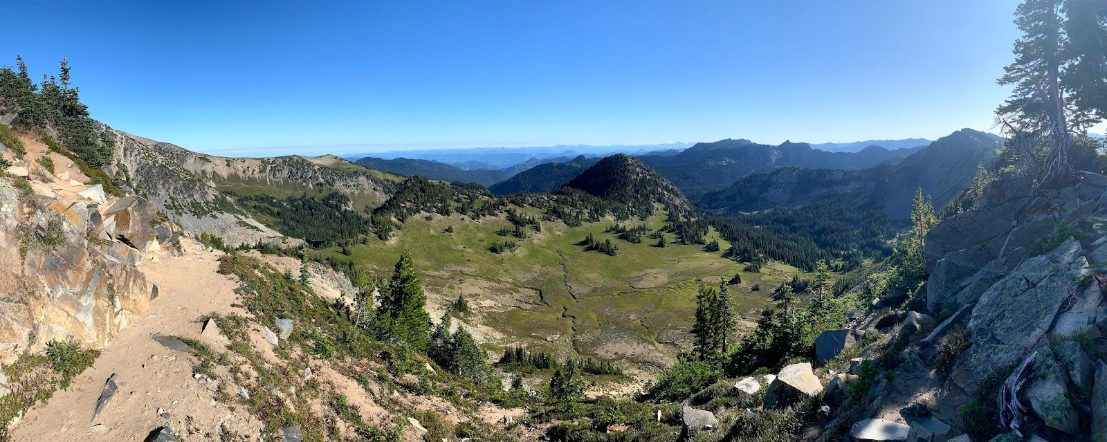
Pano from the summit of Glacier View to the west: Mt Rainier, and in the far distance the Goat Rocks and Mt Adams. On the right Gobblers Knob and Mt Wow


Pano from the summit of Glacier View to the east: 
In the far distance Mt St Helens, clouds over Puget Sound and the Olympic Mts.

 zoom of Mt Adams


 zoom of Mt St Helens


zoom of Gobblers Knob with lookout tower and Mt Wow


zoom of Mt Rainier: here we could see the Mowich, Puyallup and Tahoma Glaciers.


We watched the clouds start to descend over Mt Rainier and headed back to the trailhead. We were fortunate to reach the car before the afternoon rain started.


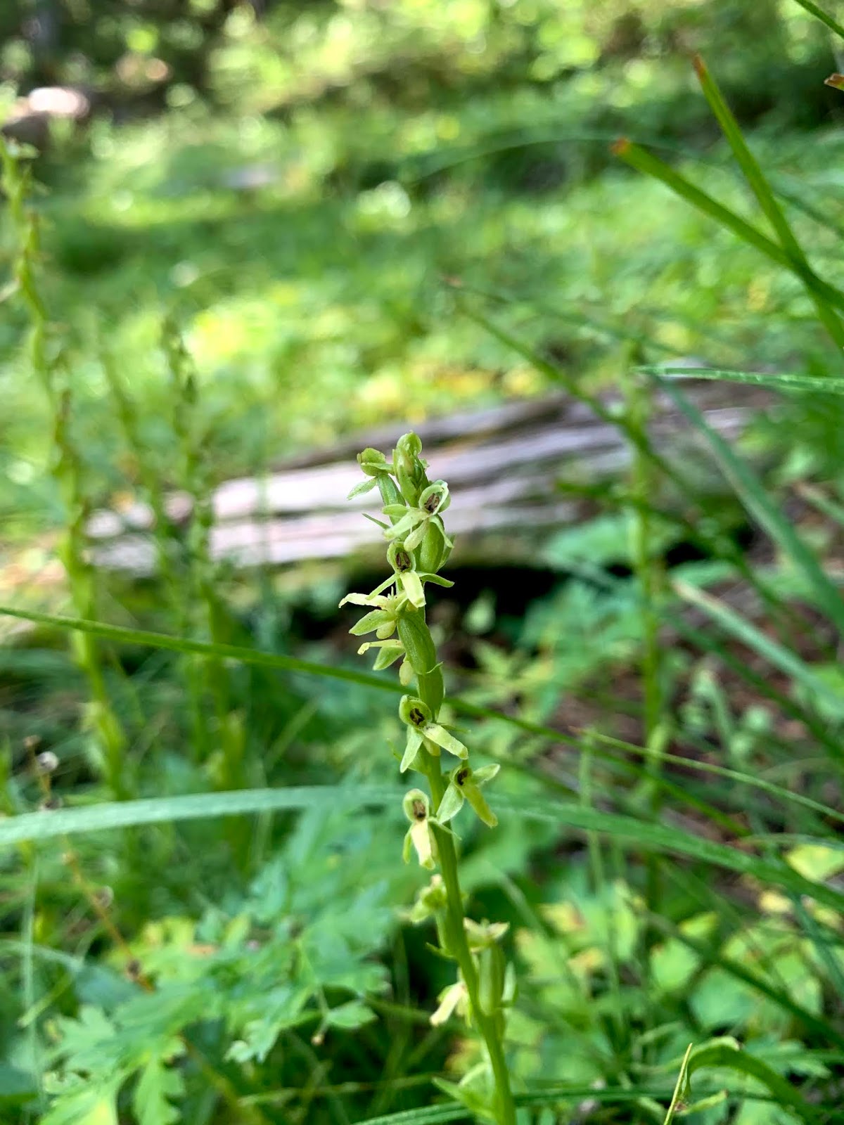
some of the wildflowers and fungi we saw along the trail today:


Monday, August 26, 2019

Forest Lake Huckleberry Creek Trail

 For my second new to me day hike from the Sunrise at Mt Rainier NP, I choose to hike down to Forest Lake along the Huckleberry Trail. From the parking area, this is a 5 mile round trip hike with an overall elevation gain of 1,750ft. I ended up hiking an additional 1/2 mile beyond Forest Lake and back, making my hike 6 miles round trip with an overall gain of 2,100 ft.


 To reach the trail, hike up to Sourdough Ridge and head left/west towards Frozen Lake, but not going that far.
 A sign marks the trail going off from the Sourdough Ridge Trail.
 The trail climbs a short distance before dropping off into Huckleberry Basin on the north side of Sourdough Ridge. View of Mt Rainier before turning around:

Pano to the north looking down into Huckleberry Basin. Forest Lake is behind and below McNeely Peak located in the center of the photo. In the far distance, I could see Mt Baker, Glacier Peak, Mt Stuart and other Cascade peaks.

 The trail steeply descends down Sourdough Ridge, I was glad I had my poles as the dry dirt was slippery.
The trail briefly goes through some trees and a slope covered in wildflowers.
The trail passes through a talus field where I saw one quick pica and heard several more.
 Stream crossing after descending from the talus field.


 The trail then steeply descends into the forest, here there were some open areas with paintbrush and other wildflowers.
As the trail followed the creek nearing the lake, there were many monkey flowerplants in bloom. McNeely Peak in the background.
 First view of Forest Lake, it was a lovely shade of green. Campsites are on the far side of the lake.


Wide angle view of Forest Lake from the camping area. Mount Fremont reflecting in the lake.

The Huckleberry Creek Trail continues for another 6 miles to the north park boundary and becomes Trails 1182 connecting to Forest Service Road 7300 in an additional mile.
I hiked about 1/2 mile further down the trail.
This was a heavily forested area, where I went around on downed tree and stepped over another.
There is some fungi here and I did startle an elk.


I continued until reaching this bridge.
I think there is a waterfall upstream from here, but it could not be seen from the trail and I did not want to hike cross country today.


 There were lots of huckleberry bushes, but I did not see any ripe huckleberries today.


 I returned back up the trail.
Taking time to enjoy the flowers as it was uphill hike back up to Sourdough Ridge.


 pasqueflower seed heads along the trail
Coiled-beak lousewort, with Mount Fremont in the background


 ground squirrel fattening up before winter returns to the mountains

 Found this marmot trying to nap on the trail back on Sourdough Ridge.


purple asters along the trail back down to Sunrise


more wildflowers and fungi seen along the trail today: