Wednesday, January 28, 2015

Blue Bell Pass via Bullion Basin Winter Hike

 Today was sunny with very few clouds up in the Cascades, much better weather than was predicted. We had decided to head up to Bullion Basin at the Crystal Mtn Ski Resort for a new snowshoe trip, but when we saw the great weather, we choose to extend the trip to get great views. Plus there was very little snow, no snowshoes needed. We were able to do the entire hike with just our microspikes.
We followed the summer trail for most of the hike, we estimated our trip was 6 miles round trip with 2000 ft of elevation gain.
The trail starts behind the condos on the hill. Although there wasn't much snow, it was icy.
There was lots of running water, here we crossed a wooden bridge.
 A short way up the trail, the view opened up and we could see the peaks around the Crystal Ski area.
 Further up the trail, we could see Mt Rainier peaking over the ridge.


We crossed two avalanche chutes on our way to Bullion Basin, not enough snow to cause an avalanche today.
We reached Bullion Basin after 2 miles and 1500 ft of elevation gain. We took a short rest stop here, enjoying the sun
There is a lot of water under the snow at Bullion Basin, be careful where you walk.

Blue Bell Pass is another mile and about 500-600 feet of elevation gain from Bullion Basin. 

We found another small basin (or maybe upper Bullion Basin???) on the way up to Blue Bell Pass. The last section was the steepest part of the trail.

The views were spectacular, well worth the extra hiking.
 Panorama view from Mt Adams to Mt Rainier:

 Close up of Mt Rainier over the ridge line at Crystal Ski area.


Looking toward Mt Adams
After lunch, we walked to the end of Blue Bell Pass for more views.
Panorama from Mt Adams to Mt Rainier and Crystal Ski area and then to the west:
 Panorama of the views to the west and north. I think the view is of Norse Peak above, Bullion Basin lies below the tree line out of view.

Hiking down from Blue Bell Pass. It was hard to leave the pass, with the gorgeous views and sunny weather. We had the entire hike to ourselves today.


  After Bullion Basin, the hike down was with the views in front of us.


Sunday, January 25, 2015

Winter Hike to Poo Poo Point on Tiger Mtn via the Chirico Trail


We hiked up to Poo Poo Point on Tiger Mountain via the Chirico Trail today in Issaquah. This is a good winter conditioning hike. The hike is 3.8 miles round trip with 1760 ft of elevation gain. A popular spot for paragliders. Most of the hike is up a hillside in the woods.


 At 1.6 miles, arrive at the South View Launch site with a great view of Mt Rainier to the south.


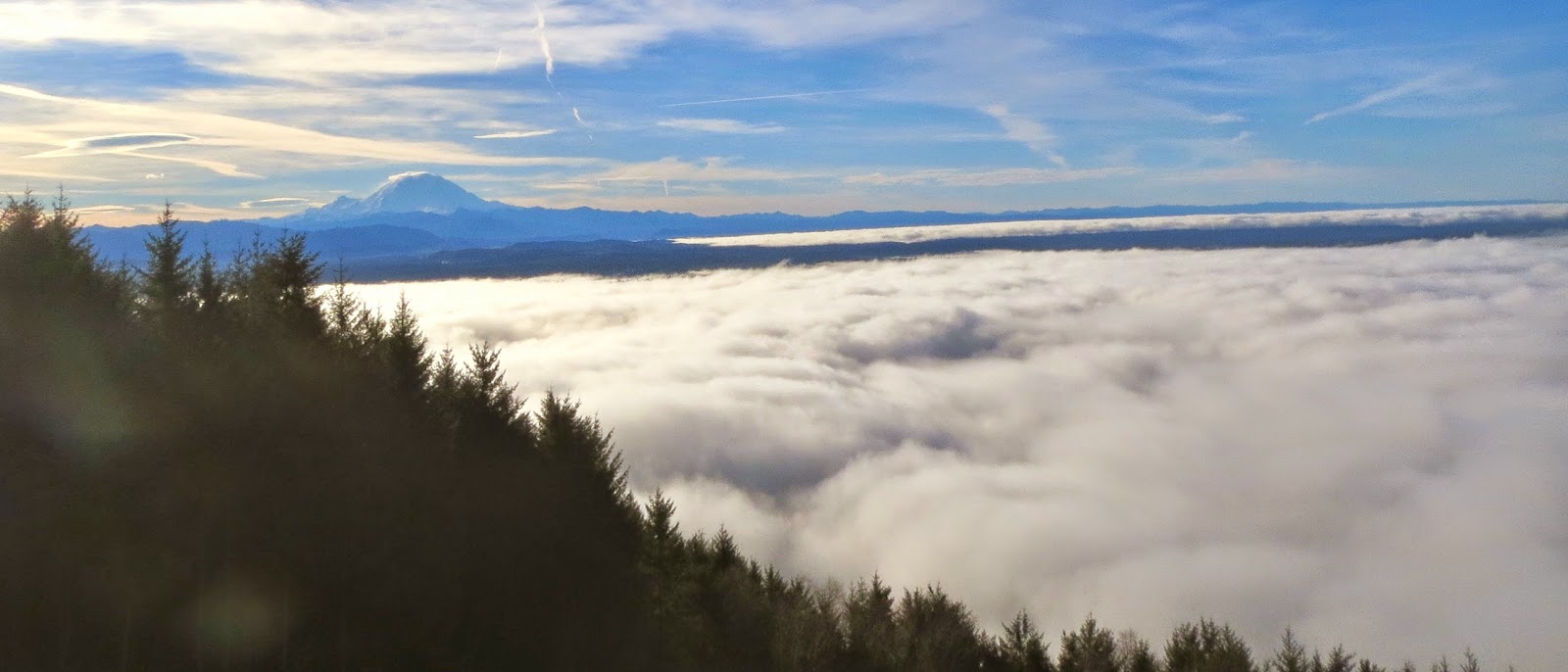
About another 180 ft up and 1/4 mile along the trail, reach the North View Launch Site with a great view over looking Sauk & Cougar Mts. Seattle and Issaquah are below the clouds. In the far distance are the Olympic Mts.

to the north we could see Mt Baker, here's a zoom photo:
This trail is very popular and crowded. But the views are worth it.

Wednesday, January 21, 2015

Snowshoe along Paradise Glacier Trail via Mazama Ridge on Mt Rainier

Today was another beautiful day, and we again headed up to Paradise on Mt Rainier for a snowshoe trip.

We choose a different route, and left the parking lot at Paradise along the Paradise Valley Route to 4th Crossing up Mazama Ridge, then headed north to the ridge line above the Paradise Glacier Trail (buried in snow). This route is marked in blue on the map to the left (going off the map). Our hike was about a 4 mile round trip with about 1000 ft of elevation gain.


Hiking along the Paradise Valley Route looking toward Mazama Ridge.


 A small waterfall seen along the way.

 After the road takes a sharp hair pin turn, look for the way up 4th crossing to the south of the creek that runs down from Sluiskin Falls (not seen in the photo).
 View of the Tatoosh Range from the top of Mazama Ridge.

 From Mazama Ridge, we headed north toward the Skyline Route.
 Along this ridge line we could see tracks where others had gone down hill, then up along Skyline Route. We stayed up on the ridge and headed north east (to the right, out of this photo).
We kept snowshoeing until we reached the top of the hill and there were sharp drop offs all around us. We had fabulous panoramic views!


 Looking southeast down Stevens Canyon with Mt Adams in the far distance.


Panoramic View of Mt Rainier and Little Tahoma to the northwest.

 How close the mountain looks with a regular photo

Hiking back to Paradise, heading southwest, views of the Tatoosh Range with Mt St Helens in the far distance

Beautiful icicles

Wednesday, January 14, 2015

Panorama Point and beyond via Edith Creek route, winter hike/snowshoe


Today was another gorgeous sunny day on Mt Rainier with low avalanche risk. So we decided to head up to Panorama Point again, but taking a different route and continuing above the point for a ways. Instead of hiking around Alta Vista to the west, we headed up the Edith Creek Basin Route to the east from the Paradise Parking lot. There wasn't much snow and it was packed in the morning, so we started with microspikes.


I marked our route on the map in pink. It is about a 5 mile hike with 1300 ft elevation gain to Panorama Point. We probably hiked another 1/4 mile or so above the point with another 200 - 300 ft in elevation gain and then returned via the route to the west of Alta Vista.

 The Edith Creek Basin Route goes over the bridge above Mildred Falls.


 Edith Creek above Mildred Falls, and Mt Rainier in the distance. My shadow as I stand on the bridge.
 A little further up the route, we can see Panorama Point to the right of Mt Rainier.
 Along the way, we found this decorated Christmas tree. There were even small solar panels in the tree to power on the lights.
 When we reached the base of Panorama Point, we decided to take the "other" route up to the Point. This one goes up along the tree lined ridge. I thought it was steeper than last week's route up the west side of Panorama Point.
 Part way up, we found a "flat" spot to sit, catch my breath, and enjoy the view.
 I was very excited to reach the flat plateau of Panorama Point, where we ate lunch and rested before continuing up.
 Way up (towards Camp Muir for those inclined). Not the trail maker seen in the snow. It is usually buried beneath the snow this time of year.


Here we are about 200 - 300 ft above Panorama Point, great views looking south towards Mt Adams, Hood and Mt St Helens.

This raven also enjoyed the views today.
 Mount Rainier seems so close here.

 Heading back down toward Panorama Point. We glissaded down a couple of the steep slopes along the way.

 Looking back at Panorama Point from the west. The main route is between the two rocky points on the left side of this picture (how we came down). Our upward route was along the tree ridge line traveling up from the right side of the picture. The drop offs (not seen, they are behind the ridge) are very steep.

 After descending from Panorama Point, the snow was mushy in the afternoon sun, so we put our snowshoes on. We continued to enjoy the views as we hiked back to the parking lot along the west side of Alta Vista.
 Enjoying another view of "the mountain" from the parking lot before driving home.


Wednesday, January 7, 2015

Panorama Point on Mt Rainier Winter Hike

Today the weather was warm (in the 50s to 60s at Paradise), sunny and low avalanche risk. Perfect day to head up to Panorama Point above Paradise on Mount Rainier. This hike is about 3 miles round trip (going up and coming back the same way) with 1300 ft of elevation gain. Being mid-week, the parking lot only had 3 cars when we started out.

 The hike starts gaining early on, and before long we were high enough where we could see volcanic peaks beginning to appear over the Tatoosh mtns, Mt. Adams
 and Mt St Helens.
 Today, the snow was well packed and we were able to make our way up using micro spikes. Panorama Point ahead.
 We followed bear tracks in the snow for a bit.

The winter trail up the side of Panorama Point is very steep.

The view from Panorama Point was spectacular. 
Looking south and seeing Mt Adams, Mt Hood and Mt St Helens.

 There were no tracks to follow heading out along the skyline trail or down to Edith Creek Basin, so we decided to head back down the west side of Panorama Point, the way we had hiked up. We hiked down part way, the glissaded!


We continued to enjoy the view as we hiked back to the parking lot at Paradise. About 1/2 mile from the parking lot, the snow had softened enough in the heat, we began to post hole, so we finally put our snowshoes on for the last bit.