We drove out to Pershastin to hike up Sauer's Mountain, 5 miles round trip with 1,750 ' gain. This trail starts on private property with access given by the oweners. After leaving the Sauer's property the trail enters the Okanogan Wenatchee National Forest. The balsmroot was in bloom.
 Going up the switchbacks, at the fork in the trail, we took the trail on the left where the sign side view 0.2 miles.
 At the end of the 0.2 miles, straight ahead is a sign that says "private property, no trespassing". I took this photo from above the sign.
 From the viewpoint, the trail continues up from a switchback to the right. From here the trail enters the forest with some ocassional views of the nearby peaks.
 Near the end, the trail crosses a closed forest road and the trail continues up on the left side of this point.
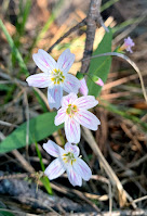
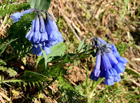
some of the wildflowers we saw along the trail today:


No comments:
Post a Comment