
As the ski lifts were closed at Hyak (East Summitt) today, I did a snowshoe, going up almost to the top of Mount Hyak, then over to Union Station and followed some of the groomed Nordic Trails (staying off to the far side) before returning to the base, overall about 5 miles and 1,100 ft of gain. Saw few people and only when I was on the side of the alpine ski runs.

A few years ago, I did the Mt Catherine Loop trail, and I was planning on doing part of this loop in the reverse direction, but the Uphill Route signs took me in a different direction, going up Mount Hyak.

Lovely blue skies this morning, looking across the valley to Kendal Peaks, and peak I don't know the name of and Rampart Ridge.

zoom of the unknown to me peak

View looking a bit further to the northwest

View to the west of Denny Mountain, Snoqualmie Mountain and Guye Peak

zoom of Snoqualmie Mountain and Guye Peak

Heading toward Union Station, Granite Mountain in the far distance

zoom of Granit Mountain with the fire lookout on top

view of Keechelus Lake to the east

Mt Catherine

Silver Peak in the distance

zoom of Silver Peak

Heading back down along the edge of Creek Run, the easiest run back down for Nordic Skiers (according to the signs), gorgeous views of Kendall peaks etc,

zoom of Kendall Peaks

and a bit further down the trail, nice view of Rampart Ridge

zoom of Rampat Ridge

 As the ski lifts were closed at Hyak (East Summitt) today, I did a snowshoe, going up almost to the top of Mount Hyak, then over to Union Station and followed some of the groomed Nordic Trails (staying off to the far side) before returning to the base, overall about 5 miles and 1,100 ft of gain. Saw few people and only when I was on the side of the alpine ski runs.
 A few years ago, I did the Mt Catherine Loop trail, and I was planning on doing part of this loop in the reverse direction, but the Uphill Route signs took me in a different direction, going up Mount Hyak.
 Lovely blue skies this morning, looking across the valley to Kendal Peaks, and peak I don't know the name of and Rampart Ridge.
 zoom of the unknown to me peak
 View looking a bit further to the northwest
 View to the west of Denny Mountain, Snoqualmie Mountain and Guye Peak
 zoom of Snoqualmie Mountain and Guye Peak
 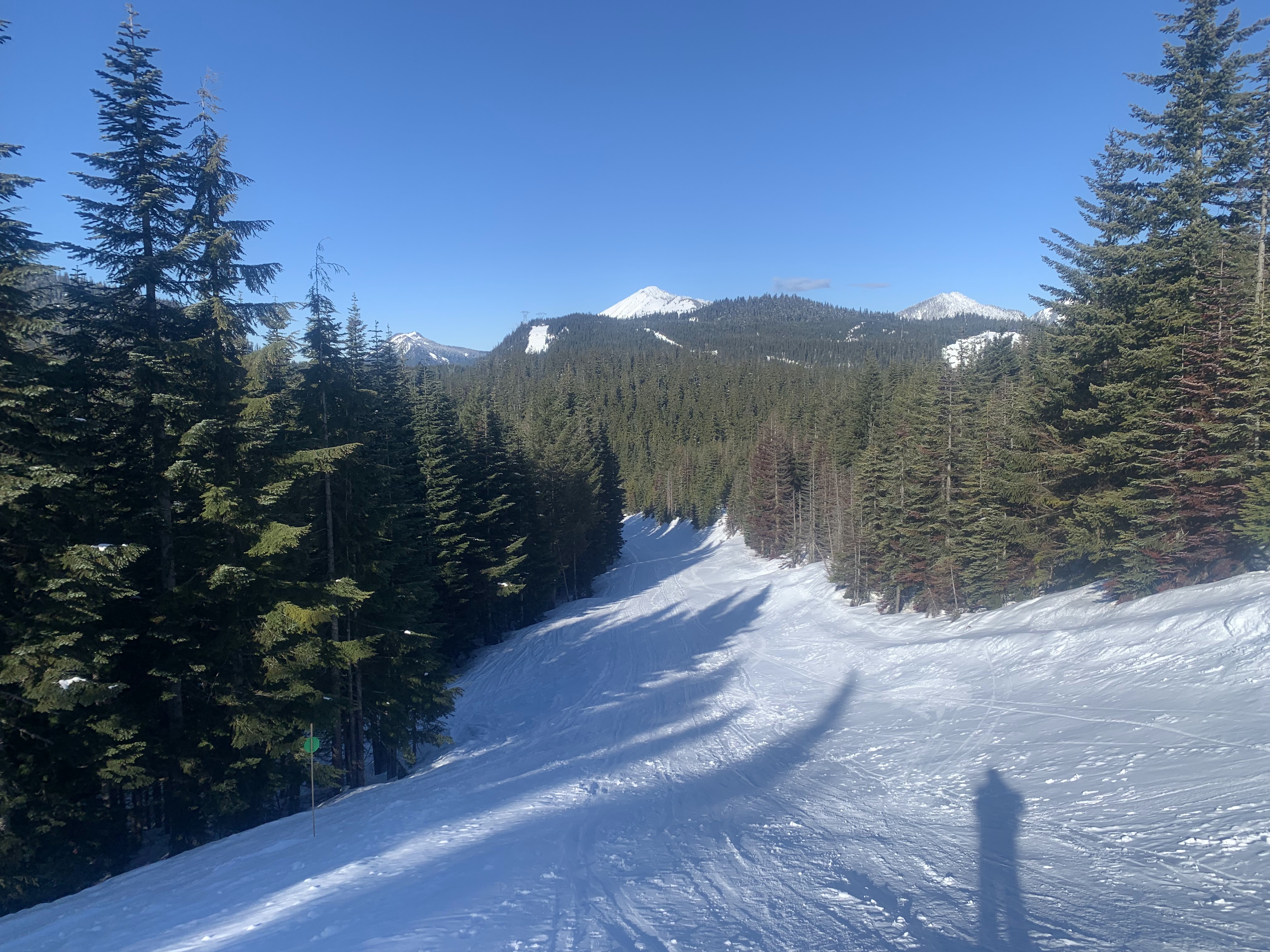 Heading toward Union Station, Granite Mountain in the far distance
 zoom of Granit Mountain with the fire lookout on top
 view of Keechelus Lake to the east
 Mt Catherine
  Silver Peak in the distance
 zoom of Silver Peak
 Heading back down along the edge of Creek Run, the easiest run back down for Nordic Skiers (according to the signs), gorgeous views of Kendall peaks etc,
 zoom of Kendall Peaks
 and a bit further down the trail, nice view of Rampart Ridge
 zoom of Rampat Ridge
No comments:
Post a Comment