
I drove up to the Narada Falls Parking Area to snowshoe to Reflection Lakes and back. I followed the trail up to the Stevens Canyon Road and went via Inspiration Point as the avalanche risk was low today. I returned via the Low Lakes Trail. Overall my hike was 3.7 miles with 550 ft of gain. I didn't see any other people on my way to the lakes, and saw 14 snowshoers on my way back. Pretty quiet for a holiday weekend. View of the Paradise River near the parking area on the way to the trailhead.

There was some new snow on the trail from last night. The route from Narada Falls area up to the Stevens Canyon Road was well packed, so I carried my snowshoes along here.

View along the Paradise River next to the trail.

Up on the Stevens Canyon Road, I was post holing, so I stopped an put on my snowshoes. Some columnar rocks and snowy bushes along the road.

I had a nice view of Mt Rainier along this section before the clouds rolled in.

Looking down the closed Stevens Canyon Road towards some of the Tatoosh Peaks. Amazed that I had the first half of this hike to myself.

Before reaching Inspiration Point, I turned around and watched the clouds come in and hide Mt Rainier from view.

view of Lane, Chutla and Eagle Peaks from Inspiration Point

zoom of Lane Peak

zoom of Chutla and Eagle Peak

Rocky cliffs along the side of the road

The sun rising behind Castle Peak and Pinnacle Peak

The part of the lake by the outflow was not frozen and I was able to get a reflection of some trees in the water.

I walked along the shore of Reflection Lake for a ways.

Mt Rainier remained hidden behind the clouds while I was at the lake.

Enjoyed the fresh snow covering the trees and ground.

Saw a small peak of Mt Rainier across the lake as I headed back.

By the time I was on the other side of the Lower Lakes Trail, the clouds had passed and I saw some nice views of Mt Rainier.

View of the Paradise River from the bridge above Ruby Falls

side view of Ruby Falls

Ruby Falls

 I drove up to the Narada Falls Parking Area to snowshoe to Reflection Lakes and back. I followed the trail up to the Stevens Canyon Road and went via Inspiration Point as the avalanche risk was low today. I returned via the Low Lakes Trail. Overall my hike was 3.7 miles with 550 ft of gain. I didn't see any other people on my way to the lakes, and saw 14 snowshoers on my way back. Pretty quiet for a holiday weekend. View of the Paradise River near the parking area on the way to the trailhead.
 There was some new snow on the trail from last night. The route from Narada Falls area up to the Stevens Canyon Road was well packed, so I carried my snowshoes along here.
 View along the Paradise River next to the trail.
 Up on the Stevens Canyon Road, I was post holing, so I stopped an put on my snowshoes. Some columnar rocks and snowy bushes along the road.
 I had a nice view of Mt Rainier along this section before the clouds rolled in.
 Looking down the closed Stevens Canyon Road towards some of the Tatoosh Peaks. Amazed that I had the first half of this hike to myself.
 Before reaching Inspiration Point, I turned around and watched the clouds come in and hide Mt Rainier from view.
 view of Lane, Chutla and Eagle Peaks from Inspiration Point
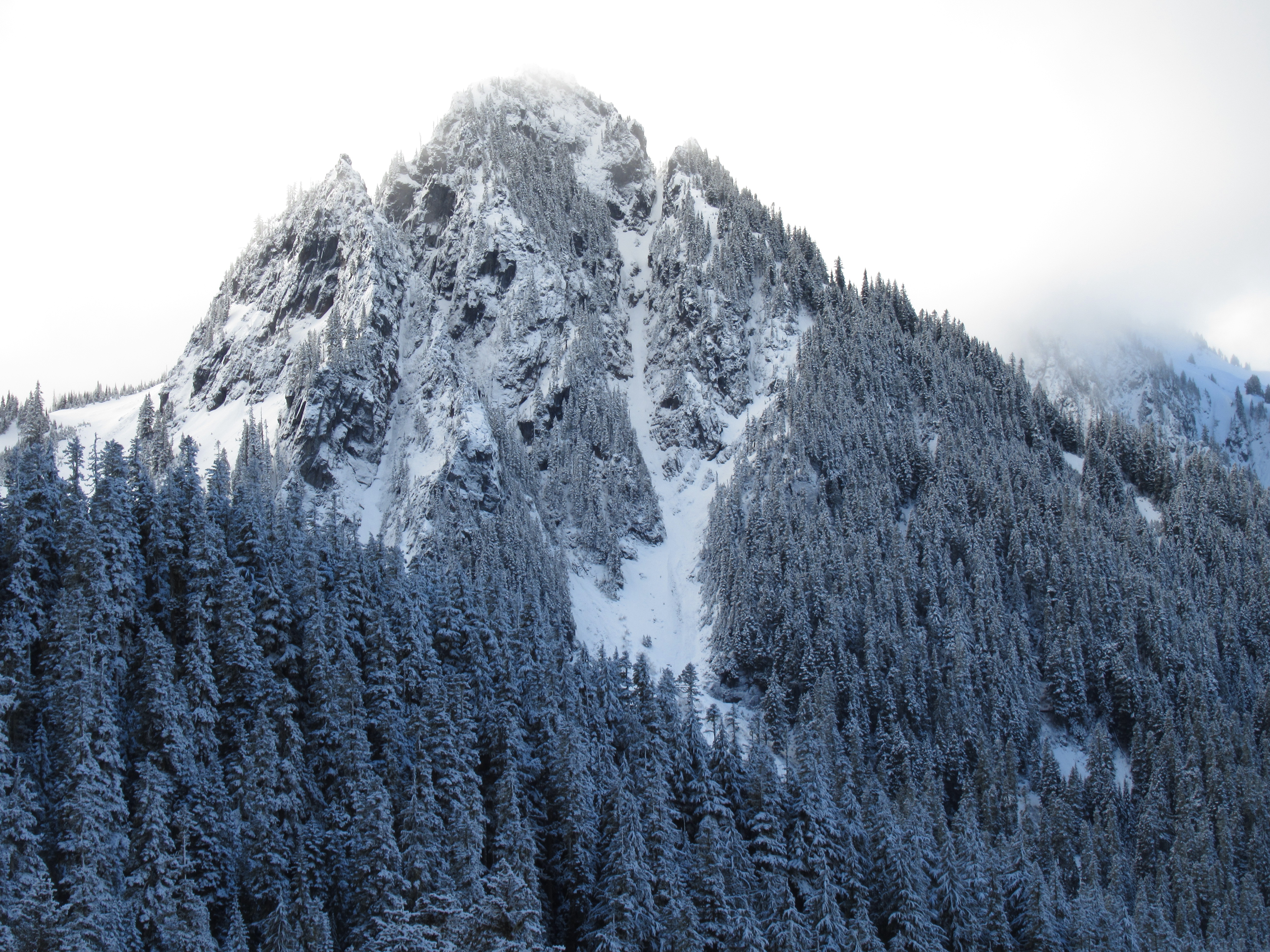 zoom of Lane Peak
 zoom of Chutla and Eagle Peak
 Rocky cliffs along the side of the road
 The sun rising behind Castle Peak and Pinnacle Peak
 The part of the lake by the outflow was not frozen and I was able to get a reflection of some trees in the water.
 I walked along the shore of Reflection Lake for a ways.
 Mt Rainier remained hidden behind the clouds while I was at the lake.
 Enjoyed the fresh snow covering the trees and ground.
 Saw a small peak of Mt Rainier across the lake as I headed back.
 By the time I was on the other side of the Lower Lakes Trail, the clouds had passed and I saw some nice views of Mt Rainier.

 View of the Paradise River from the bridge above Ruby Falls
 side view of Ruby Falls
 Ruby Falls
No comments:
Post a Comment