
 This morning I drove out to Lake Ozette in Olympic National Park to hike the Ozette Triangle: Down to Cape Alava, south on the beach for 3+ miles to Sand Point then back to Ozette Lake. Overall 9.5 miles with 350 ft of overall loss/gain. I saw a herd of elk while driving down the Hook-Ozette Road.
 From the parking area, the trail goes over the Ozette River on a large foot bridge, view upstream with Lake Ozette in the backgound,
 view downstream from the bridge.
 The trail goes through a gorgeous coastal forest, part on dirt and long sections on boardwalks.
 After 3.3 miles through the forest, the trail descends down to Cape Alava.
 The tide was going out to a low of -1.5 feet. View to the north of Cape Alava, I could hear sea lions to the north.
 I spent some time exploring along the south side of Cape Alava. It was difficult to maneuver as some areas had large deep tide pools left behind,
 and many of the rocks were very slippery. But it was beautiful to be out on the Ocean coast.


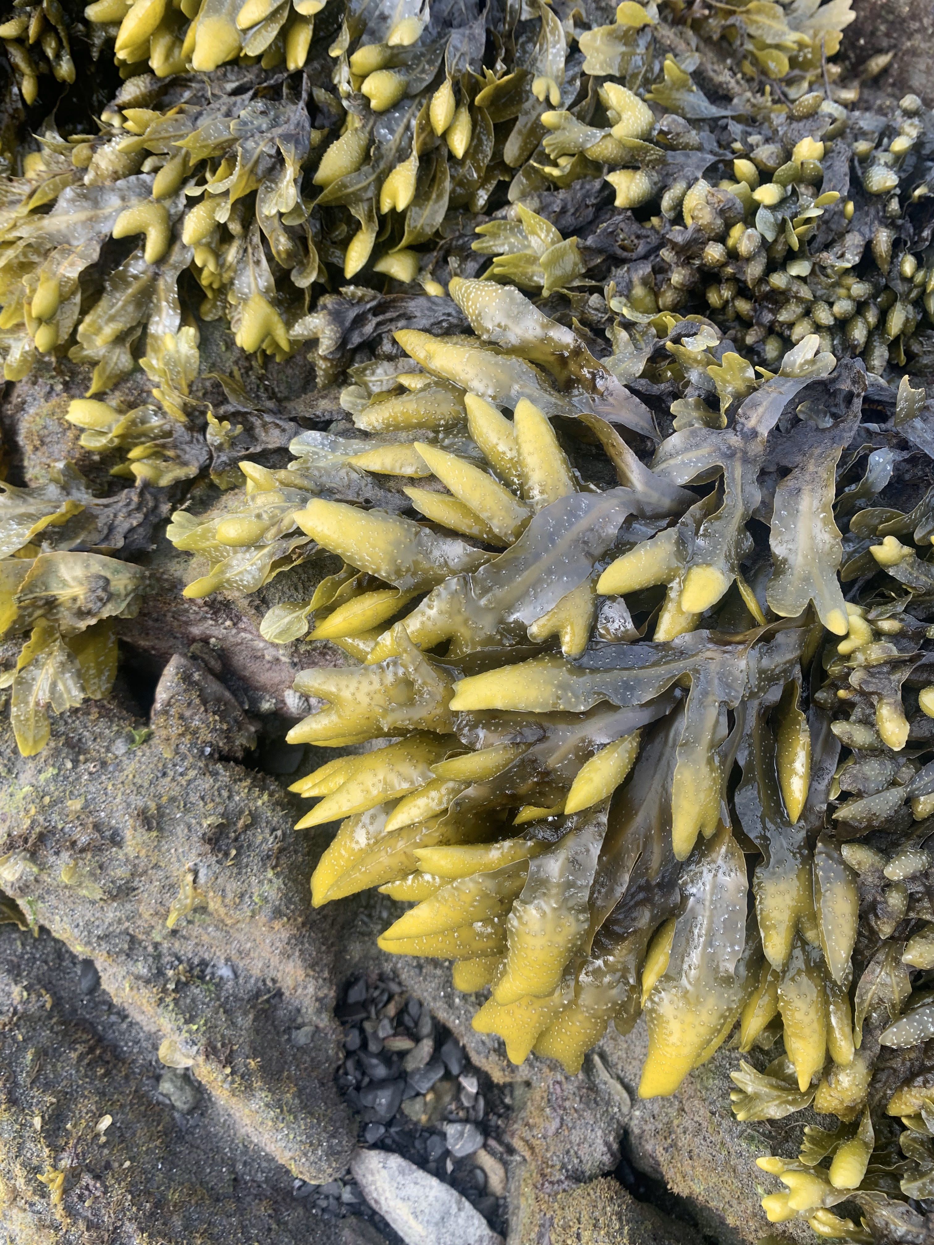
 Some of the sea life I saw in the tidal areas today:


 It was necessary to hike along the upper beach, and there were downed trees that were climbed under and over.
 I watched a couple of raccoons run from the tidal pools up the beach, and than got a photo (zoom) of one of the raccoons up on a downed trees on the upper beach.
 There were several sea stacks completely out of the water at low tide.
 I saw many small crabs scurrying across the beach.
 View looking back northwest to Cape Alava
 some of the petroglyphs at the Wedding Rocks


 A large boulder in the midst of the Wedding Rocks
 More sea stacks with the low tide leaving the high and mostly dry as I continued hiking down the beach.


 Several eagles were soaring over the exposed rocks near the waters edge. This one landed on a tree branch high above the beach (zoom).
Lots of exposed rocks at low tide with Sand Point in the distance.

 view back to the northwest
 Large rock formation at the end of Sand Point
 View of the beach to the south of Sand Point
 From Sand Point the trail continues another 3 + miles back to the trailhead. This section of the trail seemed more open in the forest.
some of the wildflowers and fungi seen along the trail:


No comments:
Post a Comment