
 We drove up to Paradise at Mt Rainier National Park this morning to hike the High Skyline Loop Trail, this was about 6.5 miles with 1,700 ft of gain. We decided to go slow and soak in what was all around us: lots of gorgeous views, wildflowers and wildlife. We started along the Deadhorse Creek Trail. Early view of Mt Rainier.
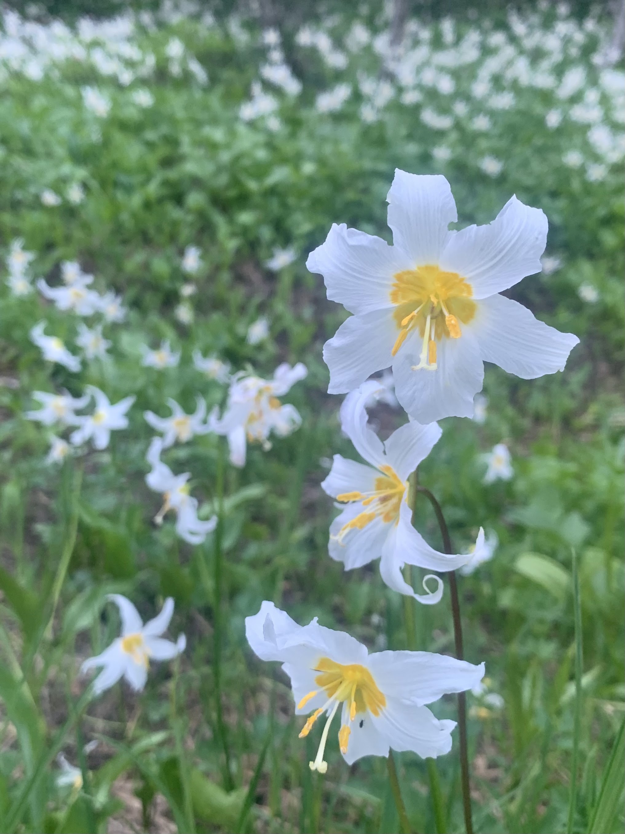 There were lots of avalanche lilies in bloom near the beginning of the trail and it several other areas along the loop.
 We saw a mother grouse (and a few chicks that moved too fast for me to get photos).
 Some magenta paintbrush along the trail. We had several portions of this loop to ourselves today. It was quite some time before we saw any other hikers on the Deadhorse Creek Trail.
 View of the Tatoosh Ridge to the south.
 The first marmot we saw was between a couple of tree trunks next to the trail.
 some of the many marmots that were along the trail today:

 View of Mt Rainier as we continued up towards the junction with the Skyline Loop Trail.
 View along the Glacier Vista Trail
 View of the Tatoosh Ridge and some distant volcanic peaks beyond to the south from Panorama Point
 zoom of the Goat Rocks
 zoom of Mt Adams
zoom of Mt Hood

 zoom of Mt St Helens
  View of Mt Rainier as we hike above Panorama Point
 The High Skyline Trail has some amazing views.
 View of the Tatoosh Peaks from the High Skyline Trail
 We saw many snow patches near the trail, but only needed to cross 3 snow patches today.
 zoom of three mountain goats on a snow field above us
 We found a nice lunch spot with a view of Mt Rainier near the top of a waterfall and
 a view looking out over Paradise towards the Tatoosh Peaks.
 More views of Mt Rainier as we continued towards Mazama Ridge: the trail goes by creeks,
 over some snow patches
 View from where the Paradise River crosses the meadow, view of Rainier and Little Tahoma
 Magenta paintbrush, pasqueflower seedbeds and some Tatoosh Peaks from Mazama Ridge
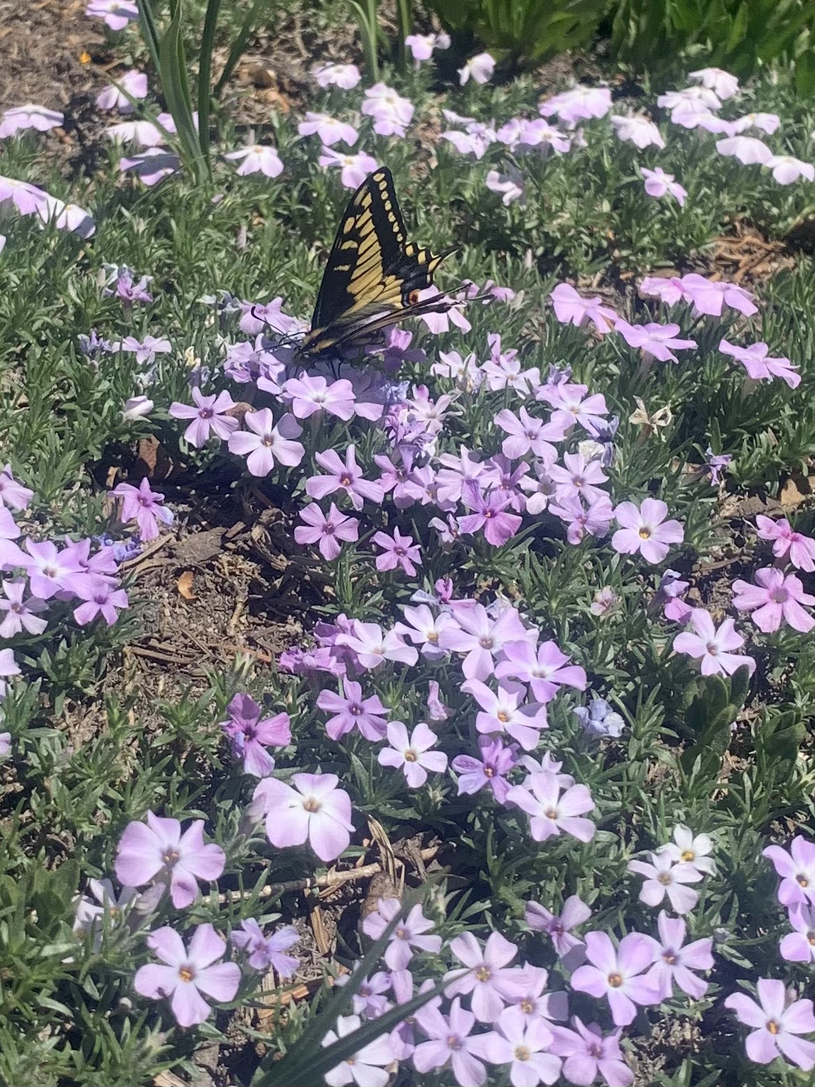 butterfly on phlox
 a field of glacier lilies
 magenta paintbrush and heather along with a view of Mt Rainier on Mazama Ridge
 another field full of avalanche lilies
 View of Mt Rainier and to the right, the ridge where we sat for our lunch break, as seen from the trail heading down off Mazama Ridge
 The Paradise River coming down from Mazama Ridge
 Another view of Tatoosh Peaks as we get closer to Paradise
 Mt Rainier as seen by Edith Creek
some of the wildflowers we saw along the trail today:


No comments:
Post a Comment