 Drove up to the end of Herrick Road to hike the West Elwah Trail and on up to the Glines Canyon Spillway Overlook and back in Olympic National Park (about 9 miles round trip with 1,700' gain). There is only room for 3 cars in the parking area, so the West Elwah Trail is not busy, I saw 4 other hikers on it as I was hiking back. Only saw about 20 hikers/bikers up on the closed Olympic Hot Spring Road to the Glines Canyon Spillway Overlook. Not busy for a sunny Sunday. The first 0.4 miles of the West Elwah Trail is in private property, so it is important to stay on the trail through there.
 As I neared the park boundary, I could see a couple of deer crossing the trail in the distance (zoom)
 The bridge across this cross as slipped of the far bank and the handrail has broken. Someone has jerry rigged the loose handrail, I would not rely on that section of the handrail for support.
 Parts of the trail are muddy and the rocks on this stream crossing were very slippery and I slipped!
The West Elwah Trail ends very close to the bridge over the Elwah River on the Olympic Hot Spring Road. View form the bridge looking downstream.

From the bridge over the Elwah River it is about 1.1 miles to the Glines Canyon Spillway Overlook. Looking upstream from the spillway to what was once Lake Mills
 About 0.3 mile below the spillway is an old road that goes down to the Elwah River where there was a canoe/kayak launch site. The color of the Elwah River is fabulous.
Hiking back through the Altair Picnic area, view across the Elwah River, and
 Another view looking upstream along the Elwah River as I continue to hike back towards the trailhead.
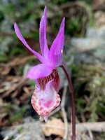
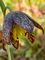
Some of the wildflowers seen along the trail today:


No comments:
Post a Comment