
 We drove out tho the end of Obstruction Point Road by Hurricane Ridge in Olympic National Park to hike the Badger Valley Grand Valley Loop Trail. This was about 8 miles with 2,500 ft gain, all at the end of the hike. The wildflowers were abundant, especially in Badger Valley. View from the parking area at the trailhead.
 The trail heads out towards Grand Ridge for 0.3 miles before dropping down into Badger Valley.
 There are a few switchbacks going down a very steep section into Badger Valley.
 We were soon going past bunches of wildflowers, here pasqueflowers gone to seed.
 Lot of heather on the upper slopes.
 By this small creek, we saw milk vetch, paintbrush, elephanthead lousewort, bog orchids and monkeyflowers.
 Some of the hillsides were covered with paintbrush
  the meadows were full of wildflowers
 Here the hillsides were covered in milk vetch and monkeyflowers lined the sides of the creek.
 Throughout the majority of the hike, we saw many harebells in bloom.
 milk vetch and bistort
 The cow parsnip was tall and
  this field was dense with columbine in bloom.
 Wildflowers and mountain views!
 Up the hillside were marmots feasting on the abundant wildflowers.
 Lots of water in Badger Creek and in this forested section between Badger Valley and Grand Lake, we saw many woodland wildflowers. From here the trail goes up and up.
 log bridge crossing over Grand Creek
 One of several grouse chicks we saw running after the mother across the trail in front of us.
 Wide angle view of Grand Lake
 View of Grand Lake as we continue heading up the trail in Grand Valley.
 As we were taking a lunch break, we watched this doe saunter through the meadow.
 zoom
zoom a few of the many butterflies we saw today

 At the junction of the of the Badger Valley Trail with the Grand Pass Trail was this meadow filled with tiger lilies.
 The trail starts getting steeper as it climbs up towards Lillian Ridge, view down to Grand Lake.
 small cascade at a creek crossing
 Many monkeyflowers at the last creek we passed on our way back up and to the trailhead (about 3 miles away).
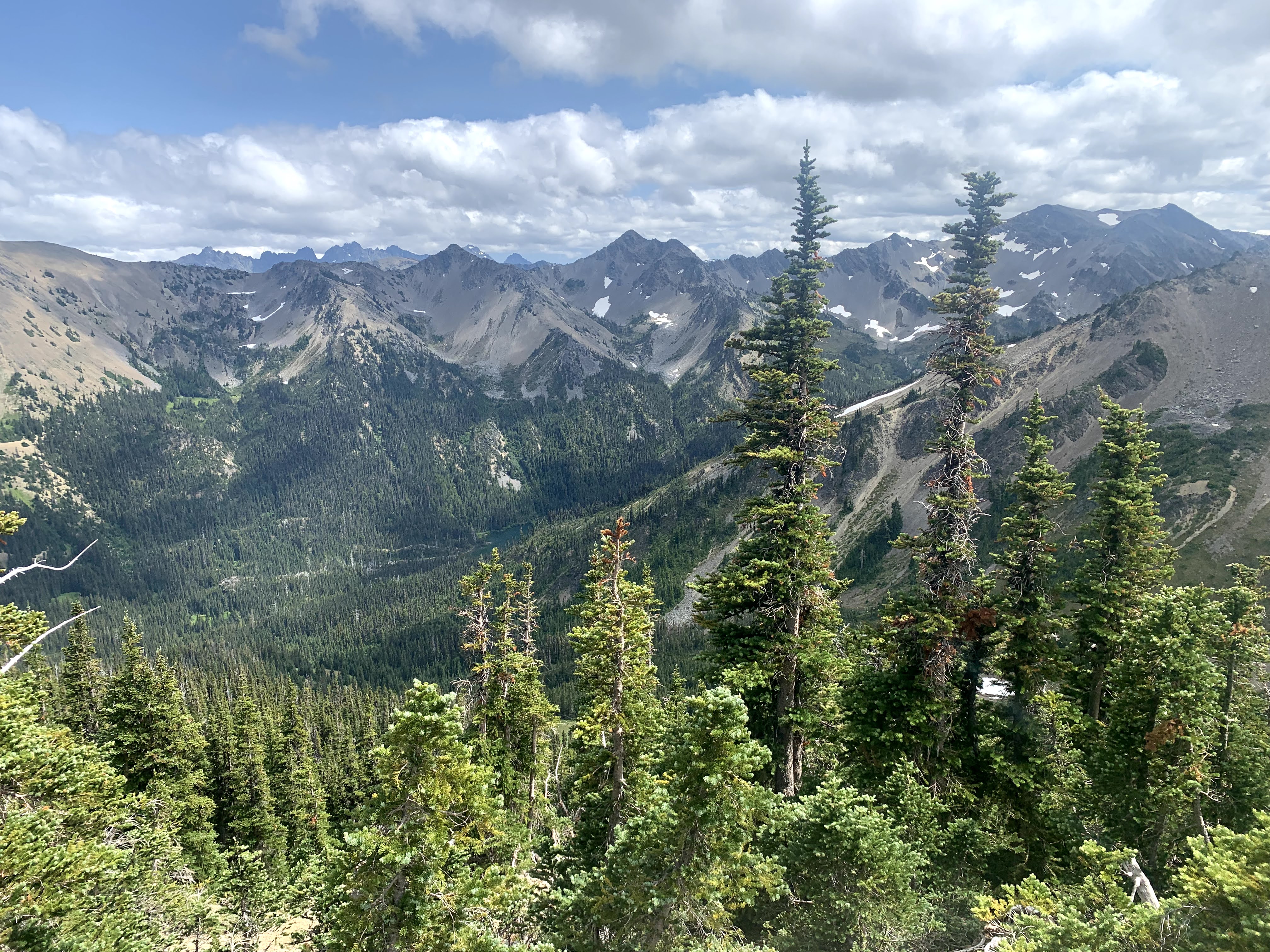 View towards Moose Lake far below as our trail continues to climb.
 Views at the junction of Lillian Ridge and Hurricane Ridge: to the southeast,
 south to Lillian Ridge,
 and southwest to many Olympic peaks, including Mt Olympus.
 zoom of Mount Olympus
 Our trail continues northwest to Obstruction Point. We saw some beautiful blue tarns up here.
 looking Northeast, more tarns below
 We were tired and watching our steps as we neared the end of the trail and did not realize that we hiked past a nearby black bear until another hiker told us we had done so. He pointed out the location of the bear and gave us this photo of the bear.
 My zoom photo of the black bear is blurry.
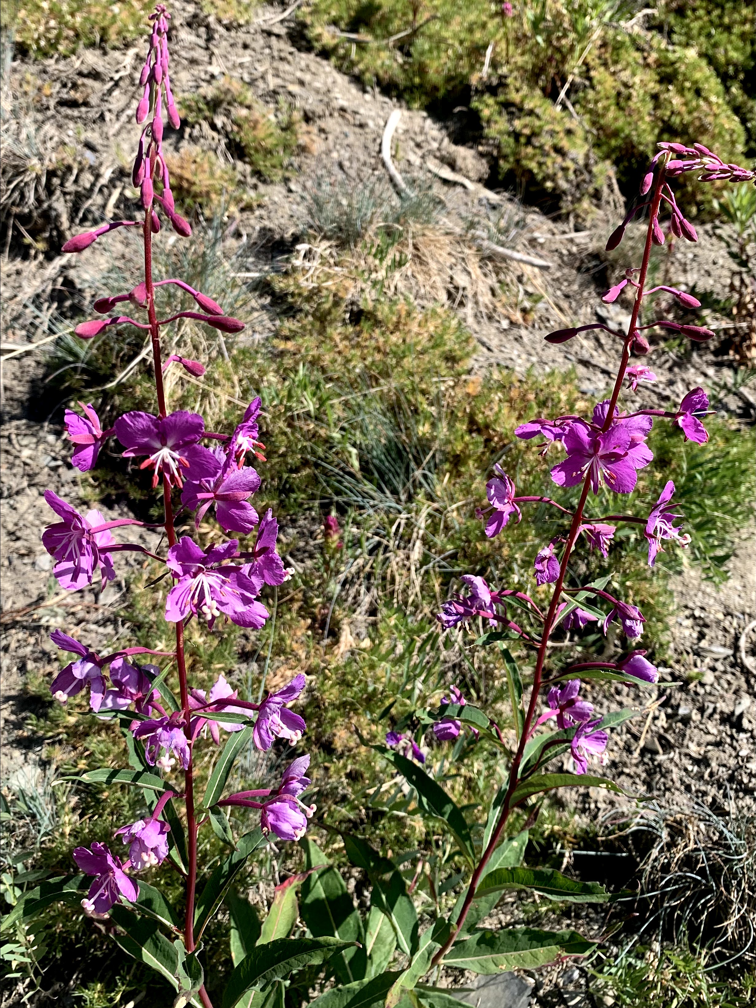
Some of the many wildflowers we saw along the trail today:


No comments:
Post a Comment